world.wikisort.org - Indonesia
South Tarogong (Indonesian: Tarogong Kidul; Sundanese: ᮒᮛᮧᮌᮧᮀ ᮊᮤᮓᮥᮜ᮪) is a district of Garut Regency which serves as its seat. The district was established in 2003 as a division of the old Tarogong district.[3] It is divided into 12 villages which are as follows:[1]
- Cibunar
- Haurpanggung
- Jayaraga
- Jayawaras
- Kersamenak
- Mekargalih
- Pataruman
- Sukabakti
- Sukagalih
- Sukakarya
- Sukajaya
- Tarogong
South Tarogong
Tarogong Kidul | |
|---|---|
District | |
| Regional transcription(s) | |
| • Sundanese | ᮒᮛᮧᮌᮧᮀ ᮊᮤᮓᮥᮜ᮪ |
 South Tarogong in the early 20th-century CE | |
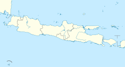
 South Tarogong Location in Java and Indonesia  South Tarogong South Tarogong (Indonesia) | |
| Coordinates: 7°12′54″S 107°53′8″E | |
| Country | |
| Province | West Java |
| Regency | Garut Regency |
| Government | |
| • Camat | Lilis Neti |
| • Secretary | Yanti |
| Area | |
| • Total | 19.46 km2 (7.51 sq mi) |
| Elevation | 714 m (2,343 ft) |
| Population (mid 2021 estimate)[2] | |
| • Total | 115,660 |
| • Density | 5,900/km2 (15,000/sq mi) |
| Time zone | UTC+7 (IWT) |
| Postal code | 44150 |
| Area code | (+62) 262 |
| Villages | 12 |
| Website | Official website |
Of the 12 villages, 5 (Jayawaras, Pataruman, Sukagalih, Sukakarya and Sukajaya) are classed as urban kelurahan and 7 classed as rural desa.
Climate
Tarogong has an elevation moderated tropical monsoon climate (Am) with moderate rainfall from June to September and heavy rainfall from October to May.
| Climate data for Tarogong | |||||||||||||
|---|---|---|---|---|---|---|---|---|---|---|---|---|---|
| Month | Jan | Feb | Mar | Apr | May | Jun | Jul | Aug | Sep | Oct | Nov | Dec | Year |
| Average high °C (°F) | 27.0 (80.6) |
27.2 (81.0) |
27.5 (81.5) |
27.7 (81.9) |
27.7 (81.9) |
27.2 (81.0) |
26.7 (80.1) |
27.2 (81.0) |
27.8 (82.0) |
28.2 (82.8) |
27.6 (81.7) |
27.3 (81.1) |
27.4 (81.4) |
| Daily mean °C (°F) | 22.9 (73.2) |
22.9 (73.2) |
23.1 (73.6) |
23.3 (73.9) |
23.2 (73.8) |
23.3 (73.9) |
21.7 (71.1) |
21.9 (71.4) |
22.5 (72.5) |
23.2 (73.8) |
23.0 (73.4) |
23.0 (73.4) |
22.8 (73.1) |
| Average low °C (°F) | 18.9 (66.0) |
18.7 (65.7) |
18.8 (65.8) |
18.9 (66.0) |
18.7 (65.7) |
17.5 (63.5) |
16.8 (62.2) |
16.7 (62.1) |
17.2 (63.0) |
18.2 (64.8) |
18.5 (65.3) |
18.8 (65.8) |
18.1 (64.7) |
| Average rainfall mm (inches) | 275 (10.8) |
243 (9.6) |
302 (11.9) |
226 (8.9) |
168 (6.6) |
92 (3.6) |
78 (3.1) |
56 (2.2) |
67 (2.6) |
148 (5.8) |
232 (9.1) |
284 (11.2) |
2,171 (85.4) |
| Source: Climate-Data.org[4] | |||||||||||||
References
- "Tarogong Kidul Subdistrict in Figures 2020". Statistics Indonesia. Retrieved December 6, 2020.
- Badan Pusat Statistik, Jakarta, 2022.
- Darpan; Suhardiman, Budi (2007). Seputar Garut (in Indonesian). Komunitas Srimanganti.
- "Climate: Tarogong". Climate-Data.org. Retrieved 12 November 2020.
Текст в блоке "Читать" взят с сайта "Википедия" и доступен по лицензии Creative Commons Attribution-ShareAlike; в отдельных случаях могут действовать дополнительные условия.
Другой контент может иметь иную лицензию. Перед использованием материалов сайта WikiSort.org внимательно изучите правила лицензирования конкретных элементов наполнения сайта.
Другой контент может иметь иную лицензию. Перед использованием материалов сайта WikiSort.org внимательно изучите правила лицензирования конкретных элементов наполнения сайта.
2019-2025
WikiSort.org - проект по пересортировке и дополнению контента Википедии
WikiSort.org - проект по пересортировке и дополнению контента Википедии