world.wikisort.org - Indonesia
Sampang is a town, district and the regency seat of Sampang Regency, in the East Java Province of Indonesia. It is located on the south coast of Madura Island. Its population was 124,390 at the 2020 Census.[2]
Sampang | |
|---|---|
 | |
 Sampang Location in East Java and Indonesia 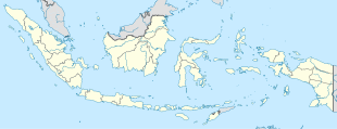 Sampang Sampang (Indonesia) | |
| Coordinates: 7°11′44.2″S 113°15′4″E | |
| Country | |
| Province | East Java |
| Regency | Sampang Regency |
| District | Sampang District |
| Area | |
| • Total | 27.03 sq mi (70.01 km2) |
| Elevation | 16 ft (5 m) |
| Population (2020 Census) | |
| • Total | 124,390 |
| • Density | 4,600/sq mi (1,800/km2) |
| [1] | |
| Time zone | UTC+7 (Indonesia Western Standard Time) |
Climate
Sampang has a tropical savanna climate (Aw) with moderate to little rainfall from June to November and heavy rainfall from December to May.
| Climate data for Sampang | |||||||||||||
|---|---|---|---|---|---|---|---|---|---|---|---|---|---|
| Month | Jan | Feb | Mar | Apr | May | Jun | Jul | Aug | Sep | Oct | Nov | Dec | Year |
| Average high °C (°F) | 31.0 (87.8) |
31.1 (88.0) |
31.3 (88.3) |
31.7 (89.1) |
31.8 (89.2) |
31.6 (88.9) |
31.3 (88.3) |
31.8 (89.2) |
32.4 (90.3) |
33.1 (91.6) |
33.1 (91.6) |
31.7 (89.1) |
31.8 (89.3) |
| Daily mean °C (°F) | 26.8 (80.2) |
26.9 (80.4) |
27.0 (80.6) |
27.2 (81.0) |
27.2 (81.0) |
26.7 (80.1) |
26.2 (79.2) |
26.5 (79.7) |
27.0 (80.6) |
27.9 (82.2) |
28.1 (82.6) |
27.2 (81.0) |
27.1 (80.7) |
| Average low °C (°F) | 22.7 (72.9) |
22.7 (72.9) |
22.7 (72.9) |
22.8 (73.0) |
22.6 (72.7) |
21.8 (71.2) |
21.1 (70.0) |
21.2 (70.2) |
21.7 (71.1) |
22.7 (72.9) |
23.2 (73.8) |
22.8 (73.0) |
22.3 (72.2) |
| Average rainfall mm (inches) | 202 (8.0) |
188 (7.4) |
211 (8.3) |
155 (6.1) |
133 (5.2) |
49 (1.9) |
42 (1.7) |
16 (0.6) |
18 (0.7) |
49 (1.9) |
113 (4.4) |
239 (9.4) |
1,415 (55.6) |
| Source: Climate-Data.org[3] | |||||||||||||
References
- Badan Pusat Statistik, Jakarta, 2021.
- Badan Pusat Statistik, Jakarta, 2021.
- "Climate: Sampang". Climate-Data.org. Retrieved November 17, 2020.
Authority control | |
|---|---|
| General | |
| National libraries | |
This East Java location article is a stub. You can help Wikipedia by expanding it. |
Текст в блоке "Читать" взят с сайта "Википедия" и доступен по лицензии Creative Commons Attribution-ShareAlike; в отдельных случаях могут действовать дополнительные условия.
Другой контент может иметь иную лицензию. Перед использованием материалов сайта WikiSort.org внимательно изучите правила лицензирования конкретных элементов наполнения сайта.
Другой контент может иметь иную лицензию. Перед использованием материалов сайта WikiSort.org внимательно изучите правила лицензирования конкретных элементов наполнения сайта.
2019-2025
WikiSort.org - проект по пересортировке и дополнению контента Википедии
WikiSort.org - проект по пересортировке и дополнению контента Википедии