world.wikisort.org - Indonesia
Praya (Indonesian: Praya or Kecamatan Praya) is the capital town of Central Lombok Regency (Indonesian: Kabupaten Lombok Tengah) on Lombok Island in the province of West Nusa Tenggara, Indonesia. It has an area of 61.26 square kilometres (23.65 sq mi) and a population of 125,890 people at the 2020 Census. It is a predominantly Muslim town, with minorities of Balinese inhabitants following Hinduism and Chinese inhabitants following Buddhism or Christianity.
This article needs additional citations for verification. (January 2021) |
Praya | |
|---|---|
Town | |
 Praya, Lombok | |
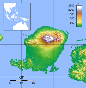 Praya Location in Indonesia  Praya Praya (Indonesia) | |
| Coordinates: 8°42′28″S 116°16′23″E | |
| Country | Indonesia |
| Region | Lesser Sunda Islands |
| Province | West Nusa Tenggara |
| Regency | Central Lombok |
| Kecamatan | Praya |
| Area | |
| • Total | 61.26 km2 (23.65 sq mi) |
| Population (2020 Census)[1] | |
| • Total | 125,890 |
| • Density | 2,100/km2 (5,300/sq mi) |
| Time zone | UTC+08 |
Transportation
It is located a short distance to the north of the Bandara Internasional Lombok airport (IATA: LOP, ICAO: WADL), which opened on 1 October 2011. The airport is the island's only operational airport and provides services for both international and domestic operations. It is also the only international airport serving the province of West Nusa Tenggara.
Climate
Praya has a tropical savanna climate (Aw) with moderate to little rainfall from May to October and heavy rainfall from November to April.
| Climate data for Praya | |||||||||||||
|---|---|---|---|---|---|---|---|---|---|---|---|---|---|
| Month | Jan | Feb | Mar | Apr | May | Jun | Jul | Aug | Sep | Oct | Nov | Dec | Year |
| Average high °C (°F) | 29.9 (85.8) |
30.0 (86.0) |
30.2 (86.4) |
30.8 (87.4) |
30.4 (86.7) |
29.7 (85.5) |
29.2 (84.6) |
29.7 (85.5) |
30.3 (86.5) |
30.7 (87.3) |
30.6 (87.1) |
30.4 (86.7) |
30.2 (86.3) |
| Daily mean °C (°F) | 26.0 (78.8) |
26.1 (79.0) |
26.0 (78.8) |
26.0 (78.8) |
25.4 (77.7) |
24.5 (76.1) |
24.0 (75.2) |
24.4 (75.9) |
25.3 (77.5) |
25.9 (78.6) |
26.3 (79.3) |
26.3 (79.3) |
25.5 (77.9) |
| Average low °C (°F) | 22.2 (72.0) |
22.3 (72.1) |
21.9 (71.4) |
21.2 (70.2) |
20.5 (68.9) |
19.4 (66.9) |
18.9 (66.0) |
19.2 (66.6) |
20.3 (68.5) |
21.1 (70.0) |
22.0 (71.6) |
22.2 (72.0) |
20.9 (69.7) |
| Average rainfall mm (inches) | 286 (11.3) |
269 (10.6) |
198 (7.8) |
160 (6.3) |
118 (4.6) |
79 (3.1) |
73 (2.9) |
31 (1.2) |
13 (0.5) |
80 (3.1) |
185 (7.3) |
307 (12.1) |
1,799 (70.8) |
| Source: Climate-Data.org[2] | |||||||||||||
References
- Badan Pusat Statistik, Jakarta, 2021.
- "Climate: Praya". Climate-Data.org. Retrieved 17 November 2020.
This West Nusa Tenggara location article is a stub. You can help Wikipedia by expanding it. |
Другой контент может иметь иную лицензию. Перед использованием материалов сайта WikiSort.org внимательно изучите правила лицензирования конкретных элементов наполнения сайта.
WikiSort.org - проект по пересортировке и дополнению контента Википедии