world.wikisort.org - Indonesia
North Sumedang (Indonesian: Sumedang Utara, Sundanese: ᮞᮥᮙᮨᮓᮀ ᮊᮜᮦᮁ; Sumedang Kalér) is a district in Sumedang Regency, West Java, Indonesia which serves as the regency seat of Sumedang Regency. It is located halfway along the provincial route connecting Bandung and Cirebon. The Cisumdawu Toll Road is planned to connect to the district in 2021, to ease travels and economic activities between Bandung, Sumedang and Kertajati International Airport.[2]
North Sumedang
Sumedang Utara Sumedang Kalér | |
|---|---|
District | |
| Regional transcription(s) | |
| • Sundanese | ᮞᮥᮙᮨᮓᮀ ᮊᮜᮦᮁ |
 Adipura Monument in Alamsari Roundabout | |
| Etymology: Kingdom of Sumedang Larang | |
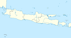
 North Sumedang Location in Java and Indonesia  North Sumedang North Sumedang (Indonesia) | |
| Coordinates: 6°50′7″S 107°55′49″E | |
| Country | |
| Province | West Java |
| Regency | Sumedang Regency |
| Government | |
| • Camat | Nandang Suparman |
| • Secretary | Ellyana |
| Area | |
| • Total | 30.40 km2 (11.74 sq mi) |
| Elevation | 468 m (1,535 ft) |
| Population (2020 Cenus)[1] | |
| • Total | 97,997 |
| • Density | 3,200/km2 (8,300/sq mi) |
| Time zone | UTC+7 (IWT) |
| Postal code | 4532x |
| Area code | (+62) 261 |
| Villages | 13 |
| Website | Official website |
North Sumedang is one of districts of Sumedang Regency known for its production of Tahu sumedang, a local Sundanese variant of tofu popular in West Java and other provinces of Indonesia.[3][4]
Climate
North Sumedang has a tropical monsoon climate (Am) with short dry season from June to September and very significant rainfall in December, January and March.
| Climate data for North Sumedang | |||||||||||||
|---|---|---|---|---|---|---|---|---|---|---|---|---|---|
| Month | Jan | Feb | Mar | Apr | May | Jun | Jul | Aug | Sep | Oct | Nov | Dec | Year |
| Average high °C (°F) | 28.6 (83.5) |
28.7 (83.7) |
29.0 (84.2) |
29.5 (85.1) |
29.6 (85.3) |
29.5 (85.1) |
29.3 (84.7) |
29.9 (85.8) |
30.5 (86.9) |
30.8 (87.4) |
29.9 (85.8) |
29.3 (84.7) |
29.6 (85.2) |
| Daily mean °C (°F) | 24.5 (76.1) |
24.5 (76.1) |
24.6 (76.3) |
24.9 (76.8) |
24.9 (76.8) |
24.4 (75.9) |
24.1 (75.4) |
24.3 (75.7) |
24.8 (76.6) |
25.3 (77.5) |
25.1 (77.2) |
24.8 (76.6) |
24.7 (76.4) |
| Average low °C (°F) | 20.5 (68.9) |
20.3 (68.5) |
20.3 (68.5) |
20.4 (68.7) |
20.3 (68.5) |
19.3 (66.7) |
18.9 (66.0) |
18.7 (65.7) |
19.1 (66.4) |
19.8 (67.6) |
20.3 (68.5) |
20.4 (68.7) |
19.9 (67.7) |
| Average rainfall mm (inches) | 380 (15.0) |
300 (11.8) |
360 (14.2) |
290 (11.4) |
190 (7.5) |
85 (3.3) |
75 (3.0) |
60 (2.4) |
54 (2.1) |
135 (5.3) |
265 (10.4) |
350 (13.8) |
2,544 (100.2) |
| Source: Climate-Data.org[5] | |||||||||||||
Administrative divisions
The district comprises 13 desa and kelurahan (administrative villages) which are as follows:[1]
- Girimukti
- Jatimulya
- Jatihurip
- Kotakaler
- Kebonjati
- Margamukti
- Mekarjaya
- Mulyasari
- Padasuka
- Rancamulya
- Sirmanulya
- Situ
- Talun
References
- "Sumedang Utara Subdistrict in Figures 2020". Statistics Indonesia. Retrieved December 12, 2020.
- "Sumedang Masuk dalam Rebana Metropolitan, Masa Depan Ekonomi Jawa Barat". SUMEDANG ONLINE (in Indonesian). 2020-11-16. Retrieved 2020-12-12.
- Indrayani, Irma; Haryatiningsih, Ria; Haviz, Meidy (2019-01-25). "Dampak Kegiatan Industri Tahu terhadap Sosial, Ekonomi dan Lingkungan Masyarakat di Sumedang Utara Studi Kasus (Desa Kebonjati)". Prosiding Ilmu Ekonomi (in Indonesian): 9–17. doi:10.29313/.v0i0.14490 (inactive 31 July 2022). ISSN 2460-6553.
{{cite journal}}: CS1 maint: DOI inactive as of July 2022 (link) - Sungkawa, Dadang (2007). "Tahu Sebagai Andalan Industri Pariwisata di Sumedang". Jurnal Geografi Gea (in Indonesian). 7 (2). doi:10.17509/gea.v7i2.1725. ISSN 2549-7529.
- "Climate: Sumedang". Climate-Data.org. Retrieved December 12, 2020.
Другой контент может иметь иную лицензию. Перед использованием материалов сайта WikiSort.org внимательно изучите правила лицензирования конкретных элементов наполнения сайта.
WikiSort.org - проект по пересортировке и дополнению контента Википедии