world.wikisort.org - Indonesia
Ngamprah (ᮌᮙ᮪ᮕᮢᮂ) is a kecamatan (district) in central Parahyangan region of Java, which serves as the regency seat of West Bandung Regency in West Java, Indonesia. Ngamprah has postal code 40552 that applies to all 11 villages located in Ngamprah.
Ngamprah | |
|---|---|
District | |
| Regional transcription(s) | |
| • Sundanese | ᮍᮙ᮪ᮕᮢᮂ |
 West Bandung Regency office in Ngamprah | |
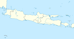
 Ngamprah Location in Java and Indonesia  Ngamprah Ngamprah (Indonesia) | |
| Coordinates: 6°49′45″S 107°29′46″E | |
| Country | |
| Province | West Java |
| Regency | West Bandung Regency |
| Government | |
| • Camat | Drs. Med Ardiwilaga, M.Si |
| Area | |
| • Total | 96.34 km2 (37.20 sq mi) |
| Elevation | 755 m (2,477 ft) |
| Population (2020)[1] | |
| • Total | 176,735 |
| • Density | 1,800/km2 (4,800/sq mi) |
| Time zone | UTC+7 (IWST) |
| Postal code | 40552 |
| Area code | (+62) 22 |
| Villages | 11 |
Administrative divisions
The district encompasses eleven administrative villages (kelurahan and desa):
- Bojongkoneng
- Cilame
- Cimanggu
- Cimareme
- Gadobangkong
- Margajaya
- Mekarsari
- Ngamprah
- Pakuhaji
- Sukatani
- Tanimulya
Climate
Ngamprah has an elevation moderated tropical rainforest climate (Af) with moderate rainfall from June to September and heavy rainfall from October to May.
| Climate data for Ngamprah | |||||||||||||
|---|---|---|---|---|---|---|---|---|---|---|---|---|---|
| Month | Jan | Feb | Mar | Apr | May | Jun | Jul | Aug | Sep | Oct | Nov | Dec | Year |
| Average high °C (°F) | 26.4 (79.5) |
26.6 (79.9) |
27.1 (80.8) |
27.5 (81.5) |
27.5 (81.5) |
27.2 (81.0) |
27.2 (81.0) |
27.9 (82.2) |
28.6 (83.5) |
28.5 (83.3) |
27.6 (81.7) |
27.1 (80.8) |
27.4 (81.4) |
| Daily mean °C (°F) | 22.3 (72.1) |
22.4 (72.3) |
22.6 (72.7) |
22.8 (73.0) |
22.6 (72.7) |
21.8 (71.2) |
21.5 (70.7) |
21.9 (71.4) |
22.5 (72.5) |
22.8 (73.0) |
22.6 (72.7) |
22.6 (72.7) |
22.4 (72.3) |
| Average low °C (°F) | 18.3 (64.9) |
18.2 (64.8) |
18.1 (64.6) |
18.2 (64.8) |
17.8 (64.0) |
16.5 (61.7) |
15.8 (60.4) |
15.9 (60.6) |
16.4 (61.5) |
17.2 (63.0) |
17.7 (63.9) |
18.1 (64.6) |
17.3 (63.2) |
| Average rainfall mm (inches) | 294 (11.6) |
270 (10.6) |
302 (11.9) |
302 (11.9) |
213 (8.4) |
101 (4.0) |
88 (3.5) |
99 (3.9) |
107 (4.2) |
206 (8.1) |
314 (12.4) |
331 (13.0) |
2,627 (103.5) |
| Source: Climate-Data.org[2] | |||||||||||||
References
- "Ngamprah Subdistrict in Figures 2020". Statistics Indonesia. Retrieved December 3, 2020.
- "Climate: Ngamprah". Climate-Data.org. Retrieved 12 November 2020.
External links
- Kode Pos Ngamprah (in Indonesian)
Текст в блоке "Читать" взят с сайта "Википедия" и доступен по лицензии Creative Commons Attribution-ShareAlike; в отдельных случаях могут действовать дополнительные условия.
Другой контент может иметь иную лицензию. Перед использованием материалов сайта WikiSort.org внимательно изучите правила лицензирования конкретных элементов наполнения сайта.
Другой контент может иметь иную лицензию. Перед использованием материалов сайта WikiSort.org внимательно изучите правила лицензирования конкретных элементов наполнения сайта.
2019-2025
WikiSort.org - проект по пересортировке и дополнению контента Википедии
WikiSort.org - проект по пересортировке и дополнению контента Википедии