world.wikisort.org - Indonesia
Jonggol is a district (Indonesian: Kecamatan) in the Bogor Regency, West Java, Indonesia. It is located 50 km to the southeast of Jakarta and is part of the Greater Jakarta metropolitan area. The average elevation is 295 meters, maximum 732 m (1.890 m in Mounth Baud, Sukamakmur, Jonggol District), and minimum 150 meters above sea level. The area was one of the areas considered for new central administration (capital) of the Republic of Indonesia.[1]
Jonggol | |
|---|---|
Town | |
| Coordinates: 6.489835°S 107.042341°E | |
| Country | |
| Province | West Java |
| Regency | Bogor Regency |
| Government | |
| • Camat | Andri Rahman |
| Area | |
| • Total | 158.86 km2 (61.34 sq mi) |
| Elevation | 295.32 m (968.90 ft) |
| Highest elevation | 1,890 m (6,200 ft) |
| Lowest elevation | 150 m (490 ft) |
| Population (2020 Census) | |
| • Total | 156,822 |
| • Density | 990/km2 (2,600/sq mi) |
| Time zone | UTC+7 (IWST) |
| Area code | (+62) 251 |
| Vehicle registration | F |
| Villages | 14 |
| Website | kecamatanjonggol |


Geography
Jonggol, is located about 50 kilometres (31 mi) southeast of Jakarta. Its elevation is 200 metres (660 ft) - 732 metres (2,402 ft), or 1.890 metres (6.20 ft) in Mt. Baud, Sukamakmur, Jonggol District above sea level.
Toll Road Access
| Toll Road | Toll Gate | KM |
|---|---|---|
| Jagorawi Toll Road | Cibubur | 21 |
| Cimanggis-Cibitung Toll Road | Jatikarya | 16 |
| Padaleunyi Toll Road | Padalarang | 92 |
Climate
Jonggol has a tropical rainforest climate (Af) with heavy to very heavy rainfall year-round.
| Climate data for Jonggol | |||||||||||||
|---|---|---|---|---|---|---|---|---|---|---|---|---|---|
| Month | Jan | Feb | Mar | Apr | May | Jun | Jul | Aug | Sep | Oct | Nov | Dec | Year |
| Average high °C (°F) | 28.6 (83.5) |
28.9 (84.0) |
29.7 (85.5) |
30.5 (86.9) |
30.2 (86.4) |
29.8 (85.6) |
30.3 (86.5) |
31.2 (88.2) |
31.7 (89.1) |
31.5 (88.7) |
30.8 (87.4) |
30.0 (86.0) |
30.3 (86.5) |
| Daily mean °C (°F) | 24.5 (76.1) |
24.6 (76.3) |
25.1 (77.2) |
25.6 (78.1) |
25.1 (77.2) |
23.8 (74.8) |
23.9 (75.0) |
25.1 (77.2) |
25.6 (78.1) |
25.8 (78.4) |
25.7 (78.3) |
25.4 (77.7) |
25.0 (77.0) |
| Average low °C (°F) | 20.9 (69.6) |
21.2 (70.2) |
21.8 (71.2) |
21.4 (70.5) |
20.5 (68.9) |
19.8 (67.6) |
20.3 (68.5) |
20.8 (69.4) |
21.3 (70.3) |
21.5 (70.7) |
21.8 (71.2) |
21.4 (70.5) |
21.1 (69.9) |
| Average rainfall mm (inches) | 371 (14.6) |
330 (13.0) |
334 (13.1) |
371 (14.6) |
305 (12.0) |
192 (7.6) |
170 (6.7) |
193 (7.6) |
210 (8.3) |
298 (11.7) |
313 (12.3) |
353 (13.9) |
3,440 (135.4) |
| Source: Climate-Data.org[2] | |||||||||||||
Gallery
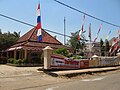 District office of Jonggol

References
- Feature: Indonesia Eyes New Capital as Jakarta Falls Apart Archived 2010-08-27 at the Wayback Machine
- "Climate: Jonggol". Climate-Data.org. Retrieved 12 November 2020.
This West Java location article is a stub. You can help Wikipedia by expanding it. |
Другой контент может иметь иную лицензию. Перед использованием материалов сайта WikiSort.org внимательно изучите правила лицензирования конкретных элементов наполнения сайта.
WikiSort.org - проект по пересортировке и дополнению контента Википедии