world.wikisort.org - Indonesia
Brebes District is a district (Indonesian: Kecamatan) and the capital of Brebes Regency, Central Java, Indonesia. It is bordered by Java Sea to the north, Tegal City (West Tegal District and Margadana District) and Tegal Regency (Dukuhturi District and Adiwerna District) to the east, Jatibarang District to the south and Wanasari District to the west. It covers 92.23 km2 and had a population of 157,149 at the 2010 Census[3] and 182,421 at the 2020 Census.[4]
This article needs additional citations for verification. (July 2020) |
Brebes District
Kecamatan Brebes | |
|---|---|
District | |
 Sights in Brebes (clockwise from top) : Randusanga Beach, Ciblon Waterboom, Alun alun Brebes, Great Mosque of Brebes, Karangbirahi Stadium | |
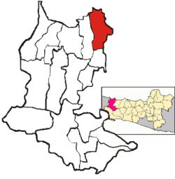 Location Brebes District in Brebes Regency | |
| Coordinates: 6°52′30″S 109°03′10″E | |
| Country | Indonesia |
| Province | Central Java |
| Regency | Brebes |
| Government | |
| • Camat | M. Amrin Alfi Umar, S.IP, M.Si[1] |
| Area | |
| • Total | 92.23 km2 (35.61 sq mi) |
| Population (2020 Census)[2] | |
| • Total | 182,421 |
| • Density | 2,000/km2 (5,100/sq mi) |
| Time zone | UTC+07.00 (WIB) |
| Postal Code | 52211 to 52220, 52251 |
| Area code(s) | 0283 |
Administrative Villages
Brebes District is divided into 23 administrative villages (5 kelurahan and 18 desa).
Desa
- Banjaranyar
- Kaligangsa Kulon
- Kaligangsa Wetan
- Kalimati
- Kaliwlingi
- Kedunguter
- Krasak
- Lembarawa
- Padasugih
- Pagejugan
- Pemaron
- Pulosari
- Randusanga Kulon
- Randusanga Wetan
- Sigambir
- Tengki
- Terlangu
- Wangandalem
Kelurahan
- Brebes
- Gandasuli
- Limbangan Kulon
- Limbangan Wetan
- Pasar Batang
References
- Ita (3 May 2015). "4.491 Relawan Kader Pendata Mulai Lakukan Pendataan Keluarga" (in Indonesian). Vimanews. Retrieved 12 May 2015.
- Badan Pusat Statistik, Jakarta, 2021.
- Biro Pusat Statistik, Jakarta, 2011.
- Badan Pusat Statistik, Jakarta, 2021.
This Central Java location article is a stub. You can help Wikipedia by expanding it. |
Текст в блоке "Читать" взят с сайта "Википедия" и доступен по лицензии Creative Commons Attribution-ShareAlike; в отдельных случаях могут действовать дополнительные условия.
Другой контент может иметь иную лицензию. Перед использованием материалов сайта WikiSort.org внимательно изучите правила лицензирования конкретных элементов наполнения сайта.
Другой контент может иметь иную лицензию. Перед использованием материалов сайта WikiSort.org внимательно изучите правила лицензирования конкретных элементов наполнения сайта.
2019-2026
WikiSort.org - проект по пересортировке и дополнению контента Википедии
WikiSort.org - проект по пересортировке и дополнению контента Википедии