world.wikisort.org - Indonesia
Belu Regency is a regency in East Nusa Tenggara province of Indonesia. Established on 20 December 1958,[3] Belu Regency has its seat (capital) in the large town of Atambua.
Belu Regency
Kabupaten Belu Rai Belu | |
|---|---|
Regency | |
 Coat of arms | |
| Nickname(s): Belu | |
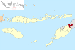 Location within East Nusa Tenggara | |
 Belu Regency Location in Timor, Lesser Sunda Islands and Indonesia  Belu Regency Belu Regency (Lesser Sunda Islands)  Belu Regency Belu Regency (Indonesia) | |
| Coordinates: 9°20′45″S 124°57′2″E | |
| Country | |
| Region | Lesser Sunda Islands |
| Province | |
| Settled | 20 December 1956 |
| Capital | Atambua |
| Government | |
| • Regent | Willy Lay |
| • Vice Regent | J. T. Ose Luan |
| Area | |
| • Total | 496.12 sq mi (1,284.94 km2) |
| Elevation | 1,230 ft (375 m) |
| Population (2020 Census)[1] | |
| • Total | 217,973 |
| • Density | 440/sq mi (170/km2) |
| Time zone | UTC+8 (ICST) |
| Postcodes | 856xx, 857xx |
| Area code | (+62) 389 |
| Religion | Christianity 95.45% — Catholic 88.39% — Protestant 7.10% Islam 4.30% Hindu 0.19% Buddhism 0.02%[2] |
| Website | belukab |
In December 2012 a separate Regency - Malaka Regency - was created from the twelve districts that formerly comprised the southern half of Belu Regency. Belu means friend in Tetum. The residual part of Belu Regency had a population of 188,163 at the 2010 Census, which rose to 206,476 at the 2015 Census[4] and to 217,973 at the 2020 Census.[5]
Administrative Districts
The Belu Regency was until 2013 divided into twenty-four districts (kecamatan), but in December 2012, the twelve southern kecamatan were removed to form the new Malaka Regency, leaving the twelve northern kecamatan in Belu Regency. The residual Belu Regency is thus composed of twelve districts (kecamatan), tabulated below with their areas (in km2) and their populations at the 2010 Census[6] and 2020 Census.[7] The table also includes the location of the district headquarters, the number of administrative villages (rural desa and urban kelurahan) in each district, and its postal code.
| Name | Area (in km2) | Population Census 2010 | Population Census 2020[8] | Administrative centre | Number of villages | Post code |
|---|---|---|---|---|---|---|
| Kota Atambua (Central Atambua) | 24.90 | 26,396 | 30,837 | Tenukiik | 4 | 85711 -85718 |
| Atambua Barat (West Atambua) | 15.55 | 21,604 | 24,178 | Sesekoe | 4 | 85713 -85718 |
| Atambua Selatan (East Atambua) | 15.73 | 22,464 | 26,144 | Asuulun | 4 | 85716 -85718 |
| Total Atambua town | 56.18 | 70,464 | 81,159 | 12 | 85711 -85718 | |
| Raimanuk | 179.42 | 14,411 | 16,755 | Arekama | 9 | 85760 |
| Tasifeto Barat (West Tasifeto) | 224.19 | 22,362 | 24,545 | Kimbana | 8 | 85753 |
| Kakulak Mesak | 187.54 | 17,608 | 21,988 | Umarese | 6 | 85752 |
| Nanaet Dubesi | 60.25 | 4,006 | 4,783 | Tete Seban | 4 | 85751 |
| Tasifeto Timur (East Tasifeto) | 211.37 | 20,932 | 26,121 | Wedomu | 12 | 85771 |
| Western rural sector (a) | 862.77 | 79,319 | 94,192 | 39 | ||
| Raihat | 87.20 | 13,319 | 14,359 | Bei Sari Loo | 6 | 85773 |
| Lasiolat | 64.48 | 6,166 | 7,096 | Lafuli | 7 | 85771 |
| Lamaknen | 105.90 | 11,583 | 12,632 | Weluli | 9 | 85772 |
| Lamaknen Selatan (South Lamaknen) | 18.41 | 7,312 | 8,535 | Pie Bulak | 8 | 85770 |
| Eastern salient (b) | 365.99 | 38,380 | 42,622 | 30 | ||
| Totals for regency | 1,284.94 | 188,163 | 217,973 | 81 |
Note: (a) the five westerly rural kecamatan, mainly surrounding or south of Atambua. (b) the area projecting into East Timor.
Media
Belu Regency is served with four radio stations that cover the wider area around this regency (including Malaka Regency, Alor Regency, and Timor Tengah Utara Regency), which are RRI Pro1 Atambua (FM 91.5 MHz) RRI Pro2 Atambua (FM 99.8 MHz) RRI Pro3 (FM 99.0 MHz), and Saluran Citra Budaya Timor (alias Pro4) (FM 93.1 MHz). There's still a lot of radio that can be found in the town.
The regency is only served with two television stations (TVRI - including TVRI East Nusa Tenggara, Belu TV) and a few other East Timor stations that reach the border pass.
References
- Badan Pusat Statistik, Jakarta, 2021.
- "Kabupaten Belu Dalam Angka 2019". www.belukab.bps.go.id (in Indonesian). Retrieved 13 February 2020.
- Government of Indonesia (9 August 1958), Establishment of the Second-level Administrative Regions under the First-level Administrative Region of Bali, West Nusa Tenggara and East Nusa Tenggara (in Indonesian ed.), Indonesia Ministry of Law and Justice, UU No. 69/1958, retrieved 24 August 2007[permanent dead link]
- Badan Pusat Statistik, Jakarta, 2018.
- Badan Pusat Statistik, Jakarta, 2021.
- Biro Pusat Statistik, Jakarta, 2011.
- Badan Pusat Statistik, Jakarta, 2021.
- Badan Pusat Statistik, Jakarta, 2021.
This East Nusa Tenggara location article is a stub. You can help Wikipedia by expanding it. |
На других языках
- [en] Belu Regency
[ru] Белу (округ)
Белу (индон. Belu) — округ в провинции Восточная Нуса-Тенгара, Индонезия. Административный центр — город Атамбуа (индон.) (рус.. Население — 352 297 чел. (2010)[1].Другой контент может иметь иную лицензию. Перед использованием материалов сайта WikiSort.org внимательно изучите правила лицензирования конкретных элементов наполнения сайта.
WikiSort.org - проект по пересортировке и дополнению контента Википедии