world.wikisort.org - India
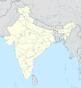
Sonepur è una suddivisione dell'India, classificata come municipality, di 17.535 abitanti, capoluogo del distretto di Subarnapur, nello stato federato dell'Orissa. In base al numero di abitanti la città rientra nella classe IV (da 10.000 a 19.999 persone)[4].
| Sonepur Municipalità (Municipality) | |
|---|---|
| Localizzazione | |
| Stato | |
| Stato federato | Orissa |
| Divisione | Non presente |
| Distretto | Subarnapur |
| Territorio | |
| Coordinate | 20°50′N 83°55′E |
| Altitudine | 120[1] m s.l.m. |
| Superficie | 15,13 km² |
| Abitanti | 17 535 (2001) |
| Densità | 1 158,96 ab./km² |
| Altre informazioni | |
| Lingue | oriya, inglese |
| Cod. postale | 767017[2] |
| Prefisso | 6654[3] |
| Fuso orario | UTC+5:30 |
| Cartografia | |
Geografia fisica
La città è situata a 20° 49' 60 N e 83° 55' 0 E e ha un'altitudine di 120 m s.l.m.[1].
Società
Evoluzione demografica
Al censimento del 2001 la popolazione di Sonepur assommava a 17.535 persone, delle quali 9.297 maschi e 8.238 femmine. I bambini di età inferiore o uguale ai sei anni assommavano a 1.852, dei quali 969 maschi e 883 femmine. Infine, coloro che erano in grado di saper almeno leggere e scrivere erano 12.987, dei quali 7.635 maschi e 5.352 femmine.[5]
Note
- (EN) Falling Rain Genomics, Inc, Sonepur, India Page, su fallingrain.com. URL consultato l'11-07-2008.
- (EN) India Post, Pincode search - Sonepur, su indiapost.gov.in. URL consultato il 28-07-2008.
- (EN) Bharat Sanchar Nigam Ltd, STD Codes for cities in Orissa, su bsnl.co.in. URL consultato il 28-07-2008 (archiviato dall'url originale l'8 luglio 2007).
- (EN) Census of India, Alphabetical list of towns and their population - Orissa (PDF), su censusindia.gov.in. URL consultato il 21-05-2008.
- (EN) Census of India 2001, Population, population in the age group 0-6 and literates by sex - Cities/Towns (in alphabetic order): 2001, su censusindia.net. URL consultato il 20-06-2008 (archiviato dall'url originale il 16 giugno 2004).
Altri progetti
 Wikimedia Commons contiene immagini o altri file su Sonepur
На других языках
[de] Subarnapur (Orissa)
Subarnapur (auch Sonapur, Sonpur oder Sonepur) ist eine Stadt im ostindischen Bundesstaat Odisha (Orissa). Sie liegt an der Mündung des Flusses Tel in den Mahanadi und ist Hauptstadt des gleichnamigen Distrikts.[en] Subarnapur, Odisha
Subarnapur, also known as Sonepur, is a town and district headquarters of Subarnapur district of Odisha. The district spreads over an area of 2284.89 km2. It is also known as Second Varanasi of India for its cluster of temples having architectural importance and also of tantricism and second Allahabad for the Meeting Point (Sangam) of two rivers Mahanadi and Tel in place just like in Allahabad.[1] Subarnapur is also famous for silk, handloom, prawns, terracotta etc.- [it] Sonepur
[ru] Сонепур
Сонепур (англ. Sonepur) или Субарнапур (англ. Subarnapur) — город в индийском штате Орисса. Административный центр округа Субарнапур. Средняя высота над уровнем моря — 120 метров. По данным всеиндийской переписи 2001 года, в городе проживало 17 535 человек, из которых мужчины составляли 53 %, женщины — соответственно 47 %. Уровень грамотности взрослого населения составлял 74 % (при общеиндийском показателе 59,5 %). Уровень грамотности среди мужчин составлял 82 %, среди женщин — 65 %. 11 % населения было моложе 6 лет.Текст в блоке "Читать" взят с сайта "Википедия" и доступен по лицензии Creative Commons Attribution-ShareAlike; в отдельных случаях могут действовать дополнительные условия.
Другой контент может иметь иную лицензию. Перед использованием материалов сайта WikiSort.org внимательно изучите правила лицензирования конкретных элементов наполнения сайта.
Другой контент может иметь иную лицензию. Перед использованием материалов сайта WikiSort.org внимательно изучите правила лицензирования конкретных элементов наполнения сайта.
2019-2025
WikiSort.org - проект по пересортировке и дополнению контента Википедии
WikiSort.org - проект по пересортировке и дополнению контента Википедии
