world.wikisort.org - India
Roorkee è una suddivisione dell'India, classificata come municipal board, di 118,200 abitanti, situata nel distretto di Haridwar, nello stato federato dell'Uttarakhand. In base al numero di abitanti la città rientra nella classe I[4].
| Roorkee Amministrazione Municipale (Municipal Board) | |
|---|---|
 | |
| Localizzazione | |
| Stato | |
| Stato federato | Uttarakhand |
| Divisione | Garhwal |
| Distretto | Haridwar |
| Territorio | |
| Coordinate | 29°51′41″N 77°53′20″E |
| Altitudine | 267[1] m s.l.m. |
| Superficie | 8,11 km² |
| Abitanti | 118 200 (2011) |
| Densità | 14 574,6 ab./km² |
| Altre informazioni | |
| Lingue | hindi, inglese |
| Cod. postale | 247667[2] |
| Prefisso | 1332 (Roorkee-I), 1334 (Roorkee-II)[3] |
| Fuso orario | UTC+5:30 |
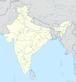
| Cartografia | |
Geografia fisica
La città è situata a 29° 52' 0 N e 77° 52' 60 E e ha un'altitudine di 267 m s.l.m.[1].
Società
Evoluzione demografica
Al censimento del 2001 la popolazione di Roorkee assommava a 118,200 persone, delle quali 63,434 maschi e 54,766 femmine. I bambini di età inferiore o uguale ai sei anni assommavano a 10.786, dei quali 5.846 maschi e 4.940 femmine. Infine, coloro che erano in grado di saper almeno leggere e scrivere erano 74.248, dei quali 41.312 maschi e 32.936 femmine.[5]
Note
- (EN) Falling Rain Genomics, Inc, Roorkee, India Page, su fallingrain.com. URL consultato l'11-07-2008.
- (EN) India Post, Pincode search - Roorkee, su indiapost.gov.in. URL consultato il 28-07-2008.
- (EN) Bharat Sanchar Nigam Ltd, STD Codes for cities in Uttaranchal [collegamento interrotto], su bsnl.co.in. URL consultato il 28-07-2008.
- (EN) Census of India, Alphabetical list of towns and their population - Uttarakhand (PDF), su censusindia.gov.in. URL consultato il 21-05-2008.
- (EN) Census of India 2001, Population, population in the age group 0-6 and literates by sex - Cities/Towns (in alphabetic order): 2001, su censusindia.net. URL consultato il 20-06-2008 (archiviato dall'url originale il 16 giugno 2004).
Altri progetti
 Wikimedia Commons contiene immagini o altri file su Roorkee
| Controllo di autorità | VIAF (EN) 158246455 · GND (DE) 4196152-3 |
|---|
На других языках
[de] Roorkee
Roorkee (Hindi: .mw-parser-output .Deva{font-size:120%}@media all and (min-width:800px){.mw-parser-output .Deva{font-size:calc(120% - ((100vw - 800px)/80))}}@media all and (min-width:1000px){.mw-parser-output .Deva{font-size:100%}}रूड़की Ruṛkī [.mw-parser-output .IPA a{text-decoration:none}ˈruɽki]) ist eine Stadt mit etwa 120.000 Einwohnern im nördlichen Teil des Doab im indischen Bundesstaat Uttarakhand.[en] Roorkee
Roorkee (Rūṛkī) is a city and a municipal corporation in the Haridwar district of the state of Uttarakhand, India. It is 31 km (19 mi) from Haridwar city, the district headquarter. It is spread over a flat terrain under Sivalik Hills of Himalayas. The city is developed on the banks of Ganges Canal, its dominant feature, which flows from north–south through middle of the city. Roorkee is home to Asia's first engineering college Indian Institute of Technology Roorkee, formerly known as Thomson College of Civil Engineering. Roorkee is also known for the Roorkee Cantonment, one of the country's oldest military establishments and the headquarters of Bengal Engineer Group since 1853.[3] A freight train ran in between Roorkee and Piran Kaliyar on 22 December 1851, this was two years before first passenger trains were started between Bombay and Thana in 1853 and 14 years after first freight trains ran in Chennai in 1837.[4]- [it] Roorkee
[ru] Рурки
Рурки (англ. Roorkee) — город в индийском штате Уттаракханд в округе Харидвар. Расположен на берегах Гангского канала в 172 километрах к северу от Дели. Средняя высота над уровнем моря — 268 метров.Текст в блоке "Читать" взят с сайта "Википедия" и доступен по лицензии Creative Commons Attribution-ShareAlike; в отдельных случаях могут действовать дополнительные условия.
Другой контент может иметь иную лицензию. Перед использованием материалов сайта WikiSort.org внимательно изучите правила лицензирования конкретных элементов наполнения сайта.
Другой контент может иметь иную лицензию. Перед использованием материалов сайта WikiSort.org внимательно изучите правила лицензирования конкретных элементов наполнения сайта.
2019-2025
WikiSort.org - проект по пересортировке и дополнению контента Википедии
WikiSort.org - проект по пересортировке и дополнению контента Википедии
