world.wikisort.org - India
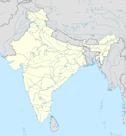
Nandurbar è una città dell'India di 94.365 abitanti, capoluogo del distretto di Nandurbar, nello stato federato del Maharashtra. In base al numero di abitanti la città rientra nella classe II (da 50.000 a 99.999 persone)[4].
| Nandurbar Consiglio Municipale (Municipal Council) | |
|---|---|
| Localizzazione | |
| Stato | |
| Stato federato | Maharashtra |
| Divisione | Nashik |
| Distretto | Nandurbar |
| Territorio | |
| Coordinate | 21°22′N 74°15′E |
| Altitudine | 209[1] m s.l.m. |
| Superficie | 31,41 km² |
| Abitanti | 94 365 (2001) |
| Densità | 3 004,3 ab./km² |
| Altre informazioni | |
| Lingue | marathi, inglese |
| Cod. postale | 425412[2] |
| Prefisso | 2564[3] |
| Fuso orario | UTC+5:30 |
| Cartografia | |
Geografia fisica
La città è situata a 21° 22' 0 N e 74° 15' 0 E e ha un'altitudine di 209 m s.l.m.[1].
Società
Evoluzione demografica
Al censimento del 2001 la popolazione di Nandurbar assommava a 94.365 persone, delle quali 49.125 maschi e 45.240 femmine. I bambini di età inferiore o uguale ai sei anni assommavano a 11.683, dei quali 6.308 maschi e 5.375 femmine. Infine, coloro che erano in grado di saper almeno leggere e scrivere erano 67.787, dei quali 38.298 maschi e 29.489 femmine.[5]
Note
- (EN) Falling Rain Genomics, Inc, Nandurbar, India Page, su fallingrain.com. URL consultato l'11-07-2008.
- (EN) India Post, Pincode search - Nandurbar, su indiapost.gov.in. URL consultato il 28-07-2008.
- (EN) Bharat Sanchar Nigam Ltd, STD Codes for cities in Maharashtra, su bsnl.co.in. URL consultato il 28-07-2008 (archiviato dall'url originale il 14 maggio 2008).
- (EN) Census of India, Alphabetical list of towns and their population - Maharashtra (PDF), su censusindia.gov.in. URL consultato il 21-05-2008.
- (EN) Census of India 2001, Population, population in the age group 0-6 and literates by sex - Cities/Towns (in alphabetic order): 2001, su censusindia.net. URL consultato il 20-06-2008 (archiviato dall'url originale il 16 giugno 2004).
На других языках
[de] Nandurbar
Nandurbar ist eine Stadt im Bundesstaat Maharashtra im Westen Indiens. Sie ist Verwaltungssitz des gleichnamigen Distrikts Nandurbar. Nandurbar ist in 33 Wards (Wahlkreise) gegliedert und wird als Municipal Council verwaltet. Von Nandurbar aus sind es nach Mumbai 398 Kilometer.[en] Nandurbar
Nandurbar pronunciation (help·info) is a city and a municipal council in Nandurbar district in the Indian state of Maharashtra. Nandurbar municipal corporation is the first municipal corporation.[1] Nandurbar is an administrative district in the northwest corner of (Khandesh region) of Maharashtra.[2] On 1 July 1998 Dhule was bifurcated as two separate districts now known as Dhule and Nandurbar. The district headquarters is located at Nandurbar city. The district occupies an area of 5034 km2 and has a population of 1,311,709 of which 15.45% is urban (as of 2001). Nandurbar district is bounded to the south and south-east by Dhule district, to the west and north is the state of Gujarat, to the north and north-east is the state of Madhya Pradesh. The northern boundary of the district is defined by the great Narmada river. It came into limelight during February 2006 bird flu crisis which struck many of its poultry farms. Thousand of chickens from the farms had to be killed and buried in nearby grounds to stop the virus spreading.- [it] Nandurbar
[ru] Нандурбар
Нандурбар (англ. Nandurbar) — город в индийском штате Махараштра. Административный центр округа Нандурбар. Средняя высота над уровнем моря — 209 метров. По данным всеиндийской переписи 2001 года, в городе проживало 94 365 человек, из которых мужчины составляли 52 %, женщины — соответственно 48 %. Уровень грамотности взрослого населения составлял 72 % (при общеиндийском показателе 59,5 %). 12 % населения было моложе 6 лет.Текст в блоке "Читать" взят с сайта "Википедия" и доступен по лицензии Creative Commons Attribution-ShareAlike; в отдельных случаях могут действовать дополнительные условия.
Другой контент может иметь иную лицензию. Перед использованием материалов сайта WikiSort.org внимательно изучите правила лицензирования конкретных элементов наполнения сайта.
Другой контент может иметь иную лицензию. Перед использованием материалов сайта WikiSort.org внимательно изучите правила лицензирования конкретных элементов наполнения сайта.
2019-2025
WikiSort.org - проект по пересортировке и дополнению контента Википедии
WikiSort.org - проект по пересортировке и дополнению контента Википедии
