world.wikisort.org - India
Mayabunder è un villaggio dell'India di 3.182 abitanti[4], capoluogo del distretto di Andaman Settentrionale e Centrale, nel territorio federato delle Andamane e Nicobare.
| Mayabunder tehsil | |
|---|---|
| Localizzazione | |
| Stato | |
| Territorio | Andamane e Nicobare |
| Divisione | Non presente |
| Distretto | Andaman Settentrionale e Centrale |
| Territorio | |
| Coordinate | 12°55′59.88″N 92°55′59.88″E |
| Altitudine | 0[1] m s.l.m. |
| Abitanti | 3 182 |
| Altre informazioni | |
| Cod. postale | 744204[2] |
| Prefisso | 31927[3] |
| Fuso orario | UTC+5:30 |
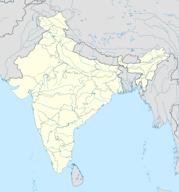
| Cartografia | |
Geografia fisica
Mayabunder è situata a 12° 55' 60 N e 92° 55' 60 E e si trova al livello del mare[1]
Note
- (EN) Falling Rain Genomics, Inc, Mayabandar, India Page, su fallingrain.com. URL consultato l'11 luglio 2008.
- (EN) India Post, Pincode search - Mayabander, su indiapost.gov.in. URL consultato il 28 luglio 2008.
- (EN) Indiacom, STD Code list for City : M, su indiacom.com. URL consultato il 10 agosto 2008.
- (EN) OurVillageIndia.org, Mayabunder (RV) VILLAGE, su ourvillageindia.org. URL consultato il 22 agosto 2008.
На других языках
[en] Mayabunder
Mayabunder is a town and a tehsil in the northern part of Middle Andaman Island, Andaman Archipelago, India. The name is also spelled Maya Bunder or Maya Bandar. As of 2001, the county had 23,912 inhabitants, of which 3182 were in the town.[1] It was settled in the British colonial period by immigrants from Myanmar and ex-convicts from Mainland India.- [it] Mayabunder
Текст в блоке "Читать" взят с сайта "Википедия" и доступен по лицензии Creative Commons Attribution-ShareAlike; в отдельных случаях могут действовать дополнительные условия.
Другой контент может иметь иную лицензию. Перед использованием материалов сайта WikiSort.org внимательно изучите правила лицензирования конкретных элементов наполнения сайта.
Другой контент может иметь иную лицензию. Перед использованием материалов сайта WikiSort.org внимательно изучите правила лицензирования конкретных элементов наполнения сайта.
2019-2025
WikiSort.org - проект по пересортировке и дополнению контента Википедии
WikiSort.org - проект по пересортировке и дополнению контента Википедии
