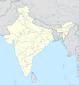
world.wikisort.org - India
Kottuvally è una suddivisione dell'India, classificata come census town, di 37.884 abitanti, situata nel distretto di Ernakulam, nello stato federato del Kerala. In base al numero di abitanti la città rientra nella classe III (da 20.000 a 49.999 persone)[2].
| Kottuvally Città Censuaria (Census Town) | |
|---|---|
| Localizzazione | |
| Stato | |
| Stato federato | Kerala |
| Divisione | Non presente |
| Distretto | Ernakulam |
| Territorio | |
| Coordinate | 10°06′49.36″N 76°14′43.66″E |
| Altitudine | 12 m s.l.m. |
| Superficie | 20,82 km² |
| Abitanti | 37 884 (2001) |
| Densità | 1 819,6 ab./km² |
| Altre informazioni | |
| Lingue | malayalam, inglese |
| Cod. postale | 683519[1] |
| Fuso orario | UTC+5:30 |
| Cartografia | |
| Sito istituzionale | |
Geografia fisica
La città è situata a 10° 06' 42 N e 76° 15' 45 E[3].
Società
Evoluzione demografica
Al censimento del 2001 la popolazione di Kottuvally assommava a 37.884 persone, delle quali 18.478 maschi e 19.406 femmine. I bambini di età inferiore o uguale ai sei anni assommavano a 3.976, dei quali 2.064 maschi e 1.912 femmine. Infine, coloro che erano in grado di saper almeno leggere e scrivere erano 31.901, dei quali 15.886 maschi e 16.015 femmine.[4]
Note
- (EN) India Post, Pincode search - Kottuvally, su indiapost.gov.in. URL consultato il 28-07-2008.
- (EN) Census of India, Alphabetical list of towns and their population - Kerala (PDF), su censusindia.gov.in. URL consultato il 21-05-2008.
- (EN) Yahoo Maps, Kottuvally, Kerala, India, su maps.yahoo.com. URL consultato il 10-10-2008.
- (EN) Census of India 2001, Population, population in the age group 0-6 and literates by sex - Cities/Towns (in alphabetic order): 2001, su censusindia.net. URL consultato il 20-06-2008 (archiviato dall'url originale il 16 giugno 2004).
Collegamenti esterni
- (ML) Sito ufficiale, su lsgkerala.in.
- (ML) Sito ufficiale, su panchayat.lsgkerala.gov.in.
На других языках
[en] Kottuvally
Kottuvally is a census town in Paravoor.It is also a village in Paravur Taluk, Ernakulam district in the Indian state of Kerala. The village is situated in the south of the taluk. The nearest town is North Paravur, 4 km away. The Kottuvally panchayath is spread out on both sides of NH-66 road.- [it] Kottuvally
Текст в блоке "Читать" взят с сайта "Википедия" и доступен по лицензии Creative Commons Attribution-ShareAlike; в отдельных случаях могут действовать дополнительные условия.
Другой контент может иметь иную лицензию. Перед использованием материалов сайта WikiSort.org внимательно изучите правила лицензирования конкретных элементов наполнения сайта.
Другой контент может иметь иную лицензию. Перед использованием материалов сайта WikiSort.org внимательно изучите правила лицензирования конкретных элементов наполнения сайта.
2019-2025
WikiSort.org - проект по пересортировке и дополнению контента Википедии
WikiSort.org - проект по пересортировке и дополнению контента Википедии
