world.wikisort.org - India
Kedarnath è una suddivisione dell'India, classificata come nagar panchayat, di 479 abitanti, situata nel distretto di Rudraprayag, nello stato federato dell'Uttarakhand. In base al numero di abitanti la città rientra nella classe VI (meno di 5.000 persone)[3].
| Kedarnath Consiglio di Frazione (Nagar Panchayat) | |
|---|---|
 | |
| Localizzazione | |
| Stato | |
| Stato federato | Uttarakhand |
| Divisione | Garhwal |
| Distretto | Rudraprayag |
| Territorio | |
| Coordinate | 30°44′N 79°04′E |
| Altitudine | 3 552[1] m s.l.m. |
| Superficie | 2,75 km² |
| Abitanti | 479 (2001) |
| Densità | 174,18 ab./km² |
| Altre informazioni | |
| Lingue | hindi, inglese |
| Cod. postale | 246445[2] |
| Fuso orario | UTC+5:30 |
| Cartografia | |
 Kedarnath | |
Geografia fisica
La città è situata a 30° 43' 60 N e 79° 4' 0 E e ha un'altitudine di 3.552 m s.l.m.[1].
Società
Evoluzione demografica
Al censimento del 2001 la popolazione di Kedarnath assommava a 479 persone, delle quali 468 maschi e 11 femmine, e non risultavano bambini di età inferiore o uguale ai sei anni. Coloro che erano in grado di saper almeno leggere e scrivere erano 301, dei quali 297 maschi e 4 femmine.[4]
Note
- (EN) Falling Rain Genomics, Inc, Kedarnath, India Page, su fallingrain.com. URL consultato il 25-09-2009.
- (EN) India Post, Pincode search - Kedarnath, su indiapost.gov.in. URL consultato il 25-09-2009.
- (EN) Census of India, Alphabetical list of towns and their population - Uttarakhand (PDF), su censusindia.gov.in. URL consultato il 21-05-2008.
- (EN) Census of India 2001, Population, population in the age group 0-6 and literates by sex - Cities/Towns (in alphabetic order): 2001, su censusindia.net. URL consultato il 20-06-2008 (archiviato dall'url originale il 16 giugno 2004).
Altri progetti
 Wikimedia Commons contiene immagini o altri file su Kedarnath
Collegamenti esterni
- (EN) Kedarnath, su Enciclopedia Britannica, Encyclopædia Britannica, Inc.
На других языках
[de] Kedarnath
Kedarnath (Hindi: .mw-parser-output .Deva{font-size:120%}@media all and (min-width:800px){.mw-parser-output .Deva{font-size:calc(120% - ((100vw - 800px)/80))}}@media all and (min-width:1000px){.mw-parser-output .Deva{font-size:100%}}केदारनाथ) ist ein kleiner Ort mit gut 600 Einwohnern im indischen Bundesstaat Uttarakhand; der in der Nähe befindliche Jyotirlinga-Tempel ist einer der wichtigsten hinduistischen Wallfahrtsorte in ganz Indien.[en] Kedarnath
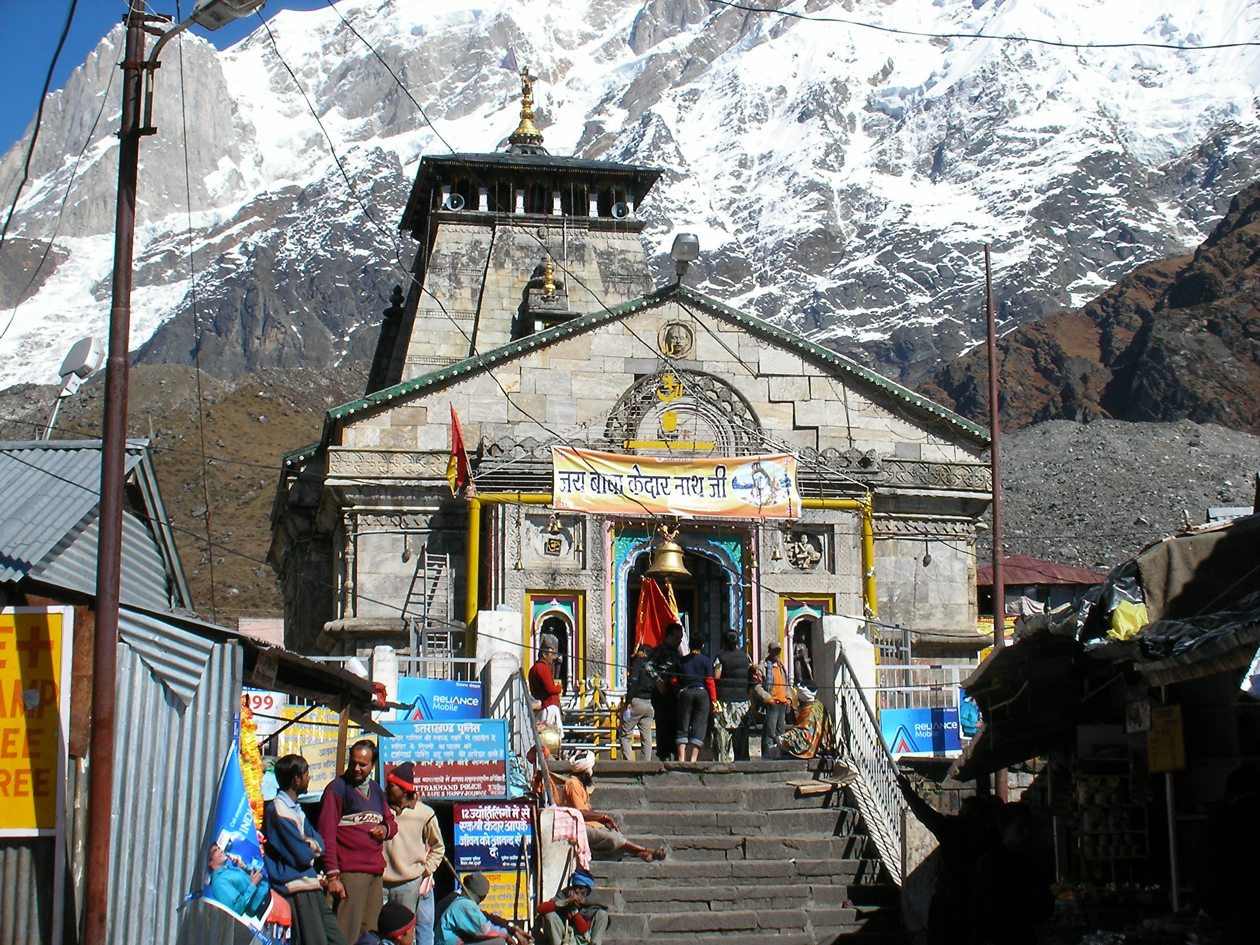
Kedarnath is a town and Nagar Panchayat in Rudraprayag district of Uttarakhand, India, known primarily for the Kedarnath Temple. It is approximately 86 kilometres from Rudraprayag, the district headquarter. Kedarnath is the most remote of the four Chota Char Dham pilgrimage sites. It is located in the Himalayas, about 3,583 m (11,755 ft) above sea level near the Chorabari Glacier, which is the source of the Mandakini river. The town is flanked by snow-capped peaks, most prominently the Kedarnath Mountain. The nearest road head is at Gaurikund about 16 km away. The town suffered extensive destruction during June 2013 from the Flash Floods caused by torrential rains in Uttarakhand state.[4]- [it] Kedarnath
Текст в блоке "Читать" взят с сайта "Википедия" и доступен по лицензии Creative Commons Attribution-ShareAlike; в отдельных случаях могут действовать дополнительные условия.
Другой контент может иметь иную лицензию. Перед использованием материалов сайта WikiSort.org внимательно изучите правила лицензирования конкретных элементов наполнения сайта.
Другой контент может иметь иную лицензию. Перед использованием материалов сайта WikiSort.org внимательно изучите правила лицензирования конкретных элементов наполнения сайта.
2019-2026
WikiSort.org - проект по пересортировке и дополнению контента Википедии
WikiSort.org - проект по пересортировке и дополнению контента Википедии