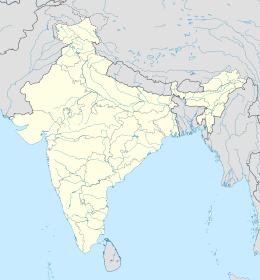
world.wikisort.org - India
Kakkanad è una località dell'India, capoluogo del distretto di Ernakulam, nello stato federato del Kerala. Semplice villaggio fino agli anni ottanta, con l'insediamento degli uffici distrettuali, che in precedenza si trovavano nella vicina Ernakulam, Kakkanad si è sviluppata fino a diventare un sobborgo della città di Kochi[2].
| Kakkanad tehsil | |
|---|---|
| കാക്കനാട് | |
 | |
| Localizzazione | |
| Stato | |
| Stato federato | Kerala |
| Divisione | Non presente |
| Distretto | Ernakulam |
| Territorio | |
| Coordinate | 10°01′01.2″N 76°20′38.4″E |
| Altitudine | 9 m s.l.m. |
| Superficie | 17,54 km² |
| Abitanti | |
| Altre informazioni | |
| Lingue | malayalam, inglese |
| Cod. postale | 682030[1] |
| Fuso orario | UTC+5:30 |
| Cartografia | |
Geografia fisica
La città è situata a 9° 59' 30 N e 76° 20' 56 E[3].
Note
- (EN) India Post, Pincode search - Kakkanad, su indiapost.gov.in. URL consultato il 28-07-2008.
- (EN) The glory of Kakkanad, in The Hindu, 27-10-2005.
- (EN) Google Maps, Kakkanad, Kerala, India, su maps.google.com. URL consultato il 18-09-2008.
Altri progetti
 Wikimedia Commons contiene immagini o altri file su Kakkanad
На других языках
[en] Kakkanad
Kakkanad is a major industrial and residential region in the city of Kochi in Kerala, India. It is situated in the eastern part of the city and houses the Cochin Special Economic Zone, Infopark, Smart City and KINFRA Export Promotion Industrial Park. It is also the administrative headquarters of the District of Ernakulam.- [it] Kakkanad
Текст в блоке "Читать" взят с сайта "Википедия" и доступен по лицензии Creative Commons Attribution-ShareAlike; в отдельных случаях могут действовать дополнительные условия.
Другой контент может иметь иную лицензию. Перед использованием материалов сайта WikiSort.org внимательно изучите правила лицензирования конкретных элементов наполнения сайта.
Другой контент может иметь иную лицензию. Перед использованием материалов сайта WikiSort.org внимательно изучите правила лицензирования конкретных элементов наполнения сайта.
2019-2025
WikiSort.org - проект по пересортировке и дополнению контента Википедии
WikiSort.org - проект по пересортировке и дополнению контента Википедии
