world.wikisort.org - India
Gopeshwar (censita come Chamoli Gopeshwar perché comprensiva della vicina località di Chamoli, nota anche come Lalsanga) è una suddivisione dell'India, classificata come municipal board, di 19.855 abitanti, capoluogo del distretto di Chamoli, nello stato federato dell'Uttarakhand. In base al numero di abitanti la città rientra nella classe IV (da 10.000 a 19.999 persone)[5].
| Gopeshwar Amministrazione Municipale (Municipal Board) | |
|---|---|
 | |
| Localizzazione | |
| Stato | |
| Stato federato | Uttarakhand |
| Divisione | Garhwal |
| Distretto | Chamoli |
| Territorio | |
| Coordinate | 30°24′35″N 79°19′09″E |
| Altitudine | 1 292[1] m s.l.m. |
| Superficie | 14,08 km² |
| Abitanti | 19 855 (2001) |
| Densità | 1 410,16 ab./km² |
| Altre informazioni | |
| Lingue | hindi, inglese |
| Cod. postale | 246401 (Gopeshwar)[2], 246424 (Chamoli)[3] |
| Prefisso | 1372[4] |
| Fuso orario | UTC+5:30 |
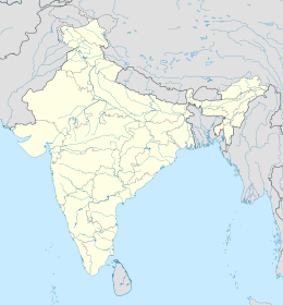
| Cartografia | |
Geografia fisica
Gopeshwar è situata a 30° 25' 0 N e 79° 19' 60 E e ha un'altitudine di 1.292 m s.l.m.[1]; Chamoli invece si trova a 30° 23' 60 N e 79° 20' 60 E, a un'altitudine di 1.754 m s.l.m.[6].
Società
Evoluzione demografica
Al censimento del 2001 la popolazione di Gopeshwar assommava a 19.855 persone, delle quali 11.126 maschi e 8.729 femmine. I bambini di età inferiore o uguale ai sei anni assommavano a 2.056, dei quali 1.112 maschi e 944 femmine. Infine, coloro che erano in grado di saper almeno leggere e scrivere erano 16.000, dei quali 9.488 maschi e 6.512 femmine.[7]
Note
- (EN) Falling Rain Genomics, Inc, Gopeshwar, India Page, su fallingrain.com. URL consultato l'11-07-2008.
- (EN) India Post, Pincode search - Gopeshwar, su indiapost.gov.in. URL consultato il 28-07-2008.
- (EN) India Post, Pincode search - Chamoli, su indiapost.gov.in. URL consultato il 28-07-2008.
- (EN) Bharat Sanchar Nigam Ltd, STD Codes for cities in Uttaranchal [collegamento interrotto], su bsnl.co.in. URL consultato il 28-07-2008.
- (EN) Census of India, Alphabetical list of towns and their population - Uttarakhand (PDF), su censusindia.gov.in. URL consultato il 21-05-2008.
- (EN) Falling Rain Genomics, Inc, Chamoli, India Page, su fallingrain.com. URL consultato l'11-07-2008.
- (EN) Census of India 2001, Population, population in the age group 0-6 and literates by sex - Cities/Towns (in alphabetic order): 2001, su censusindia.net. URL consultato il 20-06-2008 (archiviato dall'url originale il 16 giugno 2004).
| Controllo di autorità | VIAF (EN) 141999323 · LCCN (EN) n88080105 |
|---|
На других языках
[de] Gopeshwar
Gopeshwar, auch Chamoli Gopeshwar, ist eine Kleinstadt im indischen Bundesstaat Uttarakhand.[en] Chamoli Gopeshwar
Chamoli Gopeshwar is a township in the Garhwal hills and a municipal board within Chamoli district. It is the administrative headquarters of the Chamoli District of Uttarakhand in India. Located 1,550 m (5,090 ft) above sea level, it is famous for its weather (pleasant most of the year, but very cold in December and January) and its temple Chamoli Gopeshwar is known for his very beautiful temple "Gopinath" one can definitely experience the feeling of being there in Gopinath. Chamoli Gopeshwar has a very beautiful kund that is Vaitrani.- [it] Gopeshwar
[ru] Гопешвар
Гопешвар (англ. Gopeshwar) или Чамоли Гопешвар (англ. Chamoli Gopeshwar) — город в индийском штате Уттаракханд в регионе Гархвал, административный центр округа Чамоли. Средняя высота над уровнем моря — 1293 метра. В городе расположен известный храм Шивы — Гопинатх-мандир.Другой контент может иметь иную лицензию. Перед использованием материалов сайта WikiSort.org внимательно изучите правила лицензирования конкретных элементов наполнения сайта.
WikiSort.org - проект по пересортировке и дополнению контента Википедии
