world.wikisort.org - India
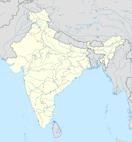
Il distretto di Ukhrul è un distretto dello stato del Manipur, in India. Il suo capoluogo è Ukhrul.
| Distretto di Ukhrul distretto | |
|---|---|
| Ukhrul District | |
| Localizzazione | |
| Stato | |
| Stato federato | Manipur |
| Divisione | Non presente |
| Amministrazione | |
| Capoluogo | Ukhrul |
| Territorio | |
| Coordinate del capoluogo | 25°06′06.96″N 94°21′44.05″E |
| Superficie | 4 544[1] km² |
| Abitanti | 183 998[2] (2011) |
| Densità | 40,49 ab./km² |
| Altre informazioni | |
| Fuso orario | UTC+5:30 |
| Cartografia | |
 | |
| Sito istituzionale | |
Note
- Ukhrul district, su ukhrul.nic.in. URL consultato il 15 luglio 2017.
- Ukhrul District : Census 2011 data, su census2011.co.in. URL consultato il 15 luglio 2017.
Collegamenti esterni
- Sito ufficiale, su ukhrul.nic.in.
| Controllo di autorità | VIAF (EN) 142107801 · LCCN (EN) n2005207713 |
|---|
На других языках
[de] Ukhrul (Distrikt)
Der Distrikt Ukhrul (bis 1983 Manipur East) ist ein Distrikt im indischen Bundesstaat Manipur. Verwaltungssitz ist die namensgebende Stadt Ukhrul.[en] Ukhrul district
Ukhrul district (Meitei pronunciation:/ˈuːkˌɹəl or ˈuːkˌɹʊl/[lower-alpha 2][2]) is an administrative district of the state of Manipur in India with its headquarters at Ukhrul, that is Hunphun.[3][4][5][6][7][8][9][10] The district occupies the north-eastern corner of the state and it extends between latitudes of 24° 29′ and 25° 42′ N and longitudes 94° 30′ and 94° 45′ E approximately (including Kamjong district). It shares an international boundary with Myanmar (Burma) on its eastern side and is bounded by Nagaland state in the north, Senapati district and Kangpokpi district in the west and Kamjong district in the south. It has the distinction of being the highest hill station of Manipur. The terrain of the district is hilly with a varying heights of 913 m to 3114 m (MSL). Ukhrul, the district HQ., at an altitude of 2020 m (MSL) is linked with Imphal, the state capital by NH 202 which is about 84 kilometres apart. The district covers an area of 4,544 square kilometres (1,754 sq mi) including Kamjong district making it the second largest district of the state after Churachandpur district and has a population of almost 1,83,998 according to Census of India 2011 comprising about 6.44 per cent of the total state population. The Tangkhul Naga tribe constitute the major bulk of the population with other communities such as Thadou, Nepalese and other non-tribals constituting a small percentage of the district population. Administratively, the district which comprises around 200 villages was divided into five sub-divisions, where their boundaries were coterminous with that of the Tribal Development Blocks. There was no statutory town in the district except one census town which was formed in 2011 Census. Recently, Kamjong district[11][12][13][14] was carved out from Ukhrul District as a separate district. Ukhrul District has three assembly constituencies before the bifurcation of the district which are Phungyar Assembly Constituency (43-ST), Ukhrul Assembly Constituency (44-ST) and Chingai Assembly Constituency. The district is best introduced by its rare Shirui Lily, (Lilium mackliniae).[citation needed] Also, the district has provided two of Manipur's chief ministers and the only from amongst the hill districts of Manipur, Yangmaso Shaiza the first tribal chief minister of Manipur and Rishang Keishing who is also the first MP from Outer Manipur (Lok Sabha constituency). William Pettigrew (missionary), an educationist and a Scottish-British Christian Missionary pioneered the western system of education and introduced the Christianity faith among the Tangkhal Naga tribe. Phungyo Baptist Church, Tangrei, Ukhrul, the oldest and the first Christian church of Manipur which still stands today is a testament to his passion for missionary work.[10]- [it] Distretto di Ukhrul
[ru] Укхрул (округ)
Укхрул (англ. Ukhrul) — округ в индийском штате Манипур. Образован в 1969 году. Административный центр — город Укхрул. Площадь округа — 4544 км². По данным всеиндийской переписи 2001 года население округа составляло 140 778 человек. Уровень грамотности взрослого населения составлял 73,12 %, что выше среднеиндийского уровня (59,5 %).Текст в блоке "Читать" взят с сайта "Википедия" и доступен по лицензии Creative Commons Attribution-ShareAlike; в отдельных случаях могут действовать дополнительные условия.
Другой контент может иметь иную лицензию. Перед использованием материалов сайта WikiSort.org внимательно изучите правила лицензирования конкретных элементов наполнения сайта.
Другой контент может иметь иную лицензию. Перед использованием материалов сайта WikiSort.org внимательно изучите правила лицензирования конкретных элементов наполнения сайта.
2019-2025
WikiSort.org - проект по пересортировке и дополнению контента Википедии
WikiSort.org - проект по пересортировке и дополнению контента Википедии
