world.wikisort.org - India
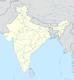
Il distretto di Satara è un distretto del Maharashtra, in India, di 2.796.906 abitanti. È situato nella divisione di Pune e il suo capoluogo è Satara.
| Distretto di Satara distretto | |
|---|---|
| Satara District | |
| Localizzazione | |
| Stato | |
| Stato federato | Maharashtra |
| Divisione | Pune |
| Amministrazione | |
| Capoluogo | Satara |
| Territorio | |
| Coordinate del capoluogo | 17°41′28.73″N 74°00′09.4″E |
| Superficie | 10 475 km² |
| Abitanti | 2 796 906 (2001) |
| Densità | 267,01 ab./km² |
| Altre informazioni | |
| Fuso orario | UTC+5:30 |
| Cartografia | |
 | |
| Sito istituzionale | |
Altri progetti
 Wikimedia Commons contiene immagini o altri file su distretto di Satara
Collegamenti esterni
- Sito ufficiale, su satara.nic.in.
- Satara (distretto), su sapere.it, De Agostini.
| Controllo di autorità | VIAF (EN) 156111011 · LCCN (EN) n97071261 · GND (DE) 4294277-9 |
|---|
На других языках
[de] Satara (Distrikt)
Der Distrikt Satara (Marathi: .mw-parser-output .Deva{font-size:120%}@media all and (min-width:800px){.mw-parser-output .Deva{font-size:calc(120% - ((100vw - 800px)/80))}}@media all and (min-width:1000px){.mw-parser-output .Deva{font-size:100%}}सातारा जिल्हा) ist einer von 35 Distrikten des Staates Maharashtra in Indien.[en] Satara district
Satara district (Marathi pronunciation: [saːt̪aɾaː]) is a district of Maharashtra state in western India with an area of 10,480 km2 (4,050 sq mi) and a population of 3,003,741 of which 14.17% were urban (as of 2011[update]).[1][2] Satara is the capital of the district and other major towns include Medha, Wai, Karad, Koregaon, Maan, Koynanagar, Rahimatpur, Phaltan, Mahabaleshwar, Vaduj and Panchgani. This district comes under Pune Administrative Division along with Pune, Sangli, Solapur and Kolhapur. The district of Pune bounds it to the north, Raigad bounds it to the north-west, Solapur the east, Sangli to the south, and Ratnagiri to the west.[3]- [it] Distretto di Satara
[ru] Сатара (округ)
Сатара (маратх. सातारा जिल्हा; англ. Satara) — округ в индийском штате Махараштра. Образован 1 мая 1960 года. Административный центр — город Сатара. Площадь округа — 10 480 км². По данным всеиндийской переписи 2001 года население округа составляло 2 808 994 человека. Уровень грамотности взрослого населения составлял 78,2 %, что выше среднеиндийского уровня (59,5 %). Доля городского населения составляла 14,2 %.Текст в блоке "Читать" взят с сайта "Википедия" и доступен по лицензии Creative Commons Attribution-ShareAlike; в отдельных случаях могут действовать дополнительные условия.
Другой контент может иметь иную лицензию. Перед использованием материалов сайта WikiSort.org внимательно изучите правила лицензирования конкретных элементов наполнения сайта.
Другой контент может иметь иную лицензию. Перед использованием материалов сайта WikiSort.org внимательно изучите правила лицензирования конкретных элементов наполнения сайта.
2019-2025
WikiSort.org - проект по пересортировке и дополнению контента Википедии
WikiSort.org - проект по пересортировке и дополнению контента Википедии
