world.wikisort.org - India
Il distretto di Barmer è un distretto del Rajasthan, in India, di 1.963.758 abitanti. È situato nella divisione di Jodhpur e il suo capoluogo è Barmer.
| Distretto di Barmer distretto | |
|---|---|
| Barmer District | |
| Localizzazione | |
| Stato | |
| Stato federato | Rajasthan |
| Divisione | Jodhpur |
| Amministrazione | |
| Capoluogo | Barmer |
| Territorio | |
| Coordinate del capoluogo | 25°44′51.09″N 71°23′25.22″E |
| Superficie | 28 387 km² |
| Abitanti | 1 963 758 (2001) |
| Densità | 69,18 ab./km² |
| Altre informazioni | |
| Fuso orario | UTC+5:30 |
| Cartografia | |
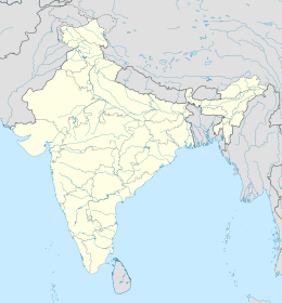
 Il distretto di Barmer è il numero 14
| |
| Sito istituzionale | |
Collegamenti esterni
- Sito ufficiale, su barmer.nic.in.
- Barmer (distretto), su sapere.it, De Agostini.
| Controllo di autorità | VIAF (EN) 156062552 · LCCN (EN) n89291246 |
|---|
На других языках
[de] Barmer (Distrikt)
Der Distrikt Barmer (Hindi बाड़मेर जिला, Bāṛmer) ist ein Distrikt im westindischen Bundesstaat Rajasthan. Er liegt in West-Rajasthan in der Wüste Thar und grenzt an Pakistan. Die Fläche beträgt 28.387 km², die Einwohnerzahl liegt bei 1.964.835 (2001).[2] Verwaltungssitz ist die gleichnamige Stadt.[en] Barmer district
Barmer District is a district in Rajasthan state of India. It is located in the western part of Rajasthan state forming a part of the Thar Desert.[2] Barmer is the third largest district by area in Rajasthan and fifth largest district in India. Occupying an area of 28,387 km2. Being in the western part of the state, it includes a part of the Thar Desert. Jaisalmer is to the north of this district while Jalore is in its south. Pali and Jodhpur form its eastern border and it shares a border with Pakistan in the west. Partially being a desert, this district has a large variation in temperature. The temperature in summer can rise up to 51 °C and falls near to 0 °C in winter. Luni is the longest river in Barmer district. After travelling a length of almost 500 km, it passes through Jalore and merges in the marshy land of Runn of Kutch. [3] District headquarters is in the town of Barmer. The other major towns in the district are: Balotra, Guda Malani, Baytoo, Siwana, and Chohatan. Recently, a large onshore oil field has been discovered and made functional in Barmer district. Now Barmer is also famous for Promegrante . A village near Balotra name, Budiwada is named by Anar village. For reference check map of budiwada..- [it] Distretto di Barmer
[ru] Бармер (округ)
Ба́рмер (англ. Barmer, хинди बाड़मेर जिला) — округ в индийском штате Раджастхан. Разделён на четыре подокруга. Расположен в западной части штата, в пустыне Тар. Административный центр округа — город Бармер. Согласно всеиндийской переписи 2001 года население округа составляло 1 963 758 человек. 86,27 % населения исповедовали индуизм, 11,8 % — ислам и 1,8 % — джайнизм. Уровень грамотности взрослого населения составлял 59,65 %, что соответствует среднеиндийскому уровню (59,5 %). На территории округа находятся крупные нефтяные месторождения.Текст в блоке "Читать" взят с сайта "Википедия" и доступен по лицензии Creative Commons Attribution-ShareAlike; в отдельных случаях могут действовать дополнительные условия.
Другой контент может иметь иную лицензию. Перед использованием материалов сайта WikiSort.org внимательно изучите правила лицензирования конкретных элементов наполнения сайта.
Другой контент может иметь иную лицензию. Перед использованием материалов сайта WikiSort.org внимательно изучите правила лицензирования конкретных элементов наполнения сайта.
2019-2025
WikiSort.org - проект по пересортировке и дополнению контента Википедии
WikiSort.org - проект по пересортировке и дополнению контента Википедии
