world.wikisort.org - India
Il distretto di Anantapur è un distretto dell'Andhra Pradesh, in India, di 3.640.478 abitanti. Il suo capoluogo è Anantapur.
| Distretto di Anantapur distretto | |
|---|---|
| Anantapur District | |
| Localizzazione | |
| Stato | |
| Stato federato | Andhra Pradesh |
| Divisione | Non presente |
| Amministrazione | |
| Capoluogo | Anantapur |
| Territorio | |
| Coordinate del capoluogo | 14°40′59.88″N 77°36′00″E |
| Superficie | 19 130 km² |
| Abitanti | 3 640 478 (2001) |
| Densità | 190,3 ab./km² |
| Altre informazioni | |
| Cod. postale | 515001 |
| Fuso orario | UTC+5:30 |
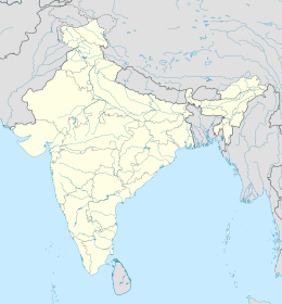
| Cartografia | |
 Il distretto di Anantapur è il numero 2
| |
| Sito istituzionale | |
Amministrazioni
Il distretto è suddiviso in 63 comuni (detti mandal) a loro volta raggruppati in tre divisioni tributarie: Anantapur (che raggruppa 20 comuni), Dharmavaram (17 comuni) e Penukonda (26 comuni).[1]
Dei 63 comuni, 7 sono classificati come municipalità (municipality) e precisamente Anantapur (il capoluogo), Dharmavaram, Guntakal, Hindupur, Kadiri, Rayadurg e Tadipatri[2].
- Divisione tributaria di Anantapur: Anantapur (sede), Atmakur, B. K. Samudram, Garlandinne, Gooty, Guntakal, Kudair, Narpala, Pamidi, Peddapappur, Peddavadugur, Putlur, Raptadu, Singanamala, Tadpatri, Uravakonda, Vajrakarur, Vidapanakal, Yadiki, Yellanur.
- Divisione tributaria di Dharmavaram: Bathalapalli, Beluguppa, Bommanahal, Brahma Samudram, C. K. Palli, Dharmavaram (sede), D. Hirehal, Gummagatta, Kalyandurg, Kambadur, Kanaganapalli, Kanekal, Kundurpi, Ramagiri, Rayadurg, Settur, Tadimarri.
- Divisione tributaria di Penukonda: Agali, Amadagur, Amarapuram, Bukkapatnam, Chilimathur, Gandlapenta, Gorantla, Gudibanda, Hindupur, Kadiri, Kothacheruvu, Lepakshi, Madakasira, Mudigubba, Nallacheruvu, Nallamada, N. P. Kunta, O. D. Cheruvu, Parigi, Penukonda (sede), Puttaparthi, Roddam, Rolla, Somandepalli, Talapula, Tanakal.[3]
Note
- (EN) Official website of Anantapur district, Historical background, su anantapur.nic.in. URL consultato il 9/6/2008 (archiviato dall'url originale il 6 ottobre 2008).
- (EN) Official website of Anantapur district, Receipts and expenditure of Municipalities [collegamento interrotto], su anantapur.nic.in. URL consultato il 9/6/2008.
- (EN) Official website of Anantapur district, Administrative divisions in the district as on 31.03.2002 [collegamento interrotto], su anantapur.nic.in. URL consultato il 9/6/2008.
Altri progetti
 Wikimedia Commons contiene immagini o altri file su distretto di Anantapur
Collegamenti esterni
- Sito ufficiale, su anantapur.nic.in.
- Anantapur (distretto), su sapere.it, De Agostini.
| Controllo di autorità | VIAF (EN) 147741517 · LCCN (EN) n80025323 · GND (DE) 4373323-2 · BNF (FR) cb155471951 (data) |
|---|
На других языках
[de] Anantapur (Distrikt)
Anantapur District (Telugu: అనంతపురం జిల్లా) ist einer von 13 Distrikten des indischen Bundesstaates Andhra Pradesh. Der Verwaltungssitz ist die Stadt Anantapur.[en] Anantapur district
Anantapur district officially: Anantapuramu district[4] is one of the eight districts in the Rayalaseema region of the Indian state of Andhra Pradesh. The district headquarters is located at Anantapur city. It is one of the driest places in South India.[5] As of 2011[update] census of India, it was the largest district in the state by area and with a population of 4,083,315. Later in the year 2022, as part of re-organisation of districts, Sri Satyasai district was carved out and so its area and population reduced by half.- [it] Distretto di Anantapur
[ru] Анантапур (округ)
Анантапу́р (англ. Anantapur) — самый большой по площади округ в индийском штате Андхра-Прадеш. Образован в 1882 году. Административный центр — город Анантапур. Площадь округа — 19 130 км². По данным всеиндийской переписи 2001 года население округа составляло 3 640 478 человек. Уровень грамотности взрослого населения составлял 56,1 %, что выше среднеиндийского уровня (59,5 %). Доля городского населения составляла 25,3 %.Текст в блоке "Читать" взят с сайта "Википедия" и доступен по лицензии Creative Commons Attribution-ShareAlike; в отдельных случаях могут действовать дополнительные условия.
Другой контент может иметь иную лицензию. Перед использованием материалов сайта WikiSort.org внимательно изучите правила лицензирования конкретных элементов наполнения сайта.
Другой контент может иметь иную лицензию. Перед использованием материалов сайта WikiSort.org внимательно изучите правила лицензирования конкретных элементов наполнения сайта.
2019-2025
WikiSort.org - проект по пересортировке и дополнению контента Википедии
WikiSort.org - проект по пересортировке и дополнению контента Википедии
