world.wikisort.org - India
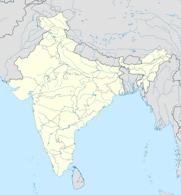
Balurghat è una suddivisione dell'India, classificata come municipality, di 135.516 abitanti, capoluogo del distretto del Dinajpur Meridionale, nello stato federato del Bengala Occidentale. In base al numero di abitanti la città rientra nella classe I (da 100.000 persone in su)[4].
| Balurghat Municipalità (Municipality) | |
|---|---|
| Localizzazione | |
| Stato | |
| Stato federato | Bengala Occidentale |
| Divisione | Jalpaiguri |
| Distretto | Dinajpur Meridionale |
| Territorio | |
| Coordinate | 25°13′N 88°46′E |
| Altitudine | 24[1] m s.l.m. |
| Abitanti | 135 516 (2001) |
| Altre informazioni | |
| Lingue | bengalese, inglese |
| Cod. postale | 733101[2] |
| Prefisso | 3522[3] |
| Fuso orario | UTC+5:30 |
| Cartografia | |
| Sito istituzionale | |
Geografia fisica
La città è situata a 25° 13' 0 N e 88° 46' 0 E e ha un'altitudine di 24 m s.l.m.[1].
Società
Evoluzione demografica
Al censimento del 2001 la popolazione di Balurghat assommava a 135.516 persone, delle quali 68.822 maschi e 66.694 femmine. I bambini di età inferiore o uguale ai sei anni assommavano a 11.570, dei quali 5.899 maschi e 5.671 femmine. Infine, coloro che erano in grado di saper almeno leggere e scrivere erano 107.295, dei quali 56.784 maschi e 50.511 femmine.[5]
Note
- (EN) Falling Rain Genomics, Inc, Balurghat, India Page, su fallingrain.com. URL consultato l'11-07-2008.
- (EN) India Post, Pincode search - Balurghat, su indiapost.gov.in. URL consultato il 28-07-2008.
- (EN) Bharat Sanchar Nigam Ltd, STD Codes for cities in West Bengal [collegamento interrotto], su bsnl.co.in. URL consultato il 28-07-2008.
- (EN) Census of India, Alphabetical list of towns and their population - West Bengal (PDF), su censusindia.gov.in. URL consultato il 21-05-2008.
- (EN) Census of India 2001, Population, population in the age group 0-6 and literates by sex - Cities/Towns (in alphabetic order): 2001, su censusindia.net. URL consultato il 20-06-2008 (archiviato dall'url originale il 16 giugno 2004).
Collegamenti esterni
- Sito ufficiale, su wb.gov.in.
- (EN) Balurghat, su Enciclopedia Britannica, Encyclopædia Britannica, Inc.
На других языках
[de] Balurghat
Balurghat ist eine Stadt im indischen Bundesstaat Westbengalen. Der Fluss Atrai fließt durch die Stadt und teilt sie in zwei Hälften.[en] Balurghat
Balurghat (pron:bʌlʊəˈgɑ:t) is a town and a municipality in the state of West Bengal, India. It is the district headquarter of the Dakshin Dinajpur district. It is one of the major cities connected through National Highway 512. In this town there are museum, parks, super speciality hospital, govt. offices, district court, schools, colleges, a university, police station, railway station, hotels, restaurants, cinema halls, temples, mosques, churches, etc. There is the Atreyee river which flows through this town. It is a place/town to live peacefully. It is a place to visit in the month of October to November when one can enjoy ritualistic and religious festivals. From the inner area of Balurghat one can go Hilli, a rural area, where one can see India-Bangladesh border.- [it] Balurghat
[ru] Балургхат
Ба́лургхат (англ. Balurghat) — город в индийском штате Западная Бенгалия. Административный центр округа Южный Динаджпур. Средняя высота над уровнем моря — 25 метров. По данным всеиндийской переписи 2001 года, в городе проживало 135 516 человек, из которых мужчины составляли 51 %, женщины — соответственно 49 %. Уровень грамотности взрослого населения составлял 78,8 % (при общеиндийском показателе 59,5 %). Уровень грамотности среди мужчин составлял 82,5 %, среди женщин — 75,7 %. 9 % населения было моложе 6 лет.Текст в блоке "Читать" взят с сайта "Википедия" и доступен по лицензии Creative Commons Attribution-ShareAlike; в отдельных случаях могут действовать дополнительные условия.
Другой контент может иметь иную лицензию. Перед использованием материалов сайта WikiSort.org внимательно изучите правила лицензирования конкретных элементов наполнения сайта.
Другой контент может иметь иную лицензию. Перед использованием материалов сайта WikiSort.org внимательно изучите правила лицензирования конкретных элементов наполнения сайта.
2019-2025
WikiSort.org - проект по пересортировке и дополнению контента Википедии
WikiSort.org - проект по пересортировке и дополнению контента Википедии
