world.wikisort.org - India
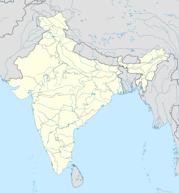
Baghmara è una suddivisione dell'India, classificata come municipal board, di 8.643 abitanti, capoluogo del distretto dei Monti Garo Meridionali, nello stato federato del Meghalaya. In base al numero di abitanti la città rientra nella classe V (da 5.000 a 9.999 persone)[4].
| Baghmara Amministrazione Municipale (Municipal Board) | |
|---|---|
| Localizzazione | |
| Stato | |
| Stato federato | |
| Divisione | Non presente |
| Distretto | Monti Garo Meridionali |
| Territorio | |
| Coordinate | 25°11′36.57″N 90°38′04.67″E |
| Altitudine | 101[1] m s.l.m. |
| Abitanti | 8 643 (2001) |
| Altre informazioni | |
| Lingue | garo, khasi, inglese |
| Cod. postale | 794102[2] |
| Prefisso | 3639[3] |
| Fuso orario | UTC+5:30 |
| Cartografia | |
Geografia fisica
La città è situata a 25° 11' 60 N e 90° 37' 60 E e ha un'altitudine di 101 m s.l.m.[1].
Società
Evoluzione demografica
Al censimento del 2001 la popolazione di Baghmara assommava a 8.643 persone, delle quali 4.602 maschi e 4.041 femmine. I bambini di età inferiore o uguale ai sei anni assommavano a 1.412, dei quali 725 maschi e 687 femmine. Infine, coloro che erano in grado di saper almeno leggere e scrivere erano 6.071, dei quali 3.340 maschi e 2.731 femmine.[5]
Note
- (EN) Falling Rain Genomics, Inc, Baghamara, India Page, su fallingrain.com. URL consultato l'11-07-2008.
- (EN) India Post, Pincode search - Baghmara, su indiapost.gov.in. URL consultato il 28-07-2008.
- (EN) Bharat Sanchar Nigam Ltd, STD Codes for cities in Meghalaya [collegamento interrotto], su bsnl.co.in. URL consultato il 28-07-2008.
- (EN) Census of India, Alphabetical list of towns and their population - Meghalaya (PDF), su censusindia.gov.in. URL consultato il 21-05-2008.
- (EN) Census of India 2001, Population, population in the age group 0-6 and literates by sex - Cities/Towns (in alphabetic order): 2001, su censusindia.net. URL consultato il 20-06-2008 (archiviato dall'url originale il 16 giugno 2004).
На других языках
[de] Baghmara
Baghmara ist eine Stadt im indischen Bundesstaat Meghalaya. Sie befindet sich nahe der Grenze zu Bangladesch.[en] Baghmara, India
Baghmara (IPA: ˌbægˈmɑ:rə) is the headquarters of South Garo Hills district in the state of Meghalaya in India. The place is bordered by Bangladesh and is about 113 km from Tura; 248 km from Guwahati; and 287 km from state capital Shillong. It has the famous river, Someshwari, also known as Simsang in Garo tribal language, flowing through its expanse and is also covered in hills and tracts along the way. This southern part of the Garo Hills region has lots of tourist spots compared to other districts and is a popular tourist destination for both domestic and international tourists when it comes to tourism in Western Meghalaya.- [it] Baghmara
Текст в блоке "Читать" взят с сайта "Википедия" и доступен по лицензии Creative Commons Attribution-ShareAlike; в отдельных случаях могут действовать дополнительные условия.
Другой контент может иметь иную лицензию. Перед использованием материалов сайта WikiSort.org внимательно изучите правила лицензирования конкретных элементов наполнения сайта.
Другой контент может иметь иную лицензию. Перед использованием материалов сайта WikiSort.org внимательно изучите правила лицензирования конкретных элементов наполнения сайта.
2019-2025
WikiSort.org - проект по пересортировке и дополнению контента Википедии
WikiSort.org - проект по пересортировке и дополнению контента Википедии
