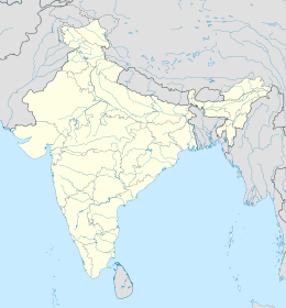
world.wikisort.org - India
Ahiri, o Aheri, è un villaggio dell'India, sede di taluka nel distretto di Gadchiroli, nello stato federato del Maharashtra.
| Ahiri Villaggio | |
|---|---|
 | |
| Localizzazione | |
| Stato | |
| Stato federato | Maharashtra |
| Divisione | Nagpur |
| Distretto | Gadchiroli |
| Territorio | |
| Coordinate | 19°24′42″N 80°00′14″E |
| Altitudine | 120 m s.l.m. |
| Superficie | 9,53 km² |
| Abitanti | 14 384 (2001) |
| Densità | 1 509,34 ab./km² |
| Altre informazioni | |
| Lingue | marathi, hindi, inglese |
| Cod. postale | 442705[1] |
| Fuso orario | UTC+5:30 |
| Cartografia | |
Note
- (EN) India Post, Pincode search - Aheri, su indiapost.gov.in. URL consultato il 02-03-2012.
На других языках
[en] Aheri, Gadchiroli
Aheri is a town and a tehsil and a district sub-division in Gadchiroli district in the Indian state of Maharashtra. It is located on the bank of Pranhita River, a tributary of Godavari River. This town is situated at the border of the Indian states of Maharashtra and Telangana. Aheri is known for its unity among the people. It represents religious, cultural and linguistic diversity. Aheri is among two Scheduled Area listed under Gadhiroli district by Government Of India. Viththal Rukhmai Mandir is the famous temple here, located right at the heart of the town.- [it] Ahiri
Текст в блоке "Читать" взят с сайта "Википедия" и доступен по лицензии Creative Commons Attribution-ShareAlike; в отдельных случаях могут действовать дополнительные условия.
Другой контент может иметь иную лицензию. Перед использованием материалов сайта WikiSort.org внимательно изучите правила лицензирования конкретных элементов наполнения сайта.
Другой контент может иметь иную лицензию. Перед использованием материалов сайта WikiSort.org внимательно изучите правила лицензирования конкретных элементов наполнения сайта.
2019-2025
WikiSort.org - проект по пересортировке и дополнению контента Википедии
WikiSort.org - проект по пересортировке и дополнению контента Википедии
