world.wikisort.org - India
Tumkur, officially renamed as Tumakuru,[4] is a city located in the southern part of Indian state of Karnataka. Tumkur is situated at a distance of 70 km (43 mi) northwest of Bangalore,[5] the state capital along NH 48 and NH 73. It is the headquarters of the Tumkur district. It is located at an altitude of 835 m (2739.5 ft).[6]
Tumkur
Kalpataru Nadu | |
|---|---|
City | |
| Tumakuru | |
 Clockwise from top: Siddaganga Matha, Kote Anjaneya Swami Statue, Globe Library of SSIT, SIT, India Food Park | |
| Nickname: Kalpatharu Nadu (land of coconut trees)[1] | |
 Tumkur Location of Tumkur in Karnataka, India  Tumkur Tumkur (India) | |
| Coordinates: 13.34°N 77.1°E | |
| Country | |
| State | Karnataka |
| Region | Bayaluseemē |
| District | Tumkur District |
| Government | |
| • Type | Mayor–Council |
| • Body | Tumkur City Corporation |
| • Mayor | B.G. Krishnappa |
| • Commissioner | T Bhoobalan IAS[2] |
| Area | |
| • City | 48.60 km2 (18.76 sq mi) |
| Elevation | 822 m (2,697 ft) |
| Population (2011)[3] | |
| • City | 305,821 |
| • Rank | India : 151 Karnataka : 11 |
| • Density | 6,300/km2 (16,000/sq mi) |
| • Metro | 400,442 |
| Demonym | Tumkurian |
| Time zone | UTC+5:30 (IST) |
| Pincode(s) | 572101-106 |
| Telephone code | +91-(0)816 |
| Vehicle registration | KA-06 |
| Official language | Kannada |
| Website | www |
Tumkur hosts India's first mega food park, a project of the ministry of food processing. The India Food Park was inaugurated by Prime Minister Narendra Modi in September 2014.[7] Tumkur is also included in the Smart Cities Mission list and is among the 100 smart cities to be developed in India.[8] Since 28 August 2010, Tumkur has been accorded the status of a city corporation.[9]
Etymology
Etymologically, the name of the city is believed to have been mutated possibly from "Tumbe ooru" because of the abundance of thumbe hoovu, a kind of flower, or thamate ooru because of the folk musical percussion instrument thamate, that might have been used most here. It is also called Kalpatharu Nadu (land of coconut trees), due to the abundance of coconut trees in the area.[1]
Another story says that during the rule of cholas Gulur was their capital. Since Tumkur is at high elevation the guards used to be there on any hill with tumaki (a kind of drum) and used to make sound in case of any alerts, hence the name. The Indian central government approved the request to officially rename the Tumkur and 12 other cities in October 2014. The city officially became "Tumakuru" on 1 November 2014.[10]
Geography
Tumkur is located at 13.34°N 77.1°E.[11] It has an average elevation of 822 metres (2696 feet). The city has a railway station on the South Western railway, 70 km (43 mi) northwest from Bangalore, 130 km (81 mi) southeast from Chitradurga city and 130 km (81 mi) from Kolar City.
Demographics
As of 2011 India census,[12] Tumkur had a population of 305,821. More than 5,00,000 people lived in the corporation limit. At the 2001 census, males constitutes 52% of the population and females 48%. Tumkur had an average literacy rate of 75%, higher than the national average of 59.5%: male literacy was 79%, and female literacy was 70%. About 11% of the population was under 6 years of age. The most common language in the city is Kannada.
History
The known history of the Tumkur district begins with the Western Ganga dynasty.[13] The Ganga family ruled over the southern and eastern districts of the state from early in the Christian era to 1025 C.E. The earliest record of The Ganga family found in this district belongs to about 400 C.E. After the Gangas, Tumkur was ruled by the Rastrakutas and The Chalukyas. The Nolambas under these rulers ruled the area for a long time. The cholas also ruled some parts of the district. The Vijayanagara Empire ruled supreme for the latter part of the 13th to 17th century. During the 18th and 19th centuries, Tumkur was ruled by The Wodeyars of Mysore until independence.
The Tumkur town municipality was set up by the Mysore Wodeyars in the 1916. Self-rule of the residents of Tumkur started after the setting up of the municipality. Tumkur was converted into a city corporation only in 2010 by adding 22 villages adjoining the city. The population is 3,05,877 as per the 2011 census. Tumkur is now a middle class majority city, with a literacy rate of 80%, mainly traders, government employees, small and medium industrialists, and self-employed individuals. The GDP of Tumkur is around 16600 crores (2014) and the total collection of income tax in the last financial year[when?] was approximately 80 crores. Being an Agrarian economy, the major plantation crops of Tumkur are coconut and areca nut. The major cash crops are paddy, ragi and groundnut. Iron ore, manganese and granite are the major minerals found in the Tumkur district.
Tumkur is a knowledge hub in the south interior of Karnataka. It has Tumkur University, two medical colleges, five engineering colleges, 38 degree and postgraduate colleges, one dental college and many polytechnics, high schools and primary schools.
The Indian budget for the year 2014-2015 held on 10 July 2014 announced that Tumkur was one of the cities in south India to be developed as an "Industrial Smart" city.[14] The city was also selected as one among the 100 in the country shortlisted for the Smart City Project. Tumkur was competing to be one among the 20 to be taken up for development in 2018.[citation needed] The government of India has promised 100 crores each as a matching grant for five years and the local body with assistance from the state government has to match another 100 crores. Thus, in five years, development in the amount of 1000 crores will happen in Smart City.[citation needed]
Climate
| Climate data for Tumkur (1981–2010, extremes 1972–1999) | |||||||||||||
|---|---|---|---|---|---|---|---|---|---|---|---|---|---|
| Month | Jan | Feb | Mar | Apr | May | Jun | Jul | Aug | Sep | Oct | Nov | Dec | Year |
| Record high °C (°F) | 32.5 (90.5) |
35.0 (95.0) |
37.4 (99.3) |
38.9 (102.0) |
38.1 (100.6) |
39.0 (102.2) |
36.1 (97.0) |
36.1 (97.0) |
32.5 (90.5) |
33.0 (91.4) |
31.2 (88.2) |
31.0 (87.8) |
39.0 (102.2) |
| Average high °C (°F) | 28.6 (83.5) |
31.3 (88.3) |
33.9 (93.0) |
35.0 (95.0) |
34.5 (94.1) |
30.5 (86.9) |
28.9 (84.0) |
28.4 (83.1) |
29.2 (84.6) |
28.9 (84.0) |
27.8 (82.0) |
27.3 (81.1) |
30.4 (86.7) |
| Average low °C (°F) | 16.2 (61.2) |
17.9 (64.2) |
20.1 (68.2) |
21.5 (70.7) |
21.2 (70.2) |
20.3 (68.5) |
19.6 (67.3) |
19.3 (66.7) |
19.3 (66.7) |
19.1 (66.4) |
17.8 (64.0) |
16.3 (61.3) |
19.1 (66.4) |
| Record low °C (°F) | 10.6 (51.1) |
12.1 (53.8) |
13.0 (55.4) |
6.0 (42.8) |
14.5 (58.1) |
14.5 (58.1) |
13.0 (55.4) |
15.6 (60.1) |
11.8 (53.2) |
10.0 (50.0) |
10.6 (51.1) |
10.4 (50.7) |
6.0 (42.8) |
| Average rainfall mm (inches) | 7.2 (0.28) |
2.4 (0.09) |
8.4 (0.33) |
31.9 (1.26) |
60.5 (2.38) |
91.9 (3.62) |
124.5 (4.90) |
119.7 (4.71) |
158.2 (6.23) |
137.3 (5.41) |
52.2 (2.06) |
15.2 (0.60) |
809.5 (31.87) |
| Average rainy days | 0.3 | 0.2 | 0.5 | 1.9 | 4.2 | 6.3 | 8.1 | 8.5 | 7.6 | 6.8 | 3.2 | 1.0 | 48.8 |
| Average relative humidity (%) (at 17:30 IST) | 35 | 27 | 24 | 29 | 40 | 61 | 67 | 68 | 62 | 60 | 57 | 47 | 48 |
| Source: India Meteorological Department[15][16] | |||||||||||||
Transportation
Karnataka State Road Transport Corporation, KSRTC, has a divisional office situated in Tumkur City. The city is well-connected to Bangalore and other cities in the state by KSRTC buses. Volvo buses are available for the city, Bangalore. Frequent buses are available connecting other taluks and towns of the district. Three National Highways NH 48, NH 73 and NH 69 pass through the city. The three National Highways connect Tumkur to Hubli, Mangalore and Shimoga in Karnataka respectively. TCB Road(Karnataka)(Tumkur-Chelur-Bukkapatna Road) connects the people of Hagalavadi, Chelur and Bellavi Towns to Tumkur Corporation City. Plenty of private and Karnataka State Road Transport Corporation buses are currently operating on this route.
Railways also play a major role in connectivity. The city's Railway Station comes under South Western Railway Zone (India) and was constructed during the British period and has been renovated recently.[when?] It is located in centre of the city close to the bus stand and the town hall. It is located in the Bangalore-Hubli main line.
The city buses are also available for transportation within the city by KSRTC. Popularly known as Sri Siddaganga Nagara Sarige, named after the holy place, Siddaganga. There are more than 100 buses transporting in the city.
The nearest airport to Tumkur is Kempegowda International Airport in Bangalore which is around 90 km from the city.
Economy
This section does not cite any sources. (July 2018) |
- Tumkur district's economy is majorly derived from agriculture. Plantation crops such as coconut, areca nut, paddy cultivation (some parts) attributes to its economy.
- Tumkur City's economy comes from industries.
Due to its proximity to Bangalore, the state capital, it acts as a gateway to North Karnataka, being on the Chennai – Mumbai industrial corridor and the infrastructure that Tumkur provides, it has the potential to be the satellite city to decongest the Bangalore. It also has been identified as National Investment and Manufacturing Zone (NIMZ). NIMZ of approximately 13500 acres and the HAL helicopter manufacturing facility (Near Gubbi) 610 acres are being developed as integrated industrial townships with state-of-the art infrastructure and land use on the basis of zoning, clean and energy efficient technology, necessary social infrastructure, and skill development facilities, for promoting world class manufacturing activity. Tumkur is home to 24 large scale industries with an investment of 911.42 crores and generating an employment for 6445 persons. The existing 15 medium scale industries and 23804 micro and small industries employ 132994 persons and account for an investment of close to 790 crores. A 2000 MW of solar power plant on 11000 acres is being developed near Pavagada to cater to the power needs of Tumkur and adjoining districts.

Educational institutes
- Siddaganga Institute of Technology
- Tumkur University
Tumkur is famous for Siddaganga Matha 5 km toward HITECH city flyover, known for providing free education and dorms for more than 9000 children. Karnataka Rathna Shivakumara Swami, was the president of this matha.[17]
Notable people
Actors
- Arjun Sarja, actor
- Jaggesh, actor
- Sharath Lohitashwa, actor
- Lohithaswa T. S., actor, writer
- Manjula, actress
- Narasimharaju
- Siddhanth, actor
- Ashika Ranganath, actress
- Rangayana Raghu, Actor and Comedian
Arts
- Doddarange Gowda, poet
- Amarashilpi Jakanachari, sculptor
- Renuka Kesaramadu, painter and sculptor
- Kunigal Nagabhushan, writer
- T. Sunandamma, writer and humorist
- B. M. Srikantaiah, writer known as Kannadada Kanva
- T. N. Srikantaiah, poet, linguist and teacher
- Chi. Udayashankar, lyricist
- Gubbi Veeranna, theatre director
- Chandrika Gururaj - playback singer
Politicians
- G. S. Basavaraj, politician
- K. Lakkappa, politician
- S. Mallikarjunaiah, politician
- Rank Nazeer Ahmed, politician
- G. Parameshwara, former Deputy Chief Minister of Karnataka, former KPCC President
Sports
- Poll Ashokanand, cricketer
- Poll Shyamsunder, cricketer
Others
- C. P. Sadashivaiah, Indian freedom fighter
- Shivakumara Swami, supercentenarian, humanitarian, spiritual leader and educator
- Saalumarada Thimmakka, Indian environmentalist
Media
Tumkur has a private FM radio channel, Siddhartha, situated at SSIT campus, broadcasting in Kannada language. Amogha local channel is Amogha Networks.
 Bhanasankari Temple
 City Entrance
 Town Hall junction
 Masjid Al Rayyan,Ring Road
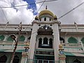 Masjid e Aqsa
 Rank Nazeer Saheb Eidgah
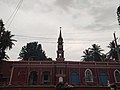 CSI Wesley Church


See also
References
- "About Tumkur, the land of education | SSDC". www.ssdctumkur.org. Retrieved 31 December 2020.
- "Commissioner". Tumakuru City Corporation. Retrieved 9 September 2015.
- "City Summary". Tumkur City Corporation. Retrieved 1 June 2016.
- Prabhu, Nagesh (1 November 2014). "New names for cities". The Hindu. ISSN 0971-751X. Retrieved 31 December 2020.
- "About Tumkur | SSDC". www.ssdctumkur.org. Retrieved 31 December 2020.
- elevationmap.net. "Tumkur City, Tumkur, Bangalore, India on the Elevation Map. Topographic Map of Tumkur City, Tumkur, Bangalore, India". elevationmap.net. Retrieved 31 December 2020.
- "Modi inaugurates Mega Food Park in Tumkur". 24 September 2014 – via The Hindu.
- "About Smart City". www.smartcitytumakuru.in. Retrieved 31 December 2020.
- "Tumkur, Shimoga and Bijapur cities to be upgraded as Municipal Corporations". The Hindu. Special Correspondent. 2 September 2013. ISSN 0971-751X. Retrieved 1 January 2021.
{{cite news}}: CS1 maint: others (link) - New City, Names to Karnatka. "New name for cities". The Hindu. Retrieved 1 November 2014.
- "Maps, Weather, and Airports for Tumkur, India".
- "Census of India 2001: Data from the 2001 Census, including cities, villages and towns (Provisional)". Census Commission of India. Archived from the original on 16 June 2004. Retrieved 1 November 2008.
- "History | District Tumkur, Government of Karnataka". Retrieved 26 March 2019.
- "Unauthorized Request Blocked". uddkar.gov.in. Retrieved 26 March 2019.
- "Station: Tumkur Climatological Table 1981–2010" (PDF). Climatological Normals 1981–2010. India Meteorological Department. January 2015. pp. 759–760. Archived from the original (PDF) on 5 February 2020. Retrieved 19 April 2020.
- "Extremes of Temperature & Rainfall for Indian Stations (Up to 2012)" (PDF). India Meteorological Department. December 2016. p. M104. Archived from the original (PDF) on 5 February 2020. Retrieved 19 April 2020.
- "SSDC". ssdctumkur.org. Retrieved 29 October 2022.
External links
Authority control | |
|---|---|
| General |
|
| National libraries | |
На других языках
[de] Tumakuru
Tumakuru, bis 2014 Tumkur (Kannada: ತುಮಕೂರು Tumakūru), ist eine Industriestadt im südindischen Bundesstaat Karnataka, auch bekannt unter dem Namen Shaikshanika Nagari (die Stadt der Bildung) und Kalpatharu Nadu (das Land der Kokospalmen) mit rund 306.000 Einwohnern (Volkszählung 2011).- [en] Tumkur
[ru] Тумкур
Тумкур (англ. Tumkur) — город в индийском штате Карнатака. Административный центр округа Тумкур. Средняя высота над уровнем моря — 822 метра. По данным всеиндийской переписи 2011 года, в городе проживало 305 821 человека, из которых мужчины составляли 52 %, женщины — соответственно 48 %. Уровень грамотности взрослого населения составлял 75 % (при общеиндийском показателе 59,5 %). Уровень грамотности среди мужчин составлял 79 %, среди женщин — 70 %. 11 % населения было моложе 6 лет.Другой контент может иметь иную лицензию. Перед использованием материалов сайта WikiSort.org внимательно изучите правила лицензирования конкретных элементов наполнения сайта.
WikiSort.org - проект по пересортировке и дополнению контента Википедии