world.wikisort.org - India
Sirsaud (Devanagari: सिरसौद Sirsaud)[1] is a village in Morar block of Gwalior district, in Madhya Pradesh, India.[2] As of 2011, the village population is 3,009, in 523 households.[2]
Sirsaud | |
|---|---|
Village | |
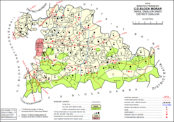 Map showing Sirsaud (986) in Morar CD block | |
 Sirsaud Location in Madhya Pradesh, India  Sirsaud Sirsaud (India) | |
| Coordinates: 26°13′N 78°28′E[1] | |
| Country | |
| State | Madhya Pradesh |
| District | Gwalior |
| Area | |
| • Total | 12.000 km2 (4.633 sq mi) |
| Population (2011)[2] | |
| • Total | 3,009 |
| • Density | 250/km2 (650/sq mi) |
| Languages | |
| • Official | Hindi |
| Time zone | UTC+5:30 (IST) |
History
At the beginning of the 20th century, Sirsaud was part of Gwalior State.[1] Located in Pichhore pargana of zila Gird Gwalior, it had a population of 413.[1] Its area was not listed because the village was unsurveyed.[1] The village was held as a jagir.[1]
References
- Luard, C.E.; Sheopuri, Dwarka Nath (1908). Gwalior State Gazetteer Vol. I, Part III: Village List. Lucknow: Newul Kishore Press. p. 17. Retrieved 14 May 2021.
- "Census of India 2011: Madhya Pradesh District Census Handbook - Gwalior, Part A (Village and Town Directory)" (PDF). Census 2011 India. pp. 196–203. Retrieved 14 May 2021.
This article related to a location in Madhya Pradesh is a stub. You can help Wikipedia by expanding it. |
Текст в блоке "Читать" взят с сайта "Википедия" и доступен по лицензии Creative Commons Attribution-ShareAlike; в отдельных случаях могут действовать дополнительные условия.
Другой контент может иметь иную лицензию. Перед использованием материалов сайта WikiSort.org внимательно изучите правила лицензирования конкретных элементов наполнения сайта.
Другой контент может иметь иную лицензию. Перед использованием материалов сайта WikiSort.org внимательно изучите правила лицензирования конкретных элементов наполнения сайта.
2019-2026
WikiSort.org - проект по пересортировке и дополнению контента Википедии
WikiSort.org - проект по пересортировке и дополнению контента Википедии