world.wikisort.org - India
Raigiri is a village of Bhuvanagiri mandal and also falls under Bhongir Municipality in Yadadri Bhuvanagiri district in the state of Telangana, India.[1]
Raigiri | |
|---|---|
Village , Ward | |
 Lake near the Raigiri | |
 Raigiri Location in Telangana, India  Raigiri Raigiri (India) | |
| Coordinates: 17.5342°N 78.9403°E | |
| Country | |
| State | Telangana |
| District | Yadadri Bhuvanagiri |
| City | Bhongir Municipality |
| Elevation | 400 m (1,300 ft) |
| Languages | |
| • Official | Telugu |
| Time zone | UTC+5:30 (IST) |
| PIN | 508116 |
| Vehicle registration | TS 30 |
| Nearest city | Bhongir |
| Lok Sabha constituency | Bhongir |
| Vidhan Sabha constituency | Bhongir |
| Climate | hot (Köppen) |
| Website | telangana |
There is a railway station in this village between Secunderabad, Bhuvanagiri and Kazipet, Warangal under South Central Railway. This is the nearest station to reach the famous pilgrimage place Yadadri temple and Bhuvanagiri fort
Gallery
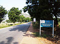 Route from Raigir to Yadadri temple
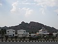 Reliance Petrol bunk in Raigiri


References
- "Medchal−Malkajgiri district" (PDF). New Districts Formation Portal. Archived from the original (PDF) on 12 October 2016. Retrieved 11 October 2016.
External links
![]() Media related to Raigiri at Wikimedia Commons
Media related to Raigiri at Wikimedia Commons
Текст в блоке "Читать" взят с сайта "Википедия" и доступен по лицензии Creative Commons Attribution-ShareAlike; в отдельных случаях могут действовать дополнительные условия.
Другой контент может иметь иную лицензию. Перед использованием материалов сайта WikiSort.org внимательно изучите правила лицензирования конкретных элементов наполнения сайта.
Другой контент может иметь иную лицензию. Перед использованием материалов сайта WikiSort.org внимательно изучите правила лицензирования конкретных элементов наполнения сайта.
2019-2026
WikiSort.org - проект по пересортировке и дополнению контента Википедии
WikiSort.org - проект по пересортировке и дополнению контента Википедии