world.wikisort.org - India
Parsathua is a village in Kochas block of Rohtas district in Bihar, India. As of 2011, its population was 4,762, in 719 households. It has a regular mandi and a weekly haat. Drinking water is provided by hand pump. The village's area covers an area of 167.94 hectares, of which most is farmland: 163.9 ha are under cultivation, and 159.1 are irrigated. 1.1 ha consists of permanent pastures, and 0.4 ha consists of orchards. An area of 0.9 ha is devoted to non-agricultural use.[2]
Parsathua | |
|---|---|
Village | |
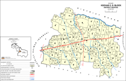 Map of Parsathua (#685) in Kochas block | |
 Parsathua Location in Bihar, India  Parsathua Parsathua (India) | |
| Coordinates: 25.21089°N 83.80939°E[1] | |
| Country | India |
| State | Bihar |
| District | Bhojpur |
| Area | |
| • Total | 1.6794 km2 (0.6484 sq mi) |
| Elevation | 76 m (249 ft) |
| Population (2011) | |
| • Total | 4,762[2] |
| Languages | |
| • Official | Bhojpuri, Hindi |
| Time zone | UTC+5:30 (IST) |
See also
- Mahabirganj — village administratively counted under Parsathua
References
- "Geonames.org. Parsathua". Retrieved 27 October 2020.
- "Census of India 2011: Bihar District Census Handbook - Rohtas, Part A (Village and Town Directory)". Census 2011 India. pp. 228–307. Retrieved 27 October 2020.
This article related to a location in Bihar is a stub. You can help Wikipedia by expanding it. |
Текст в блоке "Читать" взят с сайта "Википедия" и доступен по лицензии Creative Commons Attribution-ShareAlike; в отдельных случаях могут действовать дополнительные условия.
Другой контент может иметь иную лицензию. Перед использованием материалов сайта WikiSort.org внимательно изучите правила лицензирования конкретных элементов наполнения сайта.
Другой контент может иметь иную лицензию. Перед использованием материалов сайта WikiSort.org внимательно изучите правила лицензирования конкретных элементов наполнения сайта.
2019-2026
WikiSort.org - проект по пересортировке и дополнению контента Википедии
WikiSort.org - проект по пересортировке и дополнению контента Википедии