world.wikisort.org - India
Madanrting is a census town in East Khasi Hills district in the Indian state of Meghalaya.
Madanryting | |
|---|---|
suburb | |
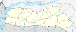 Madanryting Location in Meghalaya, India  Madanryting Madanryting (India) | |
| Coordinates: 25.5623500°N 91.8934200°E | |
| Under Community Development Block | |
| State | Meghalaya |
| District | East Khasi Hills |
| Government | |
| • Type | Traditional Chief called Headman elected in the General Meeting of adult citizens |
| • Body | Village Durbar |
| Population (2001) | |
| • Total | 16,700 |
| Languages | |
| • Official | Khasi, English |
| Time zone | UTC+5:30 (IST) |
| Vehicle registration | ML |
Demographics
As of 2001[update] India census,[1] Madanrting had a population of 16,700. Males constitute 51% of the population and females 49%. Madanrting has an average literacy rate of 76%, higher than the national average of 59.5%: male literacy is 80%, and female literacy is 72%. In Madanrting, 13% of the population is under 6 years of age.
References
- "Census of India 2001: Data from the 2001 Census, including cities, villages and towns (Provisional)". Census Commission of India. Archived from the original on 16 June 2004. Retrieved 1 November 2008.
Текст в блоке "Читать" взят с сайта "Википедия" и доступен по лицензии Creative Commons Attribution-ShareAlike; в отдельных случаях могут действовать дополнительные условия.
Другой контент может иметь иную лицензию. Перед использованием материалов сайта WikiSort.org внимательно изучите правила лицензирования конкретных элементов наполнения сайта.
Другой контент может иметь иную лицензию. Перед использованием материалов сайта WikiSort.org внимательно изучите правила лицензирования конкретных элементов наполнения сайта.
2019-2026
WikiSort.org - проект по пересортировке и дополнению контента Википедии
WikiSort.org - проект по пересортировке и дополнению контента Википедии