world.wikisort.org - India
Kaup is a village in Garhani block of Bhojpur district, Bihar, India. As of 2011, its population was 4,958, in 740 households.[2]
Kaup
Kāup | |
|---|---|
Village | |
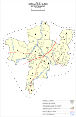 Map of Kaup (#507) in Garhani block | |
 Kaup Location in Bihar, India  Kaup Kaup (India) | |
| Coordinates: 25.37822°N 84.5546°E[1] | |
| Country | India |
| State | Bihar |
| District | Bhojpur |
| Area | |
| • Total | 0.557 km2 (0.215 sq mi) |
| Elevation | 76 m (249 ft) |
| Population (2011) | |
| • Total | 4,958[2] |
| Languages | |
| • Official | Bhojpuri, Hindi |
| Time zone | UTC+5:30 (IST) |
References
- "Geonames.org. Kāup". Retrieved 22 August 2020.
- "Census of India 2011: Bihar District Census Handbook - Bhojpur, Part A (Village and Town Directory)". Census 2011 India. pp. 604–627. Retrieved 22 August 2020.
This article related to a location in Bihar is a stub. You can help Wikipedia by expanding it. |
Текст в блоке "Читать" взят с сайта "Википедия" и доступен по лицензии Creative Commons Attribution-ShareAlike; в отдельных случаях могут действовать дополнительные условия.
Другой контент может иметь иную лицензию. Перед использованием материалов сайта WikiSort.org внимательно изучите правила лицензирования конкретных элементов наполнения сайта.
Другой контент может иметь иную лицензию. Перед использованием материалов сайта WikiSort.org внимательно изучите правила лицензирования конкретных элементов наполнения сайта.
2019-2026
WikiSort.org - проект по пересортировке и дополнению контента Википедии
WikiSort.org - проект по пересортировке и дополнению контента Википедии