world.wikisort.org - India
Kanker is a municipality and the headquarters of Kanker District, in the Indian state of Chhattisgarh. It is the second largest city of Bastar division after Jagdalpur.
Kanker | |
|---|---|
 Kanker Location in Chhattisgarh, India | |
| Coordinates: 20.27°N 81.49°E | |
| Country | |
| State | Chhattisgarh |
| District | Kanker |
| Elevation | 388 m (1,273 ft) |
| Population (2011) | |
| • Total | 41,500 |
| Languages | |
| • Official | Hindi, Chhattisgarhi, Halbi |
| Time zone | UTC+5:30 (IST) |
| PIN | 494 334 |
| Telephone code | 91 7868 |
| Vehicle registration | CG 19 |
Geography
Kanker is located at 20.27°N 81.49°E.[1] It has an average elevation of 388 metres (1272 feet).
Demographics
As of the 2011 census[update],[2] Kanker has a population of 51,385. Males are 51.6% of the population and females are 49.4%.[3] The literacy rate is 77%, higher than the national average of 59.5%. Male literacy is 83% and female literacy is 71%. In Kanker, 12% of the population is less than 23 years old.
Transport
Kanker is located on National Highway 30 (known as Raipur-Jagdalpur-Vizianagram Road) 140 km from the state capital Raipur and 160 km from the divisional headquarters Jagdalpur. Roads provide access to other parts of the state. Coaches operated by different private bus operators run at frequent intervals to major towns and cities of the state.[4] A shared cab facility offers connection to neighbouring local routes. The nearest airport and major railway station is in Raipur.
Gallery of places around Kanker
 View of Kanker from DIET
![Doodh river in Kanker[5]](//upload.wikimedia.org/wikipedia/commons/thumb/0/00/Dood_River_in_Kanker.jpg/120px-Dood_River_in_Kanker.jpg) Doodh river in Kanker[5]
Doodh river in Kanker[5]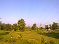 Villages around Kanker
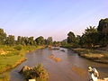 Stream in Kanker
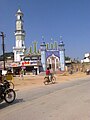 Mosque in Kanker
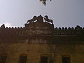 Tehsildar office
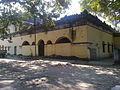 Tehsildar office 2

![Doodh river in Kanker[5]](http://upload.wikimedia.org/wikipedia/commons/0/00/Dood_River_in_Kanker.jpg)


References
- Falling Rain Genomics, Inc - Kanker
- "Census of India 2001: Data from the 2001 Census, including cities, villages and towns (Provisional)". Census Commission of India. Archived from the original on 16 June 2004. Retrieved 1 November 2008.
- http://censusindia.gov.in/PopulationFinder/View_Village_Population.aspx?pcaid=6288&category=U.A. Archived 31 December 2013 at the Wayback Machine
- "About Kanker". kanker.gov.in. Archived from the original on 5 February 2012.
- "About Kanker". Official website for Kanker, India. 27 July 2013.
Mainly five rivers flow through the district namely- doodh river, Mahanadi, Hatkul river, sindur river and Turu river.
Authority control | |
|---|---|
| General |
|
| National libraries | |
| Other | |
This article related to a location in the Indian state of Chhattisgarh is a stub. You can help Wikipedia by expanding it. |
На других языках
- [en] Kanker, Chhattisgarh
[ru] Канкер
Канкер (англ. Kanker) — город и муниципалитет в центральной части индийского штата Чхаттисгарх. Административный центр округа Канкер.Другой контент может иметь иную лицензию. Перед использованием материалов сайта WikiSort.org внимательно изучите правила лицензирования конкретных элементов наполнения сайта.
WikiSort.org - проект по пересортировке и дополнению контента Википедии