world.wikisort.org - India
Hinganghat is a city in Wardha district of the Indian state of Maharashtra. Hinganghat is the biggest city in Wardha district, in terms of area and population as well. The city is administered by a municipal council and is located about 34 km (21 mi) from Wardha and 75 km (47 mi) from Maharashtra's second capital Nagpur. Hinganghat is surrounded on two sides by the wana River, which provides natural resources. National Highway 44(old Name NH7), a part of the North-South Corridor, passes through the city. Hinganghat is located in the fertile Wardha Valley; it was historically a center of the Indian cotton trade and a major centre for grains. The tehsil of Hinganghat comprises about 76 villages. The main language spoken in Hinganghat is Marathi. Hinganghat is the ninth biggest city in Vidharbha the region of Maharashtra and ranks 436 in India [According to the 2011 census]. Baba Amte, the social worker who helped people suffering from leprosy, was born in Hinganghat. Hinganghat has the highest literacy rate in Maharashtra State which is 94.30% and Wardha has 94.01% (According to an Article by the Times of India). It hosts the largest Cotton mandi in Maharashtra state. Also, it has the tallest statue of lord Vithoba(52 ft) on the banks of river Vena.
This article has multiple issues. Please help improve it or discuss these issues on the talk page. (Learn how and when to remove these template messages)
|
Hinganghat | |
|---|---|
City | |
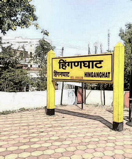
 Hinganghat Location in Maharashtra, India | |
| Coordinates: 20.57°N 78.83°E | |
| Country | |
| State | Maharashtra |
| District | Wardha |
| Government | |
| • Body | Hinganghat Municipal council |
| Area | |
| • Total | 82 km2 (32 sq mi) |
| • Rank | 1 - Wardha district |
| Elevation | 217 m (712 ft) |
| Population (2015)[1] | |
| • Total | 101,805 |
| • Rank | Maharashtra |
| • Density | 1,200/km2 (3,200/sq mi) |
| Languages | |
| • Official | Marathi |
| Time zone | UTC+5:30 (IST) |
| PIN | 442301 |
| Telephone code | 07153 |
| Vehicle registration | MH-32 |
| Sex ratio | 936 ♂/♀ |
History
Hinganghat is 1500 years old. The City was named Dandungram in the century 5 CE. Reign of Rani Prabhavati Gupta, the queen of the Vakataka Dynasty, was also here. The new name Hinganghat fall because of the availability of Hing (assafoetida) trees and ghats of the Vena river. The Development of Hinganghat was followed by the British and the Municipal Council of Hinganghat which was established on 17 May 1873. The first water tank here was built in 1873. The Municipal Council's Hall was built in 1904. The first Election of the Municipal Council was held in the year 1927. The Wena Dam was created by Municipal Council. Presently, seven water tanks are available. The city was historically a major centre of cotton and soyabean oil. Presently, Hinganghat is the largest industrial hub in Wardha District and ranking 4th in the Nagpur Division. The Dal mills and oil mills are also available here.
Geography
Hinganghat is located at 20.57°N 78.83°E.[2] The city has an average elevation of 215 m (705 ft) above sea level, which is low in comparison to the surrounding region. So, the Wena river flows throughout the year and helps the city face no drought. Apart from the river, the average depth of groundwater is around 120 ft (37 m). The Hinganghat APMC market ranks second in the Vidarbha region.[citation needed]
The city is a hub of India's cotton industry.[3] There is also a soybean oil industry and numerous small to medium scale dal mills and oil mills in the vicinity of Hinganghat.[4]Hinganghat is the largest industrial hub in Wardha District.
Demographics
In 2011, Hinganghat's population is 101,805.[5] Males constituted 52% of the population. Hinganghat's average literacy rate of 94% was higher than the Indian national average of 74%. The male literacy rate was 97% and the female literacy rate was 90%. According to the Times of India, Hinganghat has the highest literacy rate of any city in Maharashtra.[6] Literacy data analysed by UNICEF for cities with populations of more than 100,000 puts Hinganghat at the top, with a literacy rate of 94.34%, followed by Wardha (94.05%), Panvel (93.98%) and Gondia (93.70%).[7]
Religion
Hinganghat is home to the world's largest statue of Lord Pandurang, which is 16 metres (52 ft) tall.[8]
Bansilal Kochar developed the Jain temple in 1955.[9] The decorations of the temple are made of glass.
In Hinganghat, Garba is worshipped in Mata Mandir, "a temple of Mata Devi". It is the most important place in Navratri in Hinganghat and the oldest temple in the city and the land space was donated by Ganpatro Sadashiv Mawle.[10]
Transport

The Hinganghat railway station lies on the main Delhi to Chennai railway line. It is the major railway station in the region. Express services include the Navjeevan, Nandigram, Andman Express, AhilyaNagri express, Sevagram Express, Dakshin, G.T., Raptisagar Expresses, Secunderabad Superfast express, Kazipet -Pune superfast express, MGR Chennai central-Jaipur superfast express, Gomtisagar Express, Korba superfast express, Trivandrum Central Expresses, Anandwan Superfast express, Yesvantpur Superfast express, Jaipur-Mysuru express, Coimbatore-Jaipur Superfast Express And Many Trains halt at this Station. The nearest airport is Dr. Babasaheb Ambedkar International Airport, Nagpur which is 70 km away from the city centre. National Highway 44 passes through Hinganghat.
Agriculture Research Centre
The agriculture research station, Kutki is situated in Hinganghat on Pandharakwada road, which is national highway no. 44. The distance of this research station from the Hinganghat bus stop is 9 km away while from the Hinganghat railway station it is 7 km. Kutki is the nearby village of this station which is only half km away from this station. While going to Hinganghat from Wardha there is a need not to go to Hinganghat to approach this station, but by turning right before of Hinganghat on Pandhrkawada road the station is just 4 km away. A Wana river is there 1.5 km away from the station. By lift irrigation system the water is used for 33.52 Ha area of this station. More irrigation efforts are undergoing. About 19 research trials were conducted in this year Many of it was multi-varietal trials while some were an inorganic trial. Inorganic trials are conducted from the year 2005-2006. This is the identified station for multi-varietal trials.[11]
Notable people
- Baba Amte, a social worker and activist known particularly for his work with people suffering from leprosy, was born in Hinganghat on 24 December 1914.
- William Lambton, a British soldier, surveyor, and geographer, died in Hinganghat on 19 January 1823 while working on the Great Trigonometric Survey.
- Jani Babu, A legendary Indian Sufi and qawwali singer. He was born in 1935 in Hinganghat. He was born Jan Mohammad Jani Babu. He is known for his work on Shankar Shambhu (1976), Mitti (2001) and Market (2003)
- Sunil Pal[citation needed], the winner of Laughter Challenge-1 comedy show.
- Vaishali Made, winner of Sa Re Ga Ma Pa, an Indian musical reality TV Show.
- Nisha Mohota, an Indian chess player who holds the FIDE titles of International Master (IM) and Woman Grandmaster (WGM). She is the first WGM from the State of West Bengal. She became the then youngest Woman International Master (WIM) in April 1995 at the age of 14 years, 6 months and 13 days on April 26, 1995.
- D.P. Kothari is an educationist and professor who has held leadership positions at engineering institutions in India including IIT Delhi, Visvesvaraya National Institute of Technology, Nagpur and VIT University, Vellore.
- Satyapal Landage (Satyapal), Comedian, Actor & voice over artist , Films star, TV actor ( Maddam sir - SAB TV ) - Badnaam , ( Motu - Patlu ) - John , ( Dabangg ) - bachha bhaiya.[12]
References
- "Maharashtra (India): Districts, Cities, Towns and Outgrowth Wards - Population Statistics in Maps and Charts". citypopulation.de.
- "Falling Rain Genomics, Inc. – Hinganghat". Fallingrain.com. Retrieved 24 September 2013.
- "First consignment from Wardha dispatched to Bangladesh - Indian Textile Journal". 18 October 2021. Retrieved 7 September 2022.
- "Prakash Fats and Proteins » Edible and Cotton Oil Mills in Hinganghat, Wardha, Maharashtra, India". Commodities India. Retrieved 7 September 2022.
- "Hinganghat City Population Census 2011 | Maharashtra". Census2011.co.in. Retrieved 24 September 2013.
- "Nagpur most literate among state's big cities | Nagpur News - Times of India". The Times of India.
- "UNICEF data puts Nagpur above Mumbai, Pune in literacy rate in state". The Times of India. Retrieved 11 May 2015.
- author/admin (5 July 2017). "विठ्ठलाच्या दर्शनासाठी..." Lokmat (in Marathi). Retrieved 7 September 2022.
{{cite web}}:|last=has generic name (help) - "Jain Temple Details". www.jainmandir.org. Retrieved 7 September 2022.
- NAVRATRI 2020🚩🚩🚩 | By Mata Mandir Hinganghat | Facebook, retrieved 8 September 2022
- "Agriculture Research Station, Kutki, Hinganghat, Wardha eg: Dr. Panjabrao Deshmukh Vidyapeeth, Akola".
- https://www.tellychakkar.com/tv/tv-news/exclusive-satyapal-landge-reveals-interesting-story-behind-badnaam-and-karishma-singhs
External links
- This article incorporates text from a publication now in the public domain: Chisholm, Hugh, ed. (1911). "Hinganghat". Encyclopædia Britannica (11th ed.). Cambridge University Press.
Authority control | |
|---|---|
| General |
|
| National libraries | |
На других языках
[de] Hinganghat
Hinganghat ist eine Stadt im Bundesstaat Maharashtra im Westen Indiens. Sie ist Teil des Distrikts Wardha. Hinganghat ist in 33 Wards gegliedert und wird als Municipal Council verwaltet. Die Stadt befindet sich im Osten von Maharashtra. Von Hinganghat aus sind es nach Mumbai 764 Kilometer. Die Stadt ist ca. 1500 Jahre alt. In Hinganghat gibt es eine 16 Meter hohe Statue des Gottes Vithoba.- [en] Hinganghat
Другой контент может иметь иную лицензию. Перед использованием материалов сайта WikiSort.org внимательно изучите правила лицензирования конкретных элементов наполнения сайта.
WikiSort.org - проект по пересортировке и дополнению контента Википедии