world.wikisort.org - India
West Sikkim (now officially named as Gyalshing District or Geyzing District)[3] is a district of the Indian state of Sikkim. Its headquarter is Geyzing, also known as Gyalshing. The district is a favourite with trekkers due to the high elevations. Other important towns include Pelling and Yuksom. Local people also call it as Pallo-Sikkim and Sano-Sikkim commonly.
Gyalshing district | |
|---|---|
District of Sikkim | |
| Geyzing district | |
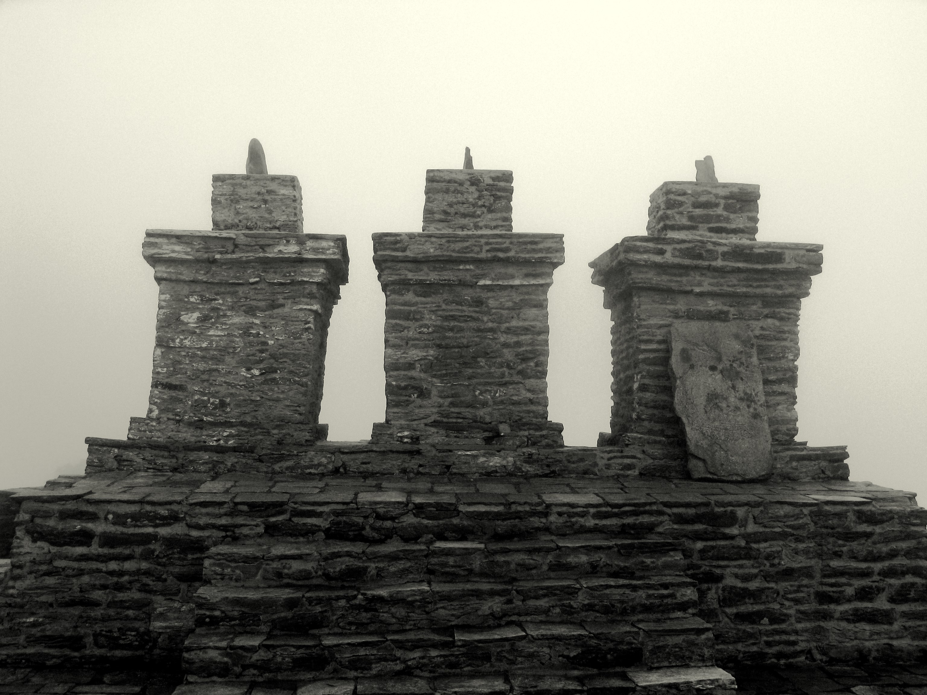
 Rabdentse Palace in Rabdentse in Gyalshing district, Sikkim | |
 Location in Sikkim | |
 'Geyzing district' or Gyalshing district | |
| Coordinates: 27°17′N 88°15′E | |
| Country | |
| State | |
| Headquarters | Gyalshing or Geyzing |
| Government | |
| • District Collector (DC) | Smt Yishey D. Yongda [1] |
| Population (2011)[2] | |
| • Total | 71,675 |
| Time zone | UTC+05:30 (IST) |
| ISO 3166 code | IN-SK |
| Vehicle registration | SK-02, SK-06 |
| Website | westsikkim |
History
West Sikkim is the site of the ancient state capital Yuksom. West Sikkim It served as Sikkim's capital beginning in 1642 for almost 50 years until it was shifted to Rabdentse. The district was under the occupation of the Nepalese for 30 years in the eighteenth and nineteenth centuries. After Anglo-Nepalese War (1814–16), the district was returned to Sikkim.
Geography
West Sikkim covers an area of 1,166 square kilometres (450 sq mi). Attractions include the Khecheopalri Lake, where, according to legend, not a leaf is allowed to fall on the surface of the lake and the Dubdi Monastery, the first monastery of the state.
Assembly constituencies
The district was previously divided into 8 assembly constituencies.
- Yoksam-Tashiding (BL)
- Yangthang
- Maneybung-Dentam
- Gyalshing-Barnyak
- Rinchenpong (BL)
- Daramdin (BL)
- Soreng-Chakung
- Salghari-Zoom (SC)
National protected area
- Khangchendzonga National Park (Part)
Economy
The economy is mainly agrarian, despite most of the land being unfit for cultivation owing to the precipitous and rocky slopes.
Transport
Roads are in poor condition owing to the frequent landslides.
Demographics
According to the 2011 census West Sikkim district has a population of 136,435,[4] roughly equal to the nation of Grenada.[5] This gives it a ranking of 608th in India (out of a total of 640).[4] The district has a population density of 117 inhabitants per square kilometre (300/sq mi) .[4] Its population growth rate over the decade 2001-2011 was 10.58%.[4] West Sikkim has a sex ratio of 941 females for every 1000 males,[4] and a literacy rate of 78.69%.[4]
After bifurcation the district had a population of 71,675. Scheduled Castes and Scheduled Tribes made up 3,391 (4.73%) and 31,847 (44.43%) of the population respectively.[2]: 59
The people are mainly of Limbu descent. Other ethnic groups include the Lepcha and Bhutia communities. Nepali is the most widely spoken language in the district.
Religion

Hinduism is followed by majority of the people in the West Sikkim district. Buddhism followed by a considerable population. [6]
The Kirateshwar Mahadev Temple, a major Hindu pilgrimage centre in Sikkim, is situated in Legship in West Sikkim district. [7]
Languages
At the time of the 2011 Census of India, 51.85% of the population in the district spoke Nepali, 22.61% Limbu, 8.68% Lepcha, 7.05% Bhotia, 2.69% Sherpa, 1.55% Rai and 1.48% Hindi as their first language.[8]
Flora and fauna
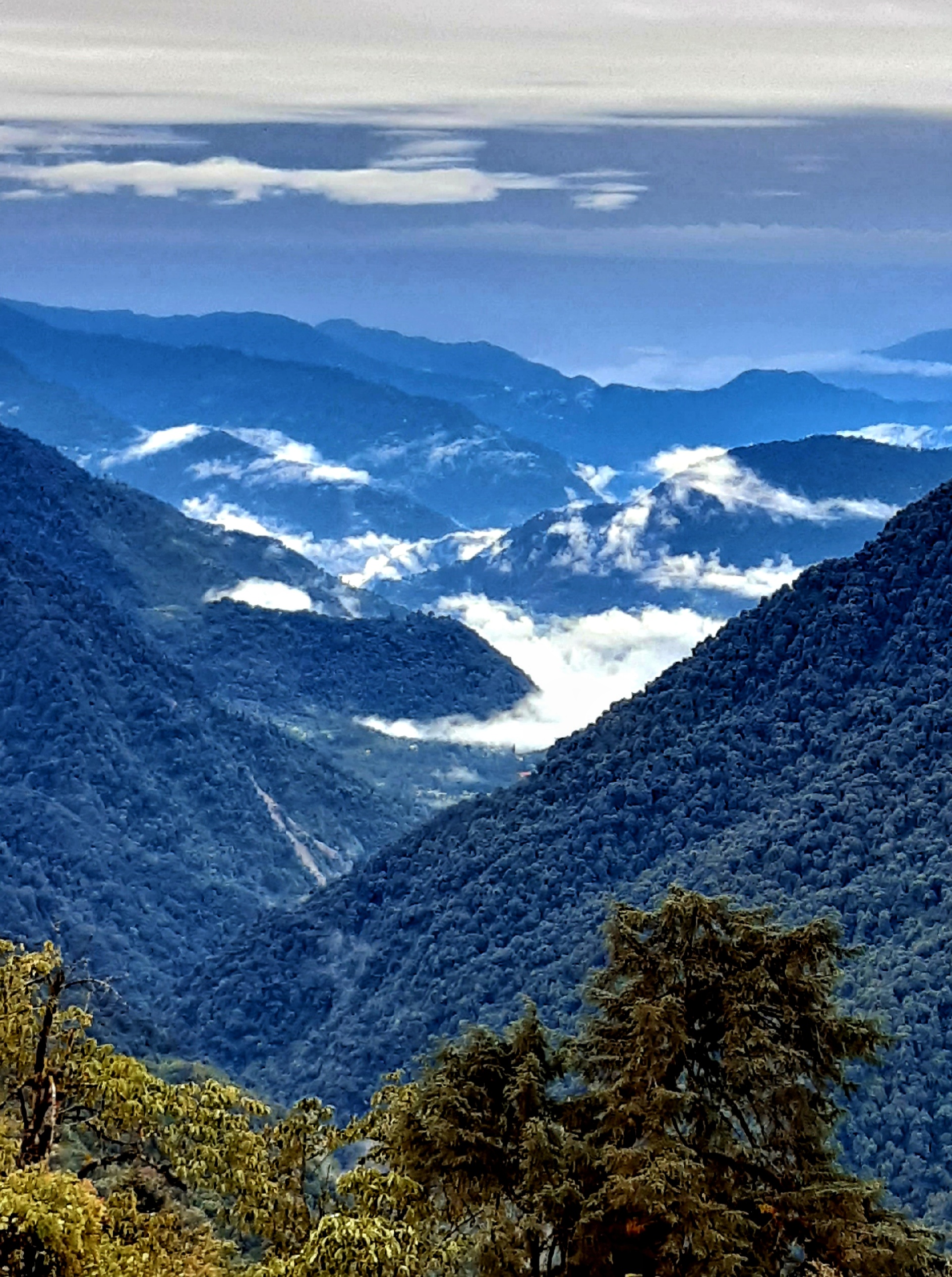
West Sikkim houses a great diversity of flora and fauna, many of which are used by Indigenous and local communities.[9] Since most of the district is hilly it enjoys a temperate climate. Above 3,800 m (12,000 ft) the slopes are full of rhododendron forests.
In 1977, West Sikkim district became home to Khangchendzonga National Park, which has an area of 1,784 km2 (688.8 sq mi).[10] It shares the park with North Sikkim district.[11]
Divisions
Administrative divisions


West Sikkim is divided into two sub-divisions:[12]

| Name | Headquarters | Number of villages[13] | Location |
| Gyalshing | Gyalshing |  | |
| Soreng | Soreng |  |
References
- "District Collectors". sikkim.gov.in.
- "District Census Hand Book - Sikkim" (PDF). Census of India. Registrar General and Census Commissioner of India.
- "thetelegraph.com".
- "District Census 2011". Census2011.co.in. 2011. Retrieved 30 September 2011.
- US Directorate of Intelligence. "Country Comparison:Population". Archived from the original on 13 June 2007. Retrieved 1 October 2011.
Grenada 108,419 July 2011 est.
- "East Sikkim District Religion Census 2011".
- "Some of the Religious Places of Sikkim". Cultural Affairs & Heritage Department. Government of Sikkim. Archived from the original on 26 April 2012. Retrieved 24 April 2021.
- "Table C-16 Population by Mother Tongue: Sikkim". Census of India. Registrar General and Census Commissioner of India.
- O'Neill, Alexander; et al. (29 March 2017). "Integrating ethnobiological knowledge into biodiversity conservation in the Eastern Himalayas". Journal of Ethnobiology and Ethnomedicine. 13 (21): 21. doi:10.1186/s13002-017-0148-9. PMC 5372287. PMID 28356115.
- O'Neill, Alexander (29 March 2017). "Sikkim claims India's first mixed-criteria UNESCO World Heritage Site" (PDF). Current Science. 112 (5): 893–994. Retrieved 11 May 2017.
- Indian Ministry of Forests and Environment. "Protected areas: Sikkim". Retrieved 25 September 2011.
- Sikkim Administrative Divisions (PDF) (Map). The Registrar General & Census Commissioner, India, New Delhi, Ministry of Home Affairs, Government of India. 2011. Retrieved 29 September 2011.
- "MDDS e-Governance Code (Sikkim Rural)" (PDF). Office of the Registrar General & Census Commissioner, India. 2011. Retrieved 15 October 2011.
External links
Places adjacent to Gyalshing district | ||||||||||||||||
|---|---|---|---|---|---|---|---|---|---|---|---|---|---|---|---|---|
| ||||||||||||||||
Capital: Gangtok | |
| State symbols |
|
| Topics |
|
| Administration |
|
| Districts |
|
| Towns | |
| Rivers | |
| Lakes | |
| Glaciers |
|
| See also | |
На других языках
[de] West Sikkim
Der Distrikt West Sikkim (Nepali पश्चिम सिक्किम जिल्ला) ist ein Distrikt im indischen Bundesstaat Sikkim. Sitz der Distriktverwaltung ist Gyalshing (manchmal auch Geyzing genannt).- [en] Gyalshing district
Другой контент может иметь иную лицензию. Перед использованием материалов сайта WikiSort.org внимательно изучите правила лицензирования конкретных элементов наполнения сайта.
WikiSort.org - проект по пересортировке и дополнению контента Википедии