world.wikisort.org - India
Daman (/dəˈmɑːn/; Indo-Portuguese; Damao) is the capital city of the Indian union territory of Dadra and Nagar Haveli and Daman and Diu. It is a municipal council situated in Daman district of the union territory.
This article has multiple issues. Please help improve it or discuss these issues on the talk page. (Learn how and when to remove these template messages)
|
Daman | |
|---|---|
City | |
 Daman  Daman | |
| Coordinates: 20.42°N 72.85°E | |
| Country | |
| Union Territory | |
| District | Daman |
| Government | |
| • Type | Daman Municipal Council |
| • Member of Parliament | Lalubhai Patel |
| • Administrator | Praful Khoda Patel, |
| • District Collector | Dr Rakesh Minhas, IAS[1] |
| Area | |
| • Total | 72 km2 (28 sq mi) |
| Elevation | 5 m (16 ft) |
| Population (2011 Census) | |
| • Total | 191,173 |
| • Density | 2,700/km2 (6,900/sq mi) |
| Languages | |
| • Official | Gujarati, Hindi |
| Time zone | UTC+5:30 (IST) |
| Vehicle registration | DD-03 |
| Sex ratio | 1.69 ♂/♀ |
| Website | https://dmcdaman.in/ |
Daman Ganga River divides Daman into two parts — Nani-Daman (nani meaning "small") and Moti-Daman (Moti meaning "big"). Despite its name, Nani-Daman is the larger of the two parts, while the old city is mainly in Moti-Daman. This holds most of the important entities like the major hospitals, supermarkets and major residential areas. Vapi, Gujarat is the nearest city to Daman.
History
The Portuguese Captain-Major Diogo de Melo arrived at the Daman shore by chance in 1523, while sailing towards Ormuz. He was caught in a violent storm and had his boat blown towards the coast of Daman.[2] Shortly after, it was acquired as a Portuguese colony for over 400 years. A larger fort was built in Moti Daman in the 16th century to guard against the Mughals who ruled the area until the Portuguese arrived. It stands today, most of it preserved in its original form. Today the majority of the municipal government offices are inside the fort.
Daman was incorporated into the Republic of India in December 1961 after an attack and invasion by the Indian Army. A battle ensued with the hopelessly outnumbered (10:1) Portuguese garrison who were forced to surrender. The battle left four Indians dead and 14 wounded;[3] Portuguese casualties were 10 dead and two wounded.[4]
Demographics
According to the 2011 census Daman District, India has a population of 191,173.[5][6] This gives it a ranking of 592nd in India (out of a total of 640).[5] The district has a population density of 2,655 inhabitants per square kilometre (6,880/sq mi) .[5] Its population growth rate over the decade 2001-2011 was 69.256%.[5] Daman has a sex ratio of 533 females for every 1,000 males,[5] and a literacy rate of 88.06%.[5]
Climate
Daman has a tropical savanna climate (Köppen Aw) with two distinct seasons: a long sunny dry season from October to May and a hot, very humid and extremely wet monsoon season from June to September. Almost no rain falls during the dry season. With milder mornings and lower humidity especially up to the middle of March, this is by far the most comfortable time of the year.
The monsoon season, though relatively short, is extremely wet. Along with the very high humidity and heavy rain every afternoon, travel is difficult and uncomfortable.
| Climate data for Daman, Daman and Diu (1961 to 1990) | |||||||||||||
|---|---|---|---|---|---|---|---|---|---|---|---|---|---|
| Month | Jan | Feb | Mar | Apr | May | Jun | Jul | Aug | Sep | Oct | Nov | Dec | Year |
| Average high °C (°F) | 29.1 (84.4) |
29.9 (85.8) |
32.8 (91.0) |
34.5 (94.1) |
34.9 (94.8) |
33.2 (91.8) |
30.3 (86.5) |
29.9 (85.8) |
30.7 (87.3) |
33 (91) |
32.6 (90.7) |
30.4 (86.7) |
31.8 (89.2) |
| Average low °C (°F) | 15.7 (60.3) |
16.6 (61.9) |
20.3 (68.5) |
20.7 (69.3) |
26.5 (79.7) |
26.5 (79.7) |
25.3 (77.5) |
24.8 (76.6) |
24.3 (75.7) |
22.6 (72.7) |
19.2 (66.6) |
16.5 (61.7) |
21.6 (70.9) |
| Average rainfall mm (inches) | 0 (0) |
0 (0) |
1 (0.0) |
0 (0) |
5 (0.2) |
324 (12.8) |
766 (30.2) |
473 (18.6) |
288 (11.3) |
44 (1.7) |
6 (0.2) |
2 (0.1) |
1,909 (75.1) |
| Source: climate-data.org[7] | |||||||||||||
Places of interest
- Nani Daman Fort (Jeronimo fort)
- Jain Temple: This 18th-century Jain temple is in the northern region of Nina Damon Fort and is dedicated to Mahavira Swami. It is built with white marble. The walls have glass cover with 18th-century murals that represent the life of Mahavira Swami.[8]
- Fort of Moti Daman
- Jampore Beach
- Devka Beach
- Church of Bom Jesus
- Daman Freedom Memorial
- Moti Daman Fort
 Nani Daman Fort Entrance
 Jain Temple, Daman
 Harbour View from Moti Daman Fort
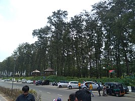 Jampore Beach in Daman
 Jampore Beach in Daman
 Sunset at Devka beach, Damao
 Church in Nani Daman Fort
 Church of Bom Jesus, Daman
 Daman Freedom Memorial
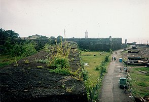 The Fort of Moti Daman


Indian Coast Guard

Indian Coast Guard Air Station, Daman is the premier air station of the Coast Guard with all the airfield facilities, air traffic control and other allied air traffic services. It is equipped with state-of-the-art airport surveillance radar (ASR), precision approach path indicator (PAPI), Doppler very high frequency omnidirectional radio range (DVOR) – distance measuring equipment (DME) and nondirectional beacon (NDB), as navigational aids. This air station provides ATC and parking facilities to defence as well as civil aircraft.[9]
Schools and colleges
- Coast Guard Public School, Nani Daman
- Swami vivekanad English & Hindi medium school, dalwada, daman
- Institute of our lady of Fatima, Convent, Moti Daman
- Podar Jumbo Kids, Daman (preschool)
- Sunrise Champs school, Mashal Chowk, Nani Daman
- Vaidik Dental college campus, Salwaar, Nani Daman
- Shrinathji School, Varkund, Nani Daman
- Divya Jyoti English High & Higher Secondary School, Dabhel, Daman
- Divya Jyoti Hindi Medium School, Dabhel, Daman
- MGM High School, Nani-Daman (Sarvajanik High School)
- Government Higher Secondary School, Nani Daman
- Government Higher Secondary School, Moti Daman
- Government Polytechnic Daman
- Shree Machchi Mahajan English Medium School, Nani Daman
- Stella Maris English Medium High School, Daman
- AIM English School, Moti Daman
- Government College, Nani Daman
- Government Primary School, Devka Mangelwad, Nani Daman
- Holy Trinity English medium high school, Dunetha, Daman
- Jawahar Navodaya Vidyalaya, Daman
References
- U.T. Administration of Daman and Diu Archived 12 November 2014 at the Wayback Machine
- Singh, Kumar Suresh (1995). Daman and Diu. People of India. Vol. XIX. Popular Prakashan. p. 3. ISBN 9788171547616. Retrieved 18 December 2010.
- Anil Shorey (21 February 1999). "The Forgotten Battles of Daman and Diu". The Tribune. Retrieved 18 December 2010.
- Chakravorty, Dr. B.C. (2008). "Operation Vijay" Archived 31 March 2014 at the Wayback Machine. Bharat Rakshak. Retrieved 12/18/2010.
- "District Census 2011". Census2011.co.in. 2011. Retrieved 30 September 2011.
- US Directorate of Intelligence. "Country Comparison: Population". Archived from the original on 13 June 2007. Retrieved 1 October 2011.
Samoa 193,161
- Climate Daman
- "Jain Temple Daman | Jain Temple in Daman Gujarat India | Religious Places of Daman | Religious Places of Gujarat | Nri Gujarati Tourism Places Jain Temple Daman".
- "Indian Coast Guard". Archived from the original on 4 November 2012. Retrieved 4 November 2012.
External links
| Authority control: National libraries |
|---|
На других языках
[de] Daman
Daman ist die Hauptstadt des indischen Unionsterritoriums Dadra und Nagar Haveli und Daman und Diu und Verwaltungssitz des gleichnamigen Distrikts. Die Stadt gehörte über 400 Jahre zum portugiesischen Kolonialreich. Sie hat etwa 44.000 Einwohner.- [en] Daman, India
[ru] Даман (город)
Даман (гудж. દમણ, англ. Daman, порт. Damão) — город и муниципальный совет в округе Даман союзной территории Дадра и Нагар-Хавели и Даман и Диу в Индии.Другой контент может иметь иную лицензию. Перед использованием материалов сайта WikiSort.org внимательно изучите правила лицензирования конкретных элементов наполнения сайта.
WikiSort.org - проект по пересортировке и дополнению контента Википедии