world.wikisort.org - India
Bunjwah (also known as Bonjwah) is a region and tehsil located in the Kishtwar district of Jammu and Kashmir, India.[3] It comprises nine panchayat and two nayabats; it became a tehsil in 2014.[4]
Bunjwah
Bonzwah | |
|---|---|
Tehsil | |
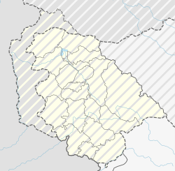 Bunjwah Location in Jammu and Kashmir, India | |
| Coordinates: 33.140680°N 75.936277°E | |
| Country | |
| Union Territory | Jammu and Kashmir |
| District | Kishtwar |
| Population | 15,899 |
| Languages | |
| • Official | Urdu, English |
| • Spoken | Kashmiri, Bhalessi, Gojri, Kishtwari |
| Time zone | UTC+5:30 (IST) |
| PIN | 182204 |
| Distance from Kishtwar town | 60 kilometres (37 mi) |
| Distance from Jammu | 220 kilometres (140 mi) |
| Website | kishtwar |
Demographics
Bunjwah is an economically underdeveloped area consisting of 2,798 households and a total population of 15,899—8,205 males and 7,694 females.[1]
Location
Bunjwah is located 60 kilometres (37 mi) from its district headquarters, Kishtwar. It borders Saroor, Nagseni Padhyarna, the Padder of Kishtwar district, Chilly, Bhalessa, Bhatyas, and Challer of Doda district, while one of its boundaries runs along Himachal Pradesh's road towards Chamba located in Bunjwah tehsil.[4]
Route
The route to Bunjwah from its nearest airport in Jammu goes through Batote via the National Highway 144, the Chenani-Nashri Tunnel, and the National Highway 244. This Batote—Kishtwar road leads to Thathri, which is 30 kilometres (19 mi) away from Kishtwar. To reach Bunjwah, it is necessary to leave the National Highway by a link road towards Thathri-Donadi where a route forks off to Bunjwah.
Economy
The region remains neglected by the state government and the district administration.[5] The “Bunjwah” area further suffers from underdevelopment and the effects of being denied basic rights and status in the Indian constitution. Most families lack the basic skills and training necessary to advance their agricultural development.
Demand for sub division status
As of 2020, demand for separate Bunjwah sub division status increased with the arguments of negligence by the present district administration.[6]
Education
While over 50 primary schools were built in the district, there is only one secondary school in the region, and the education is not affordable for many residents. [7]
References
- "Tehsil Bunjwah". www.mykishtwar.com. Retrieved 7 August 2020.
- "Tehsils in Kishtwar". Government of Jammu & Kashmir. Retrieved 7 August 2020.
- Sheikh, Shafqat Shaheen (2 April 2017). "Bunjwah: A Forgotten Village In Kishtwar". Kashmir Age. Retrieved 7 August 2020.
- Sheikh, Shafqat Shaheen (24 July 2019). "Unexplored Tourist Destinations Of Neglected Bunjwah". Legitimate News. Retrieved 7 August 2020.
- Akhtar, Romana (2007-12-25). "Status of Rotifers and Copepods in high altitude pond Sarkoot located in district Kishtwar of J&K". Current World Environment. 2 (2): 145–148. doi:10.12944/cwe.2.2.07. ISSN 0973-4929.
- Sheikh, Shafqat (1 September 2020). "Bunjwah, neglected region looking for Sub Division status". The Chenab Times. Retrieved 8 September 2020.
- "Bunjwah: A forgotten village in Kishtwar". Kashmir Age. 2017-04-02. Retrieved 2020-08-13.
Другой контент может иметь иную лицензию. Перед использованием материалов сайта WikiSort.org внимательно изучите правила лицензирования конкретных элементов наполнения сайта.
WikiSort.org - проект по пересортировке и дополнению контента Википедии