world.wikisort.org - Allemagne
Walkertshofen est une commune allemande de Bavière située dans l'arrondissement d'Augsbourg et le district de Souabe.
Cet article est une ébauche concernant une localité allemande.
Vous pouvez partager vos connaissances en l’améliorant (comment ?) selon les recommandations des projets correspondants.
| Walkertshofen | |||

| |||
 Armoiries |
|||
| Administration | |||
|---|---|---|---|
| Pays | |||
| Land | |||
| District (Regierungsbezirk) |
Souabe | ||
| Arrondissement (Landkreis) |
Augsbourg | ||
| Nombre de quartiers (Ortsteile) |
7 | ||
| Bourgmestre (Bürgermeister) Mandat |
Sven Janzen 2008-2014 |
||
| Code postal | 86 877 | ||
| Code communal (Gemeindeschlüssel) |
09 7 72 214 | ||
| Indicatif téléphonique | 08 239 | ||
| Immatriculation | A | ||
| Démographie | |||
| Population | 1 125 hab. (2010) | ||
| Densité | 89 hab./km2 | ||
| Géographie | |||
| Coordonnées | 48° 13′ 30″ nord, 10° 35′ 21″ est | ||
| Altitude | 537 m |
||
| Superficie | 1 268 ha = 12,68 km2 | ||
| Localisation | |||
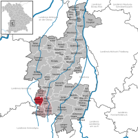
| Géolocalisation sur la carte : Allemagne
Géolocalisation sur la carte : Bavière
| |||
| Liens | |||
| Site web | www.walkertshofen.de | ||
| modifier |
|||


Géographie
Walkertshofen est située dans le Parc naturel d'Augsbourg-Westliche Wälder, sur la rivière Neufnach, affluent de la Schmutter, à 34 km au sud-ouest d'Augsbourg. La commune, qui se trouve à la limite avec les arrondissements d'Unterallgäu et de Günzburg, fait partie de la communauté d'administration de Stauden dont le siège est à Langenneufnach.
La commune est composée d'un village, Walkertshofen et de six hameaux, Ebrach, Gumpenweiler, Hölden, Oberrothan, Reute et Schweizerhof.
Communes limitrophes (en commençant par le nord et dans le sens des aiguilles d'une montre) : Langenneufnach, Mickhausen, Mittelneufnach, Eppishausen, Aichen et Ziemetshausen.
Histoire
La première mention écrite du village date de 775 dans un acte de donation. En 1099, le village est sous la domination de la famille von Waltgershoven et, à la fin du XIVe siècle, il devient propriété de l'évêché d'Augsbourg jusqu'au Recès d'Empire de 1803 et à son incorporation dans le nouveau royaume de Bavière.
Walkertshofen est érigé en commune en 1818 et est intégré à l'arrondissement de Schwabmünchen jusqu'à la disparition de ce dernier en 1972.
Démographie
Notes et références
- (de) Cet article est partiellement ou en totalité issu de l’article de Wikipédia en allemand intitulé « Walkertshofen » (voir la liste des auteurs).
 Portail de la Bavière
На других языках
[de] Walkertshofen
Walkertshofen ist eine Gemeinde im schwäbischen Landkreis Augsburg. Die Gemeinde ist Mitglied der Verwaltungsgemeinschaft Stauden mit Sitz in Langenneufnach.[en] Walkertshofen
Walkertshofen is a municipality in the district of Augsburg in Bavaria in Germany. It is set amongst gentle rolling hills of the farm district of Bavaria that are occasionally covered in snow during the winter months. Its only source of retail is one public hotel for food and refreshments. The majority of the population in the past have been mainly engaged in the workings of the surrounding farms with a small portion working on the building of the autobahns (main highways).- [fr] Walkertshofen
[ru] Валькертсхофен
Валькертсхофен (нем. Walkertshofen) — община в Германии, в Республике Бавария.[1]Другой контент может иметь иную лицензию. Перед использованием материалов сайта WikiSort.org внимательно изучите правила лицензирования конкретных элементов наполнения сайта.
WikiSort.org - проект по пересортировке и дополнению контента Википедии