world.wikisort.org - Allemagne
Sehmatal est une commune de Saxe (Allemagne), située dans l'arrondissement des Monts-Métallifères, dans le district de Chemnitz. Elle est formée des anciennes communes de Cranzahl, Neudorf et Sehma.
| Sehmatal | |
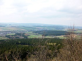
 Vue du Bärenstein | |
 Armoiries |
|
| Administration | |
|---|---|
| Pays | |
| Land | |
| District (Regierungsbezirk) |
|
| Arrondissement (Landkreis) |
Arrondissement des Monts-Métallifères |
| Nombre de quartiers (Ortsteile) |
3 |
| Bourgmestre (Bürgermeister) |
Udo Ott |
| Code postal | 09465 |
| Code communal (Gemeindeschlüssel) |
14 5 21 560 |
| Indicatif téléphonique | 037342 |
| Immatriculation | ERZ |
| Démographie | |
| Population | 6 188 hab. () |
| Densité | 139 hab./km2 |
| Géographie | |
| Coordonnées | 50° 31′ 00″ nord, 12° 59′ 00″ est |
| Altitude | 697 m Min. 700 m Max. 800 m |
| Superficie | 4 445 ha = 44,45 km2 |
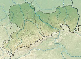
| Localisation | |
| Liens | |
| Site web | www.sehmatal.de |
| modifier |
|
Jumelage
 Sexau (Allemagne)
 Wyhl am Kaiserstuhl (Allemagne)
 Happurg (Allemagne)
 Altdorf bei Nürnberg (Allemagne)
 Running Springs (États-Unis)
Références
- Portail de la Saxe
На других языках
[de] Sehmatal
Sehmatal ist eine Gemeinde im Erzgebirgskreis in Sachsen. Sie entstand am 1. Januar 1999 durch den Zusammenschluss der Orte Neudorf, Cranzahl und Sehma.[2][en] Sehmatal
Sehmatal is a municipality in the district of Erzgebirgskreis, in Saxony, Germany, which was created in 1999 through the union of Neudorf, Cranzahl and Sehma. The three villages are located along the Sehma river, aligned in a north-south direction. At the northern end is the former village of Sehma, in the middle the town of Cranzahl, to the south the village of Neudorf.- [fr] Sehmatal
[ru] Зематаль
Зематаль (нем. Sehmatal) — коммуна в Германии, в земле Саксония. Подчиняется административному округу Кемниц. Входит в состав района Эрцгебирге. Население составляет 6988 человек (на 31 декабря 2011 года). Занимает площадь 44,45 км². Официальный код — 14 1 71 295.Текст в блоке "Читать" взят с сайта "Википедия" и доступен по лицензии Creative Commons Attribution-ShareAlike; в отдельных случаях могут действовать дополнительные условия.
Другой контент может иметь иную лицензию. Перед использованием материалов сайта WikiSort.org внимательно изучите правила лицензирования конкретных элементов наполнения сайта.
Другой контент может иметь иную лицензию. Перед использованием материалов сайта WikiSort.org внимательно изучите правила лицензирования конкретных элементов наполнения сайта.
2019-2025
WikiSort.org - проект по пересортировке и дополнению контента Википедии
WikiSort.org - проект по пересортировке и дополнению контента Википедии

