world.wikisort.org - Allemagne
Adorf/Vogtl. est une ville de Saxe (Allemagne), située dans l'arrondissement du Vogtland, dans le district de Chemnitz.
Pour les articles homonymes, voir Adorf.
| Adorf/Vogtl. | |
 Place du marché | |
 Armoiries |
|
| Administration | |
|---|---|
| Pays | |
| Land | |
| District (Regierungsbezirk) |
Chemnitz |
| Arrondissement (Landkreis) |
Vogtland |
| Code postal | 08626 |
| Code communal (Gemeindeschlüssel) |
14 5 23 010 |
| Indicatif téléphonique | 037423 |
| Immatriculation | V |
| Démographie | |
| Population | 4 791 hab. () |
| Densité | 112 hab./km2 |
| Géographie | |
| Coordonnées | 50° 19′ 14″ nord, 12° 15′ 22″ est |
| Altitude | 494 m |
| Superficie | 4 280 ha = 42,80 km2 |
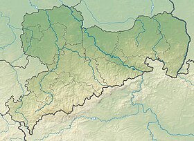
| Localisation | |
| Liens | |
| Site web | www.adorf-vogtland.de |
| modifier |
|
Quartiers
- Remtengrün
Personnalités
- Karl-Heinz Adler (1927-2018), sculpteur allemand, est né à Remtengrün.
- Portail de la Saxe
На других языках
[de] Adorf/Vogtl.
Adorf/Vogtl. ( Aussprache?/i) ist eine Kleinstadt im sächsischen Vogtlandkreis. Die Stadt gehört zum Vogtländischen Musikwinkel, in dem der Musikinstrumentenbau eine besondere Rolle spielt. Durch die Stadt führt die Alte Egerer Poststraße, einst eine wichtige Handelsstraße Leipzig – Eger.[en] Adorf
Adorf (German pronunciation: [ˈadɔʁf] (listen)) is a small town and municipality in the Vogtlandkreis to the south-west of the Free State of Saxony, Germany. Gettengrün, a village within the municipality, borders on the Czech Republic.[es] Adorf
Adorf (en alemán ˈadɔʁf) es una pequeña ciudad y municipio en el distrito de Vogtlandkreis situado al sureste del Sajonia, Alemania. El nombre Adorf se deriva de "Dorf in der Aue", en donde Aue u ouwe en alemán antiguo significa tierra rodeada por agua, pradera húmeda, isla. Gettengrün, una aldea dentro del distrito, hace frontera con la República Checa.- [fr] Adorf/Vogtl.
[ru] Адорф (Фогтланд)
Адорф (нем. Adorf/Vogtl.) — город в Германии, в земле Саксония. Подчинён земельной дирекции Кемниц. Входит в состав района Фогтланд. Население составляет 5323 человека (на 31 декабря 2010 года). Занимает площадь 42,80 км². Официальный код — 14 1 78 010.Текст в блоке "Читать" взят с сайта "Википедия" и доступен по лицензии Creative Commons Attribution-ShareAlike; в отдельных случаях могут действовать дополнительные условия.
Другой контент может иметь иную лицензию. Перед использованием материалов сайта WikiSort.org внимательно изучите правила лицензирования конкретных элементов наполнения сайта.
Другой контент может иметь иную лицензию. Перед использованием материалов сайта WikiSort.org внимательно изучите правила лицензирования конкретных элементов наполнения сайта.
2019-2025
WikiSort.org - проект по пересортировке и дополнению контента Википедии
WikiSort.org - проект по пересортировке и дополнению контента Википедии

