world.wikisort.org - Alemania
Glashütte es una ciudad del distrito de Sächsische Schweiz-Osterzgebirge, en el Estado libre de Sajonia. Actualmente la ciudad cuenta con 6.905 habitantes y es famosa por la riqueza y belleza de sus paisajes, característicos del sur de Sajonia.
| Glasshütte | ||
|---|---|---|
| Entidad subnacional | ||
 Vista del centro de la ciudad.
| ||
 Escudo | ||
 Glasshütte | ||
 Glasshütte | ||
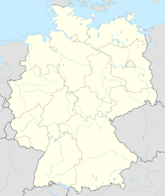
 Ubicación de Glasshütte | ||
| Coordenadas | 50°51′00″N 13°47′00″E | |
| Idioma oficial | Alemán | |
| Entidad | Municipio urbano de Alemania, Mining community y Einheitsgemeinde of Germany | |
| • País |
| |
| Superficie | ||
| • Total | 95,57 km² | |
| Altitud | ||
| • Media | 340 m s. n. m. | |
| Población (2012) | ||
| • Total | 6,905 hab. | |
| • Densidad | 72 hab/km² | |
| Huso horario | UTC+01:00 y UTC+02:00 | |
| Código postal | 01768[1] | |
| Prefijo telefónico | 035053 | |
| Matrícula | PIR | |
| Número oficial de comunidad | 14628130 | |
| [http://www.glashuette-sachs.de Sitio web oficial ] | ||
Esta ciudad es cuna de la relojería alemana, con firmas afamadas en todo el mundo, y es parada obligatoria para todos los amantes de la confitería, al tener el honor de contar con grandes pastelerías como Gaffron's, situada en la calle principal.
Entre las firmas relojeras localizadas en Glashütte están:[2]
- A. Lange & Söhne
- Glashütte Original
- Union Glashütte
- NOMOS
- Wempe Chronometerwerke
- Nautische Instrumente Mühle
Referencias
- Worldpostalcodes.org, código postal n.º 01768.
- Watch Wiki. Watch-Wiki «Glasshütte» (en alemán). Consultado el 24 de agosto de 2013.
Enlaces externos
| Control de autoridades |
|
|---|
 Datos: Q6696
 Multimedia: Glashütte (Sachsen)
На других языках
[en] Glashütte
Glashütte [German pronunciation: [ˈɡlaːsˌhʏtə] (listen)] is a town in Saxony, Germany. The town is known as the birthplace of the German watchmaking industry and has a population of about 7,000. Historically it was first mentioned in a document around 1445. In January 2008, the former municipality Reinhardtsgrimma was merged into Glashütte.- [es] Glashütte (Sajonia)
[ru] Гласхютте (Саксония)
Гласхютте (нем. Glashütte) — город в Германии, в земле Саксония. Подчинён земельной дирекции Дрезден. Входит в состав района Саксонская Швейцария — Восточные Рудные Горы. Население составляет 7139 человек (на 31 декабря 2010 года). Занимает площадь 41,76 км². Официальный код — 14 2 90 150.Текст в блоке "Читать" взят с сайта "Википедия" и доступен по лицензии Creative Commons Attribution-ShareAlike; в отдельных случаях могут действовать дополнительные условия.
Другой контент может иметь иную лицензию. Перед использованием материалов сайта WikiSort.org внимательно изучите правила лицензирования конкретных элементов наполнения сайта.
Другой контент может иметь иную лицензию. Перед использованием материалов сайта WikiSort.org внимательно изучите правила лицензирования конкретных элементов наполнения сайта.
2019-2025
WikiSort.org - проект по пересортировке и дополнению контента Википедии
WikiSort.org - проект по пересортировке и дополнению контента Википедии