world.wikisort.org - Germany
Steinen is an Ortsgemeinde – a community belonging to a Verbandsgemeinde – in the Westerwaldkreis in Rhineland-Palatinate, Germany.
Steinen | |
|---|---|
Municipality | |
 | |
|
Coat of arms | |
Location of Steinen within Westerwaldkreis district 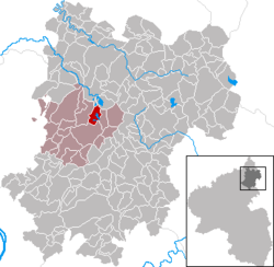 | |
 Steinen  Steinen | |
| Coordinates: 50°34′25″N 7°48′25″E | |
| Country | Germany |
| State | Rhineland-Palatinate |
| District | Westerwaldkreis |
| Municipal assoc. | Selters (Westerwald) |
| Government | |
| • Mayor (2019–24) | Mario Reifenberg[1] |
| Area | |
| • Total | 4.20 km2 (1.62 sq mi) |
| Elevation | 410 m (1,350 ft) |
| Population (2020-12-31)[2] | |
| • Total | 251 |
| • Density | 60/km2 (150/sq mi) |
| Time zone | UTC+01:00 (CET) |
| • Summer (DST) | UTC+02:00 (CEST) |
| Postal codes | 56244 |
| Dialling codes | 02626 |
| Vehicle registration | WW |
| Website | www.steinen-westerwald.de |
Geography
Steinen lies 5 km from Herschbach and 7 km from Selters on the Westerwald Lake Plateau. In the contest Unser Dorf soll schöner werden - unser Dorf hat Zukunft (“Our village should be lovelier – our village has a future”), Steinen was distinguished several times. It belongs to the Verbandsgemeinde of Selters, a kind of collective municipality. Its seat is in the like-named town.
Politics
The municipal council is made up of 13 council members, as well as the honorary and presiding mayor (Ortsbürgermeister), who were elected in a majority vote in a municipal election on 13 June 2004.
Economy and infrastructure
The community lies right on Bundesstraße 8, leading from Limburg an der Lahn to Siegburg. The nearest Autobahn interchange is Mogendorf on the A 3 (Cologne–Frankfurt). The nearest InterCityExpress stop is the railway station at Montabaur on the Cologne-Frankfurt high-speed rail line.
References
- Direktwahlen 2019, Westerwaldkreis, Landeswahlleiter Rheinland-Pfalz, accessed 9 August 2021.
- "Bevölkerungsstand 2020, Kreise, Gemeinden, Verbandsgemeinden". Statistisches Landesamt Rheinland-Pfalz (in German). 2021.
External links
- Steinen (Westerwald) (in German)
- Verbandsgemeinde of Selters (in German)
Authority control | |
|---|---|
| General |
|
| National libraries | |
This Westerwaldkreis location article is a stub. You can help Wikipedia by expanding it. |
На других языках
- [en] Steinen, Rhineland-Palatinate
[ru] Штайнен (Вестервальд)
Штайнен (нем. Steinen) — коммуна в Германии, в земле Рейнланд-Пфальц.Другой контент может иметь иную лицензию. Перед использованием материалов сайта WikiSort.org внимательно изучите правила лицензирования конкретных элементов наполнения сайта.
WikiSort.org - проект по пересортировке и дополнению контента Википедии