world.wikisort.org - Germany
Sonnenstein is a municipality in the district of Eichsfeld, Thuringia, Germany. It was formed by the merger of the previously independent municipalities Bockelnhagen, Holungen, Jützenbach, Silkerode, Steinrode, Stöckey, Weißenborn-Lüderode and Zwinge, on 1 December 2011.[2] These municipalities had previously been part of the Verwaltungsgemeinschaft Eichsfeld-Südharz, which was disbanded.[2] The seat of the municipality is in the village Weißenborn-Lüderode.[3] The municipality consists of 8 Ortschaften (municipal divisions): Bockelnhagen (villages Bockelnhagen and Weilrode), Holungen, Jützenbach, Silkerode, Steinrode (villages Werningerode and Epschenrode), Stöckey, Weißenborn-Lüderode and Zwinge.[3]
Sonnenstein | |
|---|---|
Municipality | |
Location of Sonnenstein within Eichsfeld district 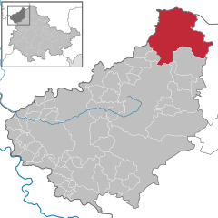 | |
 Sonnenstein  Sonnenstein | |
| Coordinates: 51°32′N 10°25′E | |
| Country | Germany |
| State | Thuringia |
| District | Eichsfeld |
| Area | |
| • Total | 94.51 km2 (36.49 sq mi) |
| Elevation | 240 m (790 ft) |
| Population (2020-12-31)[1] | |
| • Total | 4,482 |
| • Density | 47/km2 (120/sq mi) |
| Time zone | UTC+01:00 (CET) |
| • Summer (DST) | UTC+02:00 (CEST) |
| Postal codes | 37345 |
| Dialling codes | 036072 |
| Vehicle registration | EIC |
| Website | www |
References
- "Bevölkerung der Gemeinden, erfüllenden Gemeinden und Verwaltungsgemeinschaften in Thüringen Gebietsstand: 31.12.2020". Thüringer Landesamt für Statistik (in German). June 2021.
- Gebietsänderungen vom 01. Januar bis 31. Dezember 2011, Statistisches Bundesamt
- Hauptsatzung der Gemeinde Sonnenstein, 6 April 2022.
| Authority control: National libraries |
|---|
This Eichsfeld district location article is a stub. You can help Wikipedia by expanding it. |
На других языках
[de] Sonnenstein (Gemeinde)
Die Gemeinde Sonnenstein ist eine Landgemeinde im Norden des Landkreises Eichsfeld in Thüringen. Sitz der Gemeindeverwaltung ist der Ort Weißenborn-Lüderode.- [en] Sonnenstein, Thuringia
Другой контент может иметь иную лицензию. Перед использованием материалов сайта WikiSort.org внимательно изучите правила лицензирования конкретных элементов наполнения сайта.
WikiSort.org - проект по пересортировке и дополнению контента Википедии