world.wikisort.org - Germany
Püttlingen (pronounced [ˈpʏt.lɪŋ.ən] (![]() listen)) is a town in Saarland, Germany, 10 km northwest of Saarbrücken.
listen)) is a town in Saarland, Germany, 10 km northwest of Saarbrücken.
This article may be expanded with text translated from the corresponding article in German. (July 2019) Click [show] for important translation instructions.
|
Püttlingen | |
|---|---|
Town | |
 Püttlingen | |
 Flag  Coat of arms | |
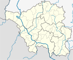
Location of Püttlingen within Saarbrücken district  | |
 Püttlingen  Püttlingen | |
| Coordinates: 49°17′N 6°53′E | |
| Country | Germany |
| State | Saarland |
| District | Saarbrücken |
| Subdivisions | 2 |
| Government | |
| • Mayor (2019–29) | Denise Klein[1] (SPD) |
| Area | |
| • Total | 23.94 km2 (9.24 sq mi) |
| Elevation | 273 m (896 ft) |
| Population (2020-12-31)[2] | |
| • Total | 18,318 |
| • Density | 770/km2 (2,000/sq mi) |
| Time zone | UTC+01:00 (CET) |
| • Summer (DST) | UTC+02:00 (CEST) |
| Postal codes | 66337–66346 |
| Dialling codes | 06806, 06898 |
| Vehicle registration | SB |
| Website | www.puettlingen.de |
Geography
The town lies in the Köller Valley, approximately 20 km to the northwest of Saarbrücken and 5 km north of Völklingen. Going in a clockwise direction from the north, the neighbouring communities are Heusweiler, Riegelsberg, Saarbrücken and Völklingen in the Regionalverband Saarbrücken and the communities of Bous and Schwalbach in the Landkreis Saarlouis.
Climate
The annual precipitation amounts to 834 mm which places it in the top third of German locales according to the German Weather Service. The driest month is April, while November, the wettest month, sees 1.4 times as much rain.
Subdivision
The town is composed of the subdivisions of Püttlingen (made up of the Berg, Bengesen and Ritterstraße areas) and Köllerbach (made up of the Engelfangen, Etzenhofen, Herchenbach, Kölln, Rittenhofen, and Sellerbach areas).
Mayors
- 1946–1949: Peter Zimmer
- 1949–1956: Peter Müller
- 1956–1966: Nikolaus Boßmann, CDU
- 1966–1974: Hans Koch, independent
- 1974–2001: Rudolf Müller, CDU
- 2002–2019: Martin Speiche, CDU[3]
- 2019–incumbent : Denise Klein, SPD[4]
Twin towns – sister cities
Püttlingen is twinned with:[5]
 Ber, Mali
 Créhange, France
 Fresagrandinaria, Italy
 Nowa Sól, Poland
 Saint-Michel-sur-Orge, France
 Senftenberg, Germany
 Veszprém, Hungary
 Žamberk, Czech Republic
Notable people
- Annegret Kramp-Karrenbauer (born 1962), politician (CDU)
- Patrik Kühnen (born 1966), tennis player and Davis Cup team captain
- Johann Nikolaus Weislinger (1691–1755), Jesuit polemicist
- Hendrick Zuck (born 1990), footballer
References
- Gewählte Ober-/Bürgermeister*innen, Landrät*innen und Regionalverbandsdirektor*in im Saarland, Statistisches Amt des Saarlandes, 27 March 2022.
- "Saarland.de – Amtliche Einwohnerzahlen Stand 31. Dezember 2020" (PDF). Statistisches Amt des Saarlandes (in German). June 2021.
- Wahl Bürgermeister/in vom 7. Juni 2009 Archived 2017-01-01 at the Wayback Machine Retrieved 2 November 2012
- Gewählte Ober-/Bürgermeister*innen, Landrät*innen und Regionalverbandsdirektor*in im Saarland, accessed 19 June 2021.
- "Partnerschaften". puettlingen.de (in German). Püttlingen. Retrieved 2021-03-11.
На других языках
[de] Püttlingen
Püttlingen (im örtlichen moselfränkischen Dialekt Piddlinge) ist eine Stadt im südlichen Saarland und gehört zum Regionalverband Saarbrücken.- [en] Püttlingen
[ru] Пютлинген
Пютлинген (нем. Püttlingen) — город в Германии, в земле Саар.Другой контент может иметь иную лицензию. Перед использованием материалов сайта WikiSort.org внимательно изучите правила лицензирования конкретных элементов наполнения сайта.
WikiSort.org - проект по пересортировке и дополнению контента Википедии