world.wikisort.org - Francia
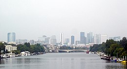
Suresnes (pronuncia: /sy'ʁɛn/; 46 477 abitanti nel 2009) è un comune francese dell'Île-de-France nel dipartimento dell'Hauts-de-Seine.
| Suresnes comune | ||
|---|---|---|
| ||
 | ||
| Localizzazione | ||
| Stato | ||
| Regione | ||
| Dipartimento | ||
| Arrondissement | Nanterre | |
| Cantone | Nanterre-2 | |
| Territorio | ||
| Coordinate | 48°52′N 2°14′E | |
| Altitudine | 36 m s.l.m. | |
| Superficie | 3,79 km² | |
| Abitanti | 46 477[1] (2009) | |
| Densità | 12 263,06 ab./km² | |
| Comuni confinanti | Nanterre, Puteaux, Rueil-Malmaison, Parigi, Saint-Cloud | |
| Altre informazioni | ||
| Cod. postale | 92150 | |
| Fuso orario | UTC+1 | |
| Codice INSEE | 92073 | |
| Cartografia | ||
 | ||
| Sito istituzionale | ||
Geografia fisica
Situato nella banlieue ovest di Parigi, sulla riva sinistra della Senna, ospita il Forte del Mont Valérien, memoriale nazionale dei martiri della resistenza, e un cimitero militare americano.
Storia
Simboli
Lo stemma di Suresnes è stato adottato nel 1962.[2]
|
«D'azzurro. alla croce cucita di rosso, caricata in cuore di uno scudetto ottagonale d'argento, bordato d'oro, sopracaricato delle lettere S e L intrecciate di nero, e accantonata da quattro gigli d'oro. Motto: Nul ne sort de Suresnes, qui souvent n'y revienne.» |
Le lettere S e L sono le iniziali di Saint Leufroy, san Leufredo d'Évreux, patrono del paese, titolare dell'antica chiesa distrutta nel 1906.
Società
Evoluzione demografica
Abitanti censiti

Istituzioni, enti e associazioni
Sono presenti un ospedale universitario e la SKEMA Business School.
Amministrazione
Gemellaggi
 Gottinga
 Hackney, dal 1962
 Hann. Münden, dal 1959
 Holon, dal 1961
 Kragujevac, dal 1967
 Villaco, dal 1992
Inoltre, il comune di Suresnes ha firmato contratti di cooperazione con:
 Cap-Haïtien, dal 1998
 Colmenar Viejo, dal 1999
Note
- INSEE popolazione legale totale 2009
- (FR) Blason de Suresnes, su armorialdefrance.fr. URL consultato il 2 giugno 2022.
Altri progetti
 Wikimedia Commons contiene immagini o altri file su Suresnes
Collegamenti esterni
- Sito ufficiale, su suresnes.fr.
- Mairie de Suresnes (canale), su YouTube.
- (EN) Suresnes, su Enciclopedia Britannica, Encyclopædia Britannica, Inc.
| Controllo di autorità | VIAF (EN) 236942393 · LCCN (EN) n85307971 · GND (DE) 4300919-0 · BNF (FR) cb15280276n (data) · J9U (EN, HE) 987007557591605171 (topic) · WorldCat Identities (EN) lccn-n85307971 |
|---|
На других языках
[de] Suresnes
Suresnes [.mw-parser-output .IPA a{text-decoration:none}sy'ʁɛn] ist eine französische Stadt mit 49.311 Einwohnern (Stand 1. Januar 2019) im Arrondissement Nanterre, im Département Hauts-de-Seine der Region Île-de-France, 12 km vom Pariser Zentrum entfernt. Die Einwohner werden Suresnois genannt.[en] Suresnes
Suresnes (French pronunciation: [syʁɛn] (listen)) is a commune in the western suburbs of Paris, Île-de-France. Located in Hauts-de-Seine, 9.3 km (5.8 mi) from the centre of Paris, it had a population of 49,145 as of 2016. The nearest communes are Nanterre, Puteaux, Rueil-Malmaison, Saint-Cloud and Boulogne-Billancourt. It is served by two stops on Île-de-France tramway Line 2 and Suresnes–Mont-Valérien station on the Transilien network, both giving access to La Défense and its RER A and Paris Métro Line 1 services. Suresnes's landmarks include the Mémorial de la France combattante and Suresnes American Cemetery and Memorial below Fort Mont-Valérien, as well as Foch Hospital in the town centre.[es] Suresnes
Suresnes es un municipio (commune) francés, situado en el departamento de Altos del Sena y en la región de Isla de Francia. Sus habitantes se denominan, en francés, con el gentilicio suresnois.[fr] Suresnes
Suresnes (prononcé : /sy.ʁɛn/) est une commune française du département des Hauts-de-Seine en région Île-de-France, sur la rive gauche de la Seine.- [it] Suresnes
[ru] Сюрен
Сюре́н (фр. Suresnes) — коммуна во Франции и ближний пригород Парижа. Расположена в 9,3 км к западу от центра Парижа. В Сюрен находится Форт Мон-Валерьен — мемориал, посвящённый американским солдатам, павшим во Второй мировой войне. С Парижем Сюрен связывают линия Транзильена, ведущая через Дефанс к парижскому вокзалу Сен-Лазар, а также линией трамвая № 2 до станции метро «Порт-де-Версаль». Автомобильное сообщение до административного центра Иль-де-Франса осуществляется по мосту Сюрен через Сену, по которому проходит аллея Лоншам, ведущая в Булонский лес. Сюрен обладает одним из самых высоких показателей плотности населения в Европе.Другой контент может иметь иную лицензию. Перед использованием материалов сайта WikiSort.org внимательно изучите правила лицензирования конкретных элементов наполнения сайта.
WikiSort.org - проект по пересортировке и дополнению контента Википедии

