world.wikisort.org - Egypt
Tala, sometimes also transliterated Talla[1] (Arabic: تلا, from Coptic: ⲧⲁⲗⲁⲛⲁⲩ[2]), is a city in the northern part of Monufia Governorate, Egypt.[3]
Tala
تلا | |
|---|---|
city | |
 | |
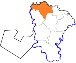 Location in Monufia Governorate | |
 Tala Location in Egypt | |
| Coordinates: 30.680108°N 30.943758°E | |
| Country | |
| Governorate | Monufia |
| Time zone | UTC+2 (EST) |
| Climate | BWh |
The 1885 Census of Egypt recorded Tala as a city in its own district in Monufia Governorate; at that time, the population of the city was 9,653 (4,784 men and 4,869 women).[4] The village of Kafr Zarqan accounts for over 1,500 of these residents, according to the 2006 census.[5]
See also
- List of cities and towns in Egypt
- Kafr Zarqan
References
- "Talla, Egypt - Geographical Names, map, geographic coordinates".
- Daressy, George. Les grandes villes d'Égypte a l'époque copte. Presses Universitaires de France.
- "Tala". Monofeya Egypt Govt. Archived from the original on 2018-02-23. Retrieved 2018-11-20.
- Egypt min. of finance, census dept (1885). Recensement général de l'Égypte. p. 302. Retrieved 21 June 2020.
- "الجهاز المركزى للتعبئة العامة والاحصاء". www.msrintranet.capmas.gov.eg. Retrieved 2021-05-24.
This geography of Egypt article is a stub. You can help Wikipedia by expanding it. |
На других языках
- [en] Tala, Egypt
[ru] Тала (Египет)
Тала[1] (араб. تلا) — город на севере Египта, расположенный на территории мухафазы Минуфия.Текст в блоке "Читать" взят с сайта "Википедия" и доступен по лицензии Creative Commons Attribution-ShareAlike; в отдельных случаях могут действовать дополнительные условия.
Другой контент может иметь иную лицензию. Перед использованием материалов сайта WikiSort.org внимательно изучите правила лицензирования конкретных элементов наполнения сайта.
Другой контент может иметь иную лицензию. Перед использованием материалов сайта WikiSort.org внимательно изучите правила лицензирования конкретных элементов наполнения сайта.
2019-2026
WikiSort.org - проект по пересортировке и дополнению контента Википедии
WikiSort.org - проект по пересортировке и дополнению контента Википедии