world.wikisort.org - Denmark
Højer (German: Hoyer; North Frisian: Huuger), is a town with a population of 1,102 (1 January 2022),[1] which was the seat of the former Højer municipality in south Denmark, in Region of Southern Denmark on the west coast of the Jutland peninsula.
Højer | |
|---|---|
Town | |
 View over the town from the watertower | |
 Højer Location in Region of Southern Denmark  Højer Højer (Denmark) | |
| Coordinates: 54°57′51″N 8°41′50″E | |
| Country | Denmark |
| Region | Southern Denmark |
| Municipality | Tønder Municipality |
| Area | |
| • Town | 86.9 km2 (33.6 sq mi) |
| • Land | 22.5 km2 (8.7 sq mi) |
| • Urban | 1.0 km2 (0.4 sq mi) |
| Population (2022)[1] | |
| • Urban | 1,102 |
| • Urban density | 1,100/km2 (2,900/sq mi) |
| Time zone | UTC+1 (CET) |
| • Summer (DST) | UTC+2 (CEST) |
| Postal code | DK-6280 Højer |
Højer Municipality
The former Højer Municipality covered an area of 117 km2, and had a total population of 2,861 (2005). Its last mayor was Peter Christensen, a member of the Social Democrats (Socialdemokraterne) political party.
The coastal area of the former municipality is a nature reserve.
The municipality was created in 1970 due to a kommunalreform ("Municipality Reform") that combined a number of existing parishes:
- Daler Parish
- Emmerlev Parish
- Hjerpsted Parish
- Højer Parish
On 1 January 2007 Højer municipality ceased to exist due to Kommunalreformen ("The Municipality Reform" of 2007). It was merged with Bredebro, Løgumkloster, Nørre-Rangstrup, Skærbæk, and Tønder municipalities to form the new Tønder Municipality. This created a municipality with an area of 1,352 km2 and a total population of 42,645 (2005).
Photos
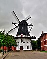 Windmill

References
- BY3: Population 1. January by rural and urban areas, area and population density The Mobile Statbank from Statistics Denmark
External links
- Tønder municipality's official website (in Danish)
- Weather forecast Højer, Denmark weather-atlas.com
Further reading
- Municipal statistics: NetBorger Kommunefakta, delivered from KMD aka Kommunedata (Municipal Data)
- Municipal mergers and neighbors: Eniro new municipalities map
Authority control | |
|---|---|
| General | |
| National libraries | |
This article about a location in the Region of Southern Denmark is a stub. You can help Wikipedia by expanding it. |
Другой контент может иметь иную лицензию. Перед использованием материалов сайта WikiSort.org внимательно изучите правила лицензирования конкретных элементов наполнения сайта.
WikiSort.org - проект по пересортировке и дополнению контента Википедии