world.wikisort.org - Tchèque
Lhota (en allemand : Böhmisch Lhota) est une commune du district de Kladno, dans la région de Bohême-Centrale, en Tchéquie. Sa population s'élevait à 656 habitants en 2020[1].
Pour les articles homonymes, voir Lhota.
Cet article est une ébauche concernant une localité tchèque.
Vous pouvez partager vos connaissances en l’améliorant (comment ?) selon les recommandations des projets correspondants.
| Lhota | |||

| |||
 |
 |
||
| Administration | |||
|---|---|---|---|
| Pays | |||
| Région | |||
| District | Kladno | ||
| Région historique | Bohême | ||
| Maire | Miloslav Poddaný | ||
| Code postal | 273 01 | ||
| Indicatif téléphonique international | +(420) | ||
| Démographie | |||
| Population | 656 hab. (2020) | ||
| Densité | 56 hab./km2 | ||
| Géographie | |||
| Coordonnées | 50° 05′ 14″ nord, 14° 00′ 45″ est | ||
| Altitude | 400 m |
||
| Superficie | 1 169 ha = 11,69 km2 | ||
| Localisation | |||

| |||
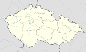
| Géolocalisation sur la carte : Tchéquie
Géolocalisation sur la carte : Tchéquie
| |||
| Liens | |||
| Site web | www.lhotaukladna.cz | ||
| modifier |
|||

Géographie
Lhota se trouve à 9 km au sud-ouest de Kladno et à 31 km à l'ouest de Prague[2].
La commune est limitée par Žilina au nord, par Družec à l'est, par Bratronice et Běleč au sud, et par Lány à l'ouest et au nord-ouest[3].
Histoire
La première mention écrite de la localité date de 1530.
Notes et références
- (cs) Population des communes de la Tchéquie au 1er janvier 2020.
- Distances à vol d'oiseau ou distances orthodromiques.
- D'après geoportal.gov.cz.
 Portail de la Tchéquie
На других языках
[de] Lhota u Kamenných Žehrovic
Lhota (deutsch Böhmisch Lhota) ist eine Gemeinde in Tschechien. Sie liegt neun Kilometer südwestlich von Kladno und gehört zum Okres Kladno.[en] Lhota (Kladno District)
Lhota is a municipality and village in Kladno District in the Central Bohemian Region of the Czech Republic. It has about 700 inhabitants.- [fr] Lhota (district de Kladno)
Текст в блоке "Читать" взят с сайта "Википедия" и доступен по лицензии Creative Commons Attribution-ShareAlike; в отдельных случаях могут действовать дополнительные условия.
Другой контент может иметь иную лицензию. Перед использованием материалов сайта WikiSort.org внимательно изучите правила лицензирования конкретных элементов наполнения сайта.
Другой контент может иметь иную лицензию. Перед использованием материалов сайта WikiSort.org внимательно изучите правила лицензирования конкретных элементов наполнения сайта.
2019-2025
WikiSort.org - проект по пересортировке и дополнению контента Википедии
WikiSort.org - проект по пересортировке и дополнению контента Википедии