world.wikisort.org - Czech
Netřebice is a municipality and village in Český Krumlov District in the South Bohemian Region of the Czech Republic. It has about 500 inhabitants.
Netřebice | |
|---|---|
Municipality | |
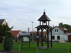
 Belfry in the centre of Netřebice | |
 Flag  Coat of arms | |
 Netřebice Location in the Czech Republic | |
| Coordinates: 48°47′27″N 14°27′20″E | |
| Country | |
| Region | South Bohemian |
| District | Český Krumlov |
| First mentioned | 1358 |
| Area | |
| • Total | 13.36 km2 (5.16 sq mi) |
| Elevation | 635 m (2,083 ft) |
| Population (2022-01-01)[1] | |
| • Total | 463 |
| • Density | 35/km2 (90/sq mi) |
| Time zone | UTC+1 (CET) |
| • Summer (DST) | UTC+2 (CEST) |
| Postal code | 382 32 |
| Website | www |
Netřebice lies approximately 11 kilometres (7 mi) east of Český Krumlov, 21 km (13 mi) south of České Budějovice, and 144 km (89 mi) south of Prague.
Administrative parts
Villages of Dlouhá and Výheň are administrative parts of Netřebice.
References
- "Population of Municipalities – 1 January 2022". Czech Statistical Office. 2022-04-29.
Wikimedia Commons has media related to Netřebice (Český Krumlov District).
На других языках
[de] Netřebice
Netřebice (deutsch Netrobitz, auch Netrowitz) ist eine Gemeinde in Tschechien. Sie liegt sieben Kilometer nordwestlich von Kaplice und gehört zum Okres Český Krumlov.- [en] Netřebice (Český Krumlov District)
Текст в блоке "Читать" взят с сайта "Википедия" и доступен по лицензии Creative Commons Attribution-ShareAlike; в отдельных случаях могут действовать дополнительные условия.
Другой контент может иметь иную лицензию. Перед использованием материалов сайта WikiSort.org внимательно изучите правила лицензирования конкретных элементов наполнения сайта.
Другой контент может иметь иную лицензию. Перед использованием материалов сайта WikiSort.org внимательно изучите правила лицензирования конкретных элементов наполнения сайта.
2019-2025
WikiSort.org - проект по пересортировке и дополнению контента Википедии
WikiSort.org - проект по пересортировке и дополнению контента Википедии