world.wikisort.org - Cuba
Taguayabón is a Cuban village and consejo popular ("popular council", i.e. hamlet) of the municipality of Camajuaní, in Villa Clara Province. In 2012 it had a population of 2053.[3]
Taguayabón | |
|---|---|
Village | |
 Road in Taguayabon | |
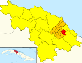 Map of Taguayabón (Red) in Camajuaní (Orange) in Villa Clara (Yellow) | |
 Location of Taguayabón in Cuba | |
| Coordinates: 22°28′39.8″N 79°39′01.2″W | |
| Country | Cuba |
| Province | Villa Clara |
| Municipality | Camajuaní |
| Founded | 1830[1] |
| Elevation | 80 m (260 ft) |
| Population (2012)[2] | |
| • Total | 2,053 |
| Time zone | UTC-5 (EST) |
| Area code | +53-422 |
History
The village, whose name means "butterfly village" in Taíno language,[citation needed] was founded in 1830. Until 1976, it was part of the former municipality of San Antonio de las Vueltas (or Vueltas), merged in Camajuaní.[1]
Geography
Located on a rural plain surrounded by scattered hills, between Camajuaní (7.7 km west) and Remedios (11 km east); Taguayabón spans on two main crossroads: "Calle José Martí" (N-S) and the "Circuito Norte" (W-E).[4] Nearest places are the villages of Palenque (3 km east), Entronque de Vueltas (3 km west) and Vega de Palma (5 km west). The village is 9 km from Vueltas, 20 from Caibarién, 26 from Placetas, 34 from Santa Clara and 80 from Cayo Santa María.
The local government area of the "Consejo Popular de Taguayabón" includes the villages of Carolina, Corea, La Julia, Las Lechugas, Lobatón, Rosalía and Palenque.[citation needed]
Transport
Taguayabón is crossed in the middle by the state highway "Circuito Norte" (CN) and counts a railway station on the line Santa Clara-Camajuaní-Remedios-Caibarién.[5] Nearest airport, the "Abel Santamaría" of Santa Clara (IATA: SNU), is 30 km west.
See also
- Parrandas
- Municipalities of Cuba
- List of cities in Cuba
References
- San Antonio de las Vueltas municipality (including Taguayabón) on guije.com
- "Camajuaní (Municipality, Villa Clara Province, Cuba) - Population Statistics, Charts, Map and Location".
- "Camajuaní (Municipality, Villa Clara Province, Cuba) - Population Statistics, Charts, Map and Location". citypopulation.de. Retrieved 2022-07-02.
- 4320533257 Taguayabón on OpenStreetMap
- 4729970437 Taguayabón railway station on OpenStreetMap
External links
- Taguayabón Destination Guide on trip-suggest.com
- Taguayabón Weather on accuweather.com
Другой контент может иметь иную лицензию. Перед использованием материалов сайта WikiSort.org внимательно изучите правила лицензирования конкретных элементов наполнения сайта.
WikiSort.org - проект по пересортировке и дополнению контента Википедии