world.wikisort.org - Cuba
Quivicán is a town and municipality in Mayabeque Province of Cuba. It is located in the south west of the province, bordering the Gulf of Batabanó. The name is of Taino origin (spelled Quibicán).[4] It was founded in 1700.[1]
Quivicán | |
|---|---|
Municipality | |
 The "Glorieta" bandstand | |
 Flag | |
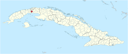 Quivicán municipality (red) within Cuba | |
| Coordinates: 22°49′29″N 82°21′21″W | |
| Country | Cuba |
| Province | Mayabeque |
| Founded | 1700[1] |
| Established | 1919 (Municipality) |
| Area | |
| • Total | 283 km2 (109 sq mi) |
| Elevation | 50 m (160 ft) |
| Population (2004)[3] | |
| • Total | 29,253 |
| • Density | 103.4/km2 (268/sq mi) |
| Time zone | UTC-5 (EST) |
| Area code | +53-7 |
| Website | https://www.quivican.gob.cu/es/ |
Geography
The municipality is divided into the barrios of Quivican Pueblo, La Salud, San Felipe, Pablo Noriega, San Agustín, Guiro Boñingal, Güiro Marrero, Santa Mónica, Aguacate and Fajardo.[1]
Demographics
In 2004, the municipality of Quivicán had a population of 29,253.[3] With a total area of 283 km2 (109 sq mi),[2] it has a population density of 103.4/km2 (268/sq mi).
Notable people
- Chucho Valdés (b. 1941), pianist
- Alejandro Miguel Portal Oliva (b. 1995), soccer player
See also
 Cuba portal
- Municipalities of Cuba
- List of cities in Cuba
- Quivicán Municipal Museum
References
- Guije.com. "Quivicán" (in Spanish). Retrieved 2007-10-07.
- Statoids (July 2003). "Municipios of Cuba". Retrieved 2007-10-07.
- Atenas.cu (2004). "2004 Population trends, by Province and Municipality" (in Spanish). Archived from the original on 2007-09-27. Retrieved 2007-10-07.
- United Confederation of Taíno People. "Taíno Dictionary" (in Spanish). Archived from the original on 2007-10-16. Retrieved 2007-10-18.
External links
![]() Media related to Quivicán at Wikimedia Commons
Media related to Quivicán at Wikimedia Commons
Places adjacent to Quivicán | ||||||||||||||||
|---|---|---|---|---|---|---|---|---|---|---|---|---|---|---|---|---|
| ||||||||||||||||
Municipalities in Mayabeque Province | ||
|---|---|---|
Authority control | |
|---|---|
| General |
|
| Other |
|
This Cuban location article is a stub. You can help Wikipedia by expanding it. |
На других языках
[de] Quivicán
Quivicán ist ein Municipio und eine Stadt in der kubanischen Provinz Mayabeque. Bis 2010 gehörte das Municipio zur aufgelösten Provinz La Habana.- [en] Quivicán
Текст в блоке "Читать" взят с сайта "Википедия" и доступен по лицензии Creative Commons Attribution-ShareAlike; в отдельных случаях могут действовать дополнительные условия.
Другой контент может иметь иную лицензию. Перед использованием материалов сайта WikiSort.org внимательно изучите правила лицензирования конкретных элементов наполнения сайта.
Другой контент может иметь иную лицензию. Перед использованием материалов сайта WikiSort.org внимательно изучите правила лицензирования конкретных элементов наполнения сайта.
2019-2026
WikiSort.org - проект по пересортировке и дополнению контента Википедии
WikiSort.org - проект по пересортировке и дополнению контента Википедии