world.wikisort.org - Cuba
Contramaestre (Spanish for "boatswain") is a Cuban town and municipality in the Santiago de Cuba Province.
Contramaestre | |
|---|---|
Municipality | |
 A church in Contramaestre | |
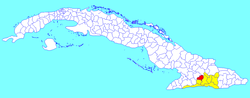 Contramaestre municipality (red) within Santiago Province (yellow) and Cuba | |
| Coordinates: 20°18′0″N 76°15′2″W | |
| Country | Cuba |
| Province | Santiago de Cuba |
| Area | |
| • Total | 610.3 km2 (235.6 sq mi) |
| Elevation | 110 m (360 ft) |
| Population (2004)[1] | |
| • Total | 101,832 |
| • Density | 166.9/km2 (432/sq mi) |
| Time zone | UTC-5 (EST) |
| Area code(s) | +53-226 |
| Website | https://www.contramaestre.gob.cu/ |
Geography
The municipality is located in the western part of the province, neighboring the provinces of Granma and Holguín; and borders with the municipalities of Jiguaní, Urbano Noris, Palma Soriano and Tercer Frente.
It includes the villages of Altos de Ventas, Anacahuita, America Libre, Baire, El Naranjo, Guaninao, La Maritonia, Laguna Blanca, Los Negros, Los Pasos, Maffo, Palo Seco, Pino de Baire, Pueblo Nuevo and Xavier.[2]
Demographics
In 2004, municipal population of Contramaestre was of 101,832,[1] of which 44,752 in the town. With a total area of 610 km2 (240 sq mi), it has a population density of 166.9/km2 (432/sq mi). Contramaestre is known as the land of citric.
Infrastructure
- Main Hospital: Orlando Pantoja Tamayo (22.July.1988)
- Elementary Schools: Jose de la Luz y Caballero. Semi-internado: Orlando Pantoja T.
- Secondary Schools: Pepito Tey. Rodolfo Rodríguez
- Public Library: Luz Berta Sánchez.
See also
- Municipalities of Cuba
- List of cities in Cuba
References
- Santiago.cu (2006). "Municipalities of Santiago de Cuba" (in Spanish). Archived from the original on 2007-12-15. Retrieved 2007-10-05.
- 5919047 Contramaestre on OpenStreetMap
External links
![]() Media related to Contramaestre at Wikimedia Commons
Media related to Contramaestre at Wikimedia Commons
Places adjacent to Contramaestre, Cuba | ||||||||||||||||
|---|---|---|---|---|---|---|---|---|---|---|---|---|---|---|---|---|
| ||||||||||||||||
Municipalities in Santiago de Cuba Province | ||
|---|---|---|
| ||
This Cuban location article is a stub. You can help Wikipedia by expanding it. |
Другой контент может иметь иную лицензию. Перед использованием материалов сайта WikiSort.org внимательно изучите правила лицензирования конкретных элементов наполнения сайта.
WikiSort.org - проект по пересортировке и дополнению контента Википедии