world.wikisort.org - Croatie
Hvar est une ville et une municipalité située sur l'île de Hvar, dans le comitat de Split-Dalmatie, en Croatie.
Cet article est une ébauche concernant une localité croate.
Vous pouvez partager vos connaissances en l’améliorant (comment ?) selon les recommandations des projets correspondants.
Pour les articles homonymes, voir Hvar.
| Hvar | ||||
 Héraldique |
 Drapeau |
|||
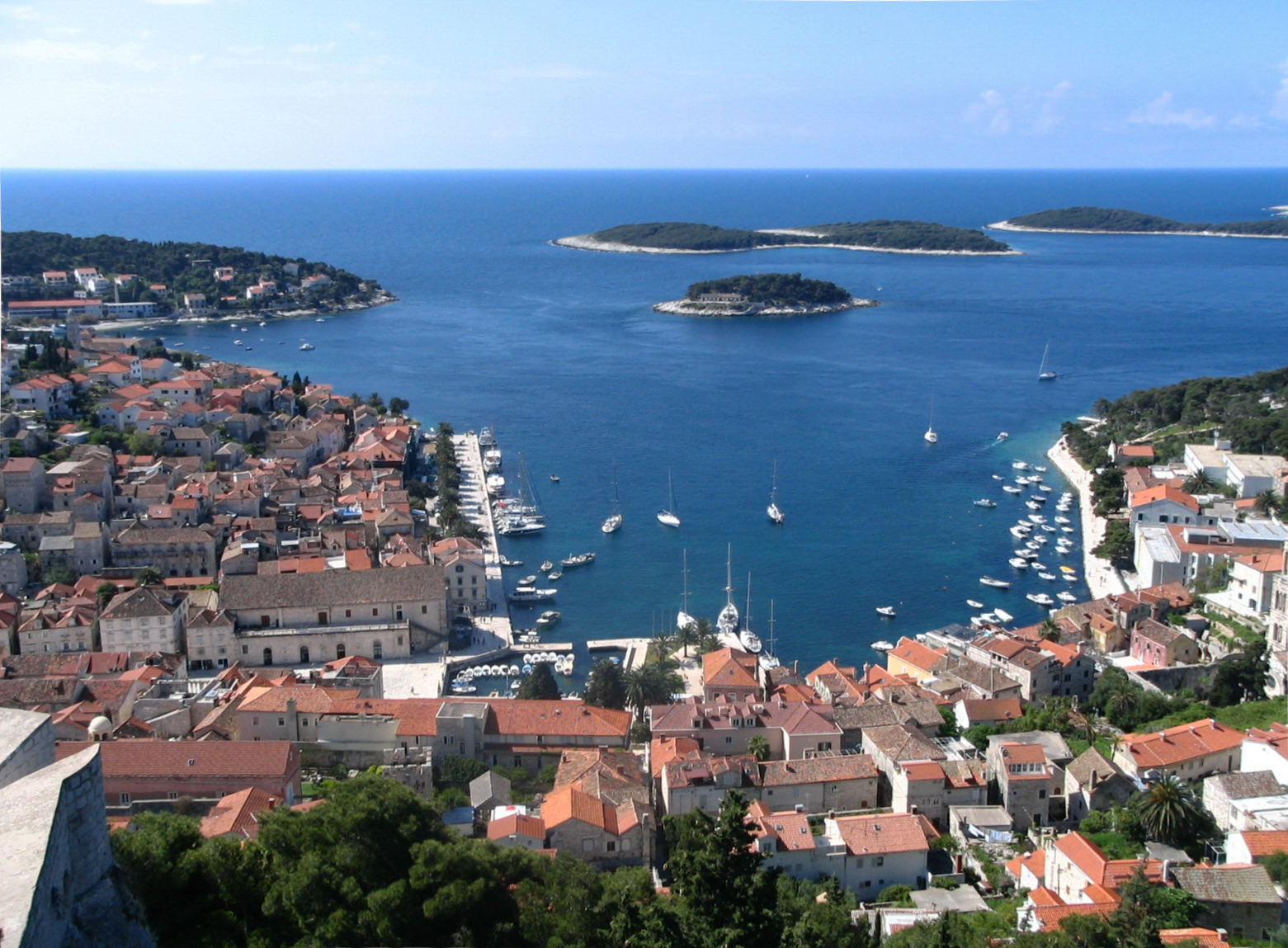 Vue du port de Hvar et des îles Infernales. | ||||
| Administration | ||||
|---|---|---|---|---|
| Pays | ||||
| Comitat | Split-Dalmatie | |||
| Maire | Pjerino Bebić | |||
| Code postal | 21450 | |||
| Indicatif téléphonique international | +(385) | |||
| Indicatif téléphonique local | (0) 21 | |||
| Démographie | ||||
| Population | 3 672 hab. (2001) | |||
| Population municipalité | 4 138 hab. (2001) | |||
| Densité | 55 hab./km2 | |||
| Géographie | ||||
| Coordonnées | 43° 10′ 14″ nord, 16° 26′ 28″ est | |||
| Altitude | 0 m |
|||
| Superficie municipalité | 7 550 ha = 75,5 km2 | |||
| Localisation | ||||
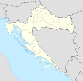
| Géolocalisation sur la carte : comitat de Split-Dalmatie
Géolocalisation sur la carte : Croatie
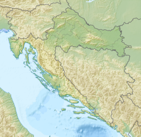
Géolocalisation sur la carte : Croatie
| ||||
| Liens | ||||
| Site web | www.hvar.hr | |||
| modifier |
||||

Histoire
Depuis 1815 (congrès de Vienne) jusqu'en 1918, la ville au nom bilingue croate-italien de HVAR- LESINA fait partie de la monarchie autrichienne (empire d'Autriche), puis Autriche-Hongrie (Cisleithanie après le compromis de 1867), chef-lieu du district de même nom, l'un des 13 Bezirkshauptmannschaften en Dalmatie[1]. Le nom italien seul (parfois LESSINA) est utilisé avant 1867[2].
Climat
| Mois | jan. | fév. | mars | avril | mai | juin | jui. | août | sep. | oct. | nov. | déc. | année |
|---|---|---|---|---|---|---|---|---|---|---|---|---|---|
| Température minimale moyenne (°C) | 5,9 | 5,9 | 7,7 | 10,5 | 14,7 | 18,3 | 20,9 | 20,8 | 17,7 | 14,3 | 10,1 | 7,2 | 12,8 |
| Température moyenne (°C) | 9,1 | 9,2 | 11,1 | 14 | 18,5 | 22,3 | 25 | 24,8 | 21,5 | 17,7 | 13,3 | 10,3 | 16,4 |
| Température maximale moyenne (°C) | 12,6 | 13 | 14,9 | 17,7 | 22,3 | 26,4 | 29,5 | 29,5 | 26 | 21,8 | 16,8 | 13,7 | 20,3 |
| Record de froid (°C) date du record |
−7 24/1942 |
−5,5 2/1929 |
−4,6 4/1949 |
0 7/1929 |
5,1 4/1935 |
10 8/1962 |
12,8 11/1969 |
9,7 19/1949 |
8 28/1931 |
4,9 30/1971 |
−3 29/1915 |
−5 19/1927 |
−7 24/1/1942 |
| Record de chaleur (°C) date du record |
19,6 30/1949 |
23,4 22/1990 |
24,5 30/2017 |
27,8 26/1952 |
33 15/1945 |
38 28/2019 |
37,5 29/1945 |
37,7 8/1956 |
34,4 1/1878 |
31,5 1/1932 |
25,7 3/2004 |
20,6 7/1967 |
38 28/6/2019 |
| Nombre de jours avec gel | 1,9 | 1,8 | 0,7 | 0 | 0 | 0 | 0 | 0 | 0 | 0 | 0,2 | 1,2 | 5,8 |
| Ensoleillement (h) | 133,3 | 155,4 | 195,3 | 222 | 288,3 | 324 | 365,8 | 334,8 | 258 | 198,4 | 135 | 124 | 2 734,3 |
| Précipitations (mm) | 68,4 | 55,7 | 62,7 | 54,1 | 46,7 | 34,4 | 26,4 | 45,2 | 63,7 | 79,3 | 94 | 83,2 | 713,7 |
| Nombre de jours avec précipitations | 9,8 | 9 | 9,4 | 10,2 | 7,8 | 6,8 | 4 | 4,7 | 7 | 9,3 | 11,3 | 10,4 | 99,8 |
| dont nombre de jours avec précipitations ≥ 10 mm | 2,4 | 1,7 | 1,7 | 1,6 | 1,5 | 1,1 | 0,7 | 1,2 | 2,1 | 2,7 | 3,4 | 2,9 | 23,1 |
| Humidité relative (%) | 68,7 | 65 | 66,4 | 65,5 | 66,6 | 63,7 | 58,8 | 61 | 65,4 | 67,8 | 68,5 | 69 | 65,5 |
| Nombre de jours avec neige | 0,1 | 0 | 0 | 0 | 0 | 0 | 0 | 0 | 0 | 0 | 0 | 0 | 0,1 |
| Nombre de jours d'orage | 2,3 | 2,6 | 2 | 3,3 | 3,1 | 3,6 | 3,1 | 4,2 | 4,2 | 4 | 4,3 | 2,8 | 39,4 |
| Nombre de jours avec brouillard | 0 | 0,2 | 0,2 | 0 | 0,4 | 0,1 | 0,1 | 0,2 | 0,1 | 0 | 0 | 0 | 1,3 |
| Diagramme climatique | |||||||||||
| J | F | M | A | M | J | J | A | S | O | N | D |
12,6 5,9 68,4 | 13 5,9 55,7 | 14,9 7,7 62,7 | 17,7 10,5 54,1 | 22,3 14,7 46,7 | 26,4 18,3 34,4 | 29,5 20,9 26,4 | 29,5 20,8 45,2 | 26 17,7 63,7 | 21,8 14,3 79,3 | 16,8 10,1 94 | 13,7 7,2 83,2 |
| Moyennes : • Temp. maxi et mini °C • Précipitation mm | |||||||||||
Localités et démographie
Au recensement de 2001, la municipalité compte 4 138 habitants, dont 92,53 % de Croates[5] (dont la ville seule 3 672 habitants[6]).
La municipalité de Hvar compte 7 localités :
|
|
Monuments
- Monastère dominicain : fortifié en 1482 pour pallier les attaques ottomanes.
- Château de Tvrdalj : ancienne résidence du poète Petar Hektorović[7].
 Pjaca Sv. Stjepan.
 Cathédrale St.-Étienne.
 Monastère franciscain.
 Forteresse espagnole.


Notes et références
- Die postalischen Abstempelungen auf den österreichischen Postwertzeichen-Ausgaben 1867, 1883 und 1890, Wilhelm KLEIN, 1967
- Handbook of Austria and Lombardy-Venetia Cancellations on the Postage Stamp Issues 1850-1864, by Edwin MUELLER, 1961.
- (en) « Monthly values and extremes for Hvar in 1858–2020 period », Croatian Meteorological and Hydrological Service (consulté le ).
- (en) « Hvar Climate Normals », Croatian Meteorological and Hydrological Service (consulté le ).
- (en) Recensement de 2001 : « Population by ethnicity, by towns/municipalities, census 2001 », sur dzs.hr, Crostat - Bureau central de statistiques (consulté le )
- (en) « Population by sex and age by settlements, census 2001 », sur dzs.hr, Crostat - Bureau central de statistiques (consulté le )
- Collectif, Dominique Auzias, Jean-Paul Labourdette, Croatie 2012, Petit Futé (ISBN 2746957248 et 9782746957244), p. 310
Voir aussi
Articles connexes
- Hvar (l'île)
- Villes de Croatie
Liens externes
 Portail de la géographie
  Portail de la Croatie
На других языках
[de] Hvar (Stadt)
Hvar [.mw-parser-output .IPA a{text-decoration:none}ˈxʋǎːr] (Im lokalen kroatischen Dialekt: Hvor oder For, Griechisch: Pharos, Lateinisch: Pharina, Italienisch Lesina) ist eine Stadt und ein Hafen auf der Insel Hvar in der Gespanschaft Split-Dalmatien, Kroatien. Die Stadt ist der Sitz der katholischen Diözese Hvar. Im Jahr 2011 betrug die Einwohnerzahl der Gesamtgemeinde Hvar 4251 Personen und der Stadt selbst 3771. Damit ist sie die größte Stadt der Insel. Sie liegt in einer Bucht auf der Südseite der Insel, gegenüber den Städten Stari Grad und Jelsa. Zur Stadt Hvar gehören ebenfalls die Teilorte Brusje, Jagodna, Malo Grablje, Milna, Sveta Nedjelja, Velo Grablje und Zaraće.[en] Hvar (town)
Hvar (Chakavian: For, Greek: Φάρος, romanized: Pharos, Latin: Pharus and Pharina, Italian: Lesina) is a town and port on the island of Hvar, part of Split-Dalmatia County, Croatia. The municipality has a population of 4,251 (2011) while the town itself is inhabited by 3,771 people, making it the largest settlement on the island of Hvar.[1] It is situated on a bay in the south coast of the island, opposite from the other nearby towns of Stari Grad and Jelsa.[es] Hvar (localidad)
Hvar es una pequeña ciudad y el territorio que la circunda, ubicada en la isla homónima, en el condado de Split-Dalmacia, Croacia. Es el área poblada más grande de la isla y la capital de la unidad de autogobierno local del mismo nombre.- [fr] Hvar (ville)
[ru] Хвар (город)
Это статья о городе Хвар. Статью об одноимённом острове см. ХварДругой контент может иметь иную лицензию. Перед использованием материалов сайта WikiSort.org внимательно изучите правила лицензирования конкретных элементов наполнения сайта.
WikiSort.org - проект по пересортировке и дополнению контента Википедии